Soldier’s Pass Trail: Sedona’s Most Active Sinkhole, Seven Sacred Pools, & Gorgeous Red Rock Views
Disclaimer: We are not paid to promote any restaurant, hotel, activity, product, or attraction. All opinions are subjective and based on our personal experience. Your experience may be different.
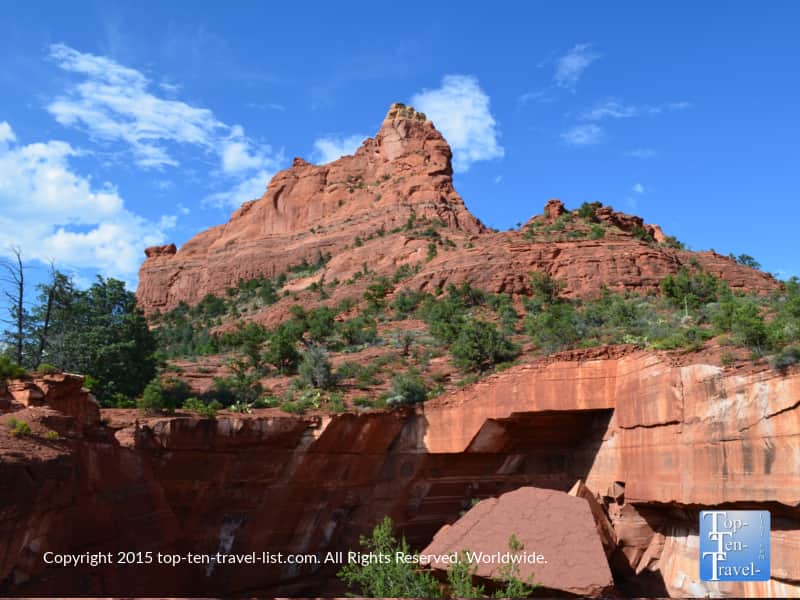
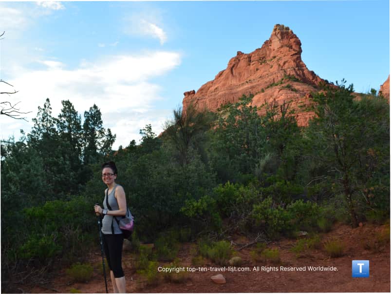
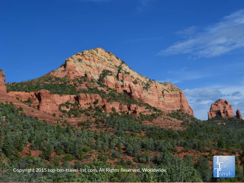
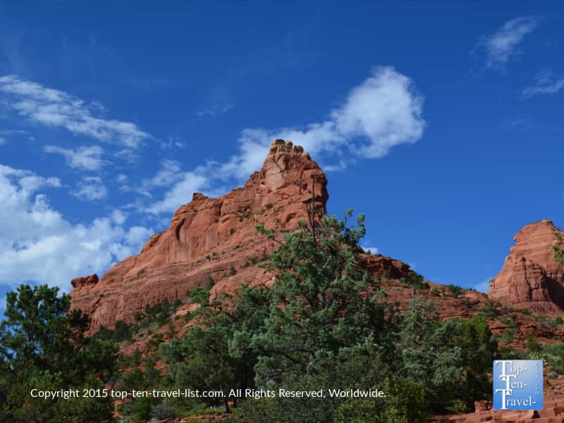
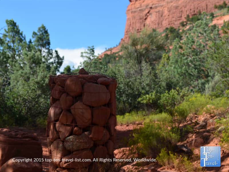
I’ve put in well over 100 miles hiking in the beautiful red rocks of Sedona since moving to neighbouring Flagstaff. There are so many incredible hikes, some more interesting than others. Hiking the Soldier Pass trail is a really unique experience due to the variety of landscapes and interesting geological features you will get to experience on your relatively short hike.
In addition to enjoying stunning red rocks views (like every other hike), you will come across the most active sinkhole, a gorgeous series of cascading pools, and some pretty arches carved naturally into the rocks.
This is a moderately easy 2.25 mile trek, so a great option if you have already hiked some of the more popular trails like Devil’s Bridge and Brin’s Mesa. This trail is very green and I love the way that the greenery frames the red rocks. The green contrasting against the red just gives it this otherworldly appeal not duplicated anywhere else.
A scenic journey into the Red Rock Secret Wilderness
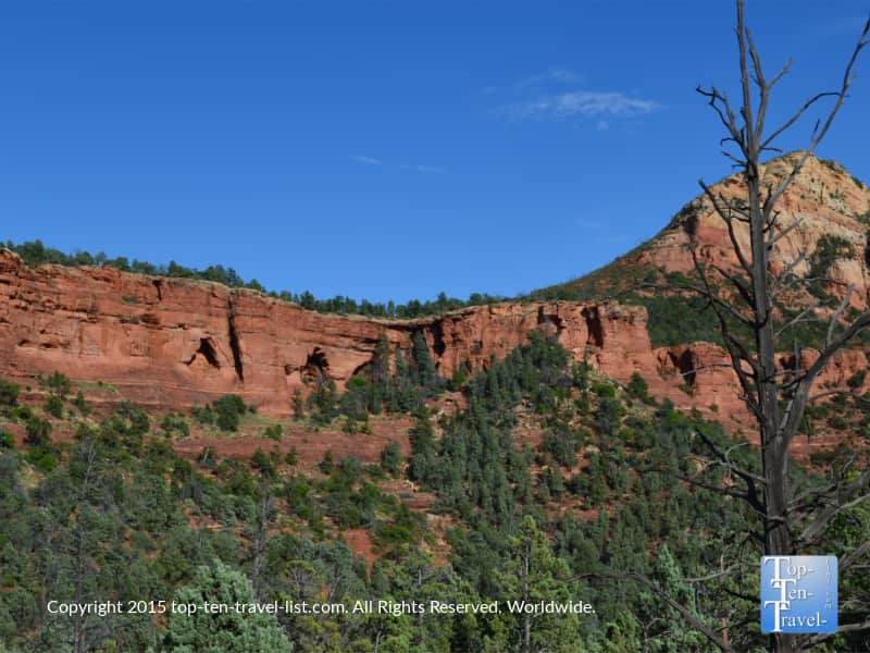
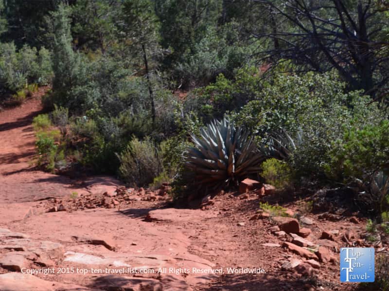
This is one of a handful of trails which crosses into the Red Rock Secret Wilderness. This area is known for its’ canyons and dense vegetation. So far, I’ve hiked Boynton and Fay Canyon and the West Fork, a popular trail on Oak Creek Canyon drive which involves crossing 13 creeks. These 3 hikes all cross into this area at some point. You can learn more about this wilderness on the Forest Service website.
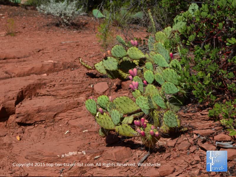
As you can see in the photos below, you will pass a diverse variety of plant life during your 2+ mile journey. This keeps the trail very interesting. I really love the many wide open views of the red rocks, although the peaceful section through the Red Rock Secret Wilderness is quite nice too (especially on hot summer afternoons). Any trail which crosses through this wilderness is a great summer pick due to the heavy shade coverage.
I would say that the only downside of this beautiful trail is the lack of trail markings. To be fair, this is a common problem in this area. In the first mile or so, you will see plenty of cairns and signs to guide you along the trail. For some reason after this time, the markings become few and far between. Maybe some people like a challenge. Although, I have to admit that the red rocks wouldn’t be such a bad place to get lost in for a little bit.
At many points (such as along the side arch trail), a simple sign could have helped greatly. Time being limited due to the parking lot’s early closing could pose problems for hikers who get lost. There are only 14 spots available, so it’s hard to find parking.
What I love most about this trail are the unique features along the route. These include:
- Devil’s Kitchen, the most active sinkhole in Sedona
- Seven Sacred pools (a series of 7 descending natural pools)
- 3 natural arches
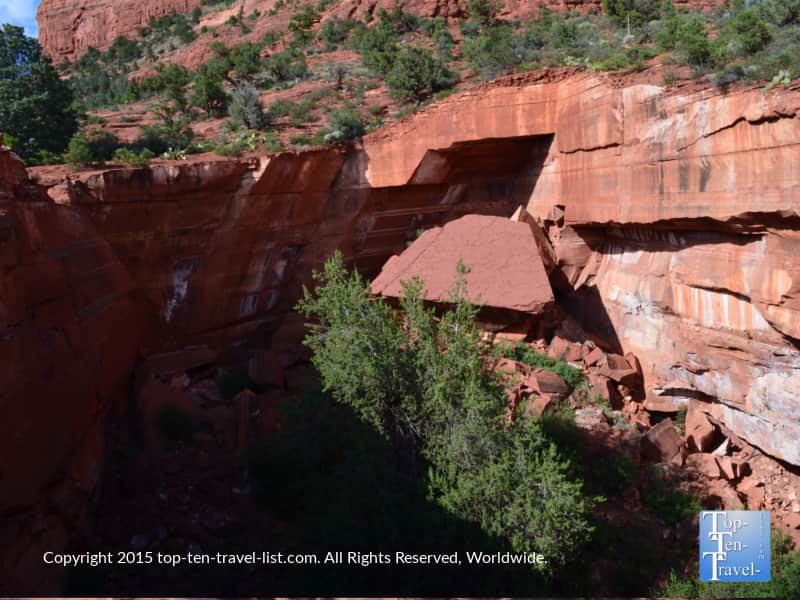
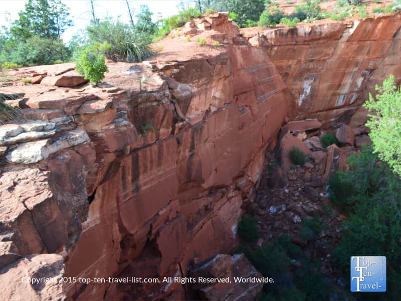
Devil’s Kitchen Sinkhole
A sinkhole is a hole in the ground, most likely formed as a result of the collapse of caves in the limestone bedrock. Although not the largest of the 7 sinkholes, the one on this trail is the most active having collapsed many times (1880’s, 1989, and 1995).
This sinkhole is about 50 feet deep with a 150 by 90 foot opening. In comparison, Sedona’s largest (Red’s Canyon) is 110 feet deep and 225 foot in diameter. I recommend reading more about the history and formation of the Devil’s Kitchen sinkhole before your hike. It’s always great to have some background info.
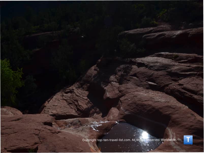
Seven Sacred Pools
Seven Sacred Pools is a series of 7 natural pools which descend down the rocks. According to Red Rock Western Jeep Tours Operation Manager Randy Rohlf, these pools were considered sacred by the Apaches and Yavapai. The pools were considered a valuable source of drinking water year-round in a barren desert, not to mention a sign of life, as well as a means of attracting wildlife to the area. I am not sure why this pic turned out so dark, but here is a view of the pools.
Sandstone Arches
After passing the Red Rock Secret Wilderness area (at a little over a mile into the hike), you will be able to see the 3 beautiful arches from the trail. To get a closer look, you can choose to take a detour right (as opposed to staying left on the main trail), at the Wilderness boundary and continue up a short, steep side trail that will take you up closer to the arches. I highly recommend hiking here if you have the ability. This is one of my favorite sights anywhere in this area. What a view!

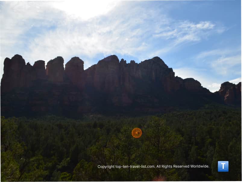
Mysterious orbs
I’ve talked about this before in several other posts such as the Little Horse trail, but I’ve seen these mysterious orbs or spiritual energy balls show up in many pictures since moving to this area. The funny thing is that I’ve never seen them anywhere else and they are always orange in color as you can see in my photo. They always seem to be floating through the sky mysteriously.
I am a big fan of the supernatural and shows like Ghost Adventures. I’ve also looked into vortex sites and many other interesting energy phenomena since moving near the New Age capital. Orange typically stands for a positive spiritual energy, so I guess I am not to concerned. I recommend a New Age tour if you are interested in learning more.
Trail Connections: extend your hike to 6 miles
Following the wilderness portion of the hike, the trail becomes a little steeper and rougher as you make your way up to Brin’s Mesa at the 2 mile point. At about 2.25 miles, it crosses the Brins Mesa trail. You can now turn back around or combine trails to make a longer loop. Combining Brin’s Mesa, Cibola Pass, and Jordan’s trail makes the journey a 6 mile loop (check the map by the start of the trail-head to plan your route). The nice thing about this area is you can always choose to go on much longer; it’s a fitness buff’s dream destination.
Although the total mileage from Soldier’s Pass to Brin’s Mesa is only 2.25 making your round trip distance about 4.5 miles, the effort exerted can feel much more intense on hot days. I would say the trail is moderate as there are a few steep sections, shade is limited at points, and it’s a bit confusing with the trail markings.
Best time to plan your hike
Although the trail tends to get busy on weekend mornings and early afternoons, after about 3 or so, crowds are basically non existent. This is a great time to plan your hike as you will get to enjoy the beautiful open desert vistas all to yourself. Just be aware that the main parking area closes at 6pm, so you may want to find somewhere else to park just to be on the safe side.
Overall, I’d say this is a great moderate hike, not my favorite, but a great way to spend the day enjoying nature and otherworldly red rock scenery. Be sure to come prepared with plenty of water, snacks, and watch your time due to the early closing hours. If possible, plan your hike early in the morning when the sun isn’t as strong, or better yet, during the cooler fall/winter season.
Also be sure to check out my list of favorite Sedona hikes for more ideas to add to your hiking bucket list.
Address
To get to the trail-head, take 89a west 1.2 miles to Soldier’s Pass Road. Drive 1.5 miles to Rim Shadows Drive. Drive 0.2 miles until reaching the gated trailhead parking area. Parking is limited, and thus, it’s best to take the free Sedona shuttle to the trailhead.
Enter the following coordinates into your GPS: 34°53’03.4″N 111°47’01.8″W
Trail details
- Distance: 2.2 miles out-and-back
- Difficulty: Moderate
- Elevation gain: 641 ft
- Dogs allowed: Yes, leashed only.
- Bikes allowed: Only to the first 1.3 miles
Learn more about this trail on the Coconino National Forest website.