Hiking Hotspot: A Quiet Nature Stroll Along Sedona’s Wilson Canyon Trail
Disclaimer: We are not paid to promote any restaurant, hotel, activity, product, or attraction. All opinions are subjective and based on our personal experience. Your experience may be different.
Wilson Canyon is one of 5 hikes beginning near Midgley Bridge off of scenic Oak Creek Canyon drive (the iconic 14 mile road which connects Sedona to Flagstaff). It’s the easiest and shortest option compared to the moderately difficult Huckaby and Jim Thompson trails, as well as the strenuous Wilson Mountain North trail. I’ve hiked this trail on numerous occasions when I did not feel like going all out for the day.
As I got to explore Sedona nearly every weekend during my years living in Flagstaff, I am pretty familiar with most of the trails, both easy and more difficult. While I wouldn’t consider Wilson a budget list worthy choice, it is a great easy option that is relatively laid-back and free of heavy tourist traffic. It’s one to consider adding to your itinerary if you will be driving Oak Creek and looking for an easy nature walk or something to do along the route.
On another positive note, this is one of my favorite summer hikes due to the short distance, lack of hills, and abundance of shady trees. Most trails in this region are either long, unshady, and/or hilly, so this is one of my most tolerable picks when temps soar past 90 daily.
An easy, scenic, well marked trek
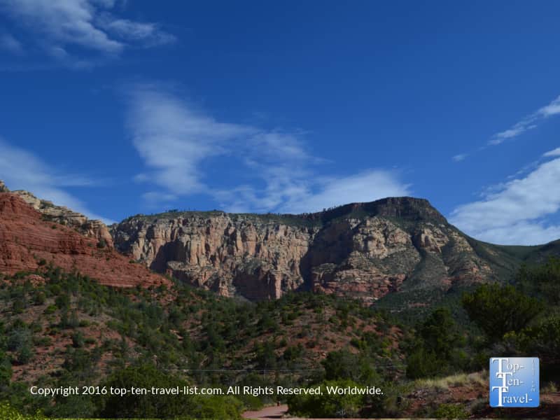
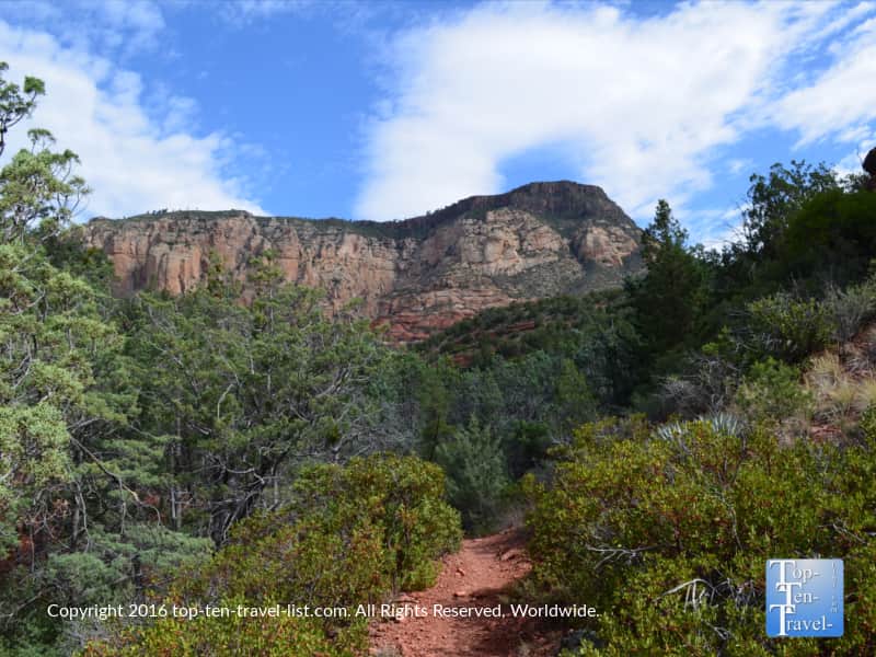
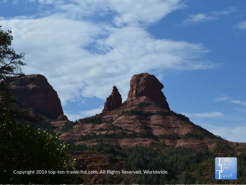
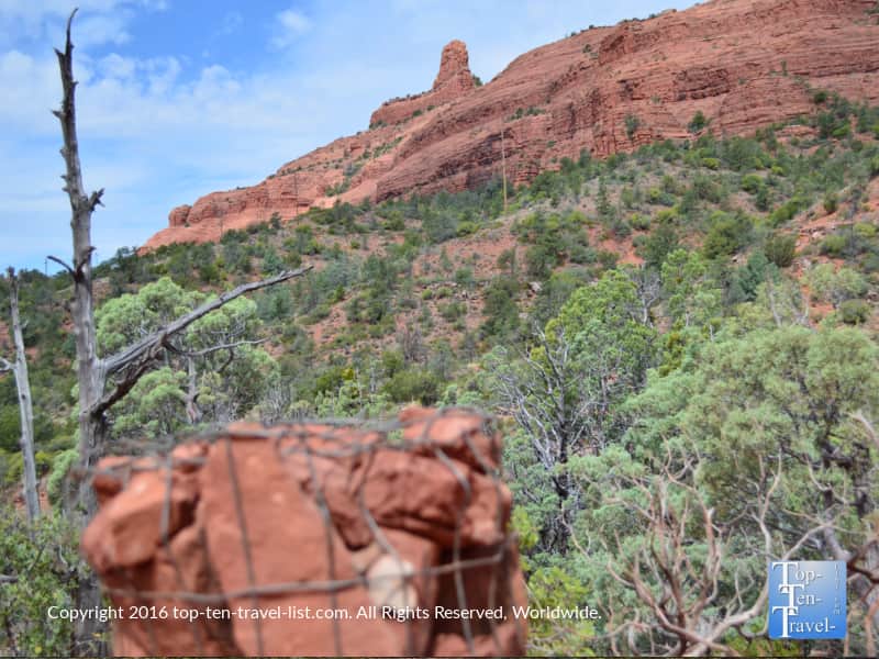
A quick 1.3 mile out-and-back hike takes you through a nice shady canyon. Lots of oak, cypress, and juniper trees provide plenty of shade coverage. The beginning of the trail offers some magnificent views of the red and white sandstone formations which this region is so known for. From here, you start on a gorgeous walk along a dry creek bed in company of lots of leafy trees, making this one of the few hikes which is different during the fall foliage season (yes this area does see a hint of fall color although West Fork is the iconic leaf peeping hike).
This trail is very easy with little in the way of hills. However, in my experience, no trail in this area is totally flat, so expect a few slight ups and downs along the way. That being said, it is by far one of the easiest trails I’ve enjoyed since my time living here and I definitely recommend it as a great beginner option.
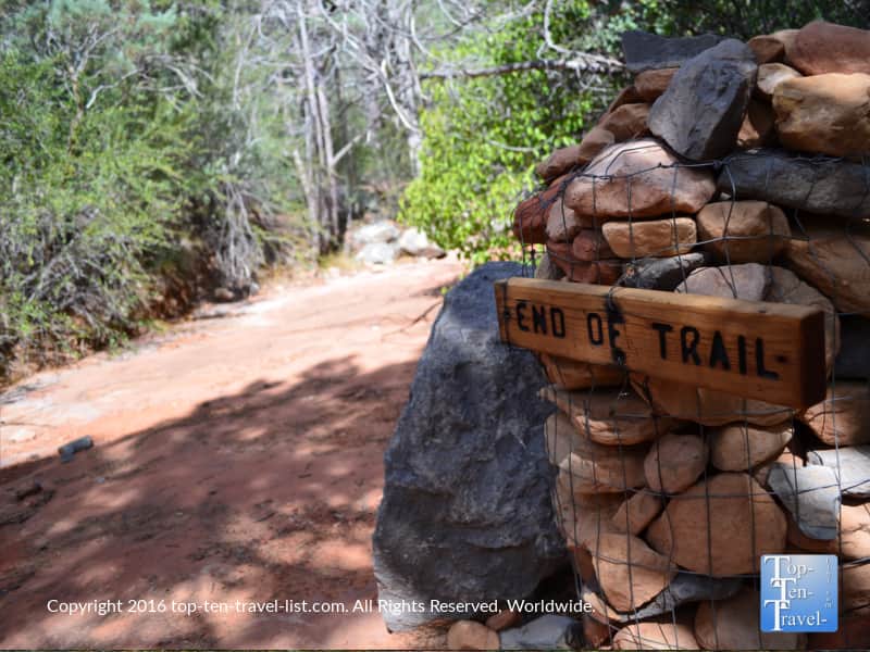
It is well marked with cairns, including a big marker letting you know it is the end of the trail. This is nice for newbies – otherwise you could keep walking forever. This is another reason I always wear a fitness watch while hiking so I can estimate the time and distance.
Why I love this hike
It’s so quiet on this trail with the only sound being birds chirping and leaves rustling in the wind. I really feel I can get back to nature here despite the tourist traffic on the adjacent tourist drive. As soon as I hit this trail, I feel at peace with nothing but beautiful nature surrounding me in every direction.
You won’t see the most magnificent rock formations on this one, but it is a wonderful trek through nature that isn’t bound to leave you exhausted at the end of the day as is typically the case with the longer trails. The setting is pretty remote for this touristy area. And most of all, the heavy tree coverage and variety of plants is a nice change of scenery from the mostly barren hikes.
Connecting trails: for those who want to enjoy the pretty scenery further
The trail officially ends at around 1.3 miles. If you have some extra energy, continue on another .2 miles or so and climb up for a better view. Or, if you prefer a longer hike, you can connect near the 1/2 mile mark to the Jim Thompson and Wilson Mountain trails, which are more intense, however, they also offer more magnificent red rock scenery.
Tips for a great hike through the canyon
Set out early in the morning for this hike. The parking lot will most definitely be full by mid morning. This is a very popular spot due to numerous trails access/easy access to the creek. Morning desert temps are typically at least 20 degrees cooler!
Always carry a water bottle, especially when hiking in a dry, hot climate. Dehydration is very common in the desert. Sometimes you are not aware of how much water you are losing because your sweat evaporates so quickly!
Stop for a healthy breakfast at Indian Gardens, conveniently located on 89a just a few miles prior to the parking lot. They serve the best espresso, muffins, and burritos! I love their Grains and Green bowl!
Always carry a hiking stick for extra traction and wear proper hiking footwear and workout apparel. So many tourists think they can just wear flip flops. There are loose rocks everywhere – you need hiking shoes for traction! Plus, the stick will take some extra pressure off your joints.
A GPS watch will help you pace yourself.
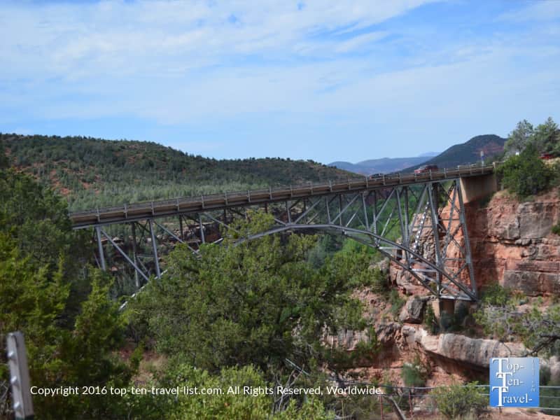
Don’t forget your camera! There are lots of beautiful photos at the start, particularly of the rock formations and Midgley bridge!
Cover yourself with sunblock. It’s almost always sunny, no matter the season. Plus the high elevation (4500+feet) means that the sun’s rays are more intense.
Fill up your water bottle pre-hike at the natural spring water tap on 89a. You will notice a bunch of cars parked on the side of the road filling up big jugs. There is a convenient pullout – look for the campground – you can’t miss it!
Check out more of my top recommended activities in the region. There is so much to do and see – definitely see as much as you can while you are out here!
Hiking details
Location: At the junction of 89A and 179. Drive 1.9 miles north on 89A until reaching the parking lot near Midgley Bridge.
Parking: You must display a daily Red Rock Pass ($5) or show your Annual National Parks pass.
Distance: 1.3 miles each way
Time: Plan for an hour-1.5 for the round trip journey.
Difficulty: Easy. One of my most recommended hikes for the casual walker.