15 Amazing Drives to add to your Bucket List
Disclaimer: We are not paid to promote any restaurant, hotel, activity, product, or attraction. All opinions are subjective and based on our personal experience. Your experience may be different.
Taking a scenic drive is one of the best ways to enjoy the natural wonders of an area. While hiking is my preferred means for taking in the vibe and scenery of an area, a leisurely cruise is my next favorite vacation activity. From the grandiose Blue Ridge Parkway which travels through the mountains of Western North Carolina and Virginia, to a beautiful high altitude trek up to a Sky Island in Southern Arizona, amazing drives are easy to find no matter where you live or travel. A cruise is a great budget friendly activity to incorporate into any vacation plans. After traveling and living across the country for many years, I have discovered so many wonderful drive around the country. Here is a guide to my favorites with lots of pictures!
1. Mt Lemmon Scenic Byway
- Location: Just outside of Tucson, Arizona
- Length of drive: 27 miles
- Highlights: Amazing views of the Saguaro cacti, beautiful mixed conifer forest, access to high altitude hiking trails, 30 degrees cooler than the surrounding desert, fabulous leaf peeping in the fall, winter snow destination
- Attractions: Marshall Gulch trail, Mt. Lemmon Ski resort chairlift ride, Iron Door restaurant, Meadow trail, picnicking, The Cookie Cabin
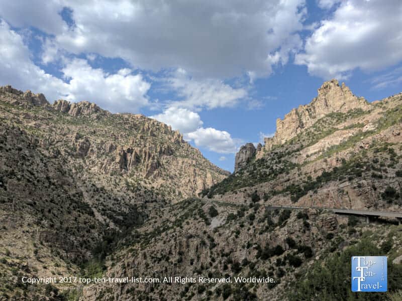
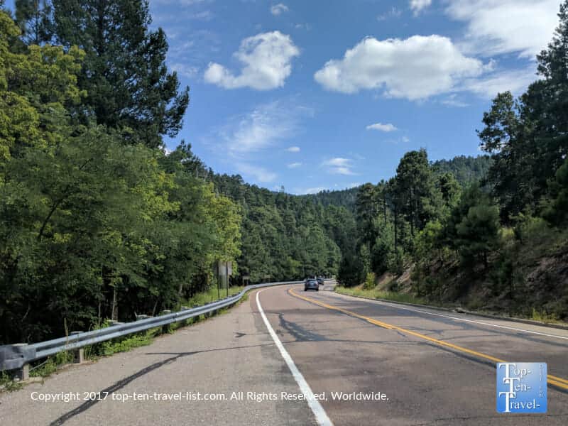
The best thing to do on a scorching summer day in the Tucson desert is to head ~6000 feet up the Mt. Lemmon Scenic Byway for a relaxing day in the cool pines. Mt. Lemmon, a “Sky island,” is home to the highest peak in the Santa Catalina Mountain range (9157 ft). Plant life on a Sky Island varies drastically from surrounding lowland desert areas. This mesmerizing drive begins in the Saguaro studded Sonoran desert at ~2300 feet. Continuing on 27 miles, you eventually reach the lovely pines at an altitude of ~8200 feet on the base of Mt. Lemmon.
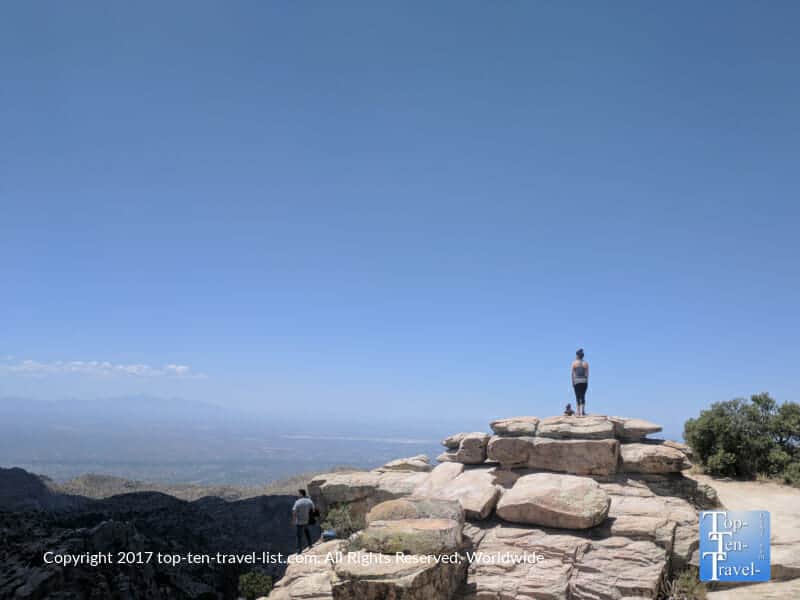
Along this drive, you will come across numerous scenic overlooks, as well as hiking trails and picnicking areas. Not surprisingly, avid hikers and cyclists flock here each weekend. Temps at Summerhaven are generally 30 degrees cooler, making this area a popular summer escape from the desert. Notable base attractions include beautiful pine lined hiking trails, a scenic chairlift ride, several restaurants, and even a ski resort.
This gem truly offers it all – stunning scenery, diverse recreation, and most importantly, a much needed break from the desert heat! While living in Tucson, I came up here at least several times per month during the scorching summer season. What a refreshing change of scenery!

2. Blue Ridge Parkway
- Location: Shenandoah National Park in Virginia to The Smoky Mountains. Plan your route via this BRP map
- Length of drive: 469 miles
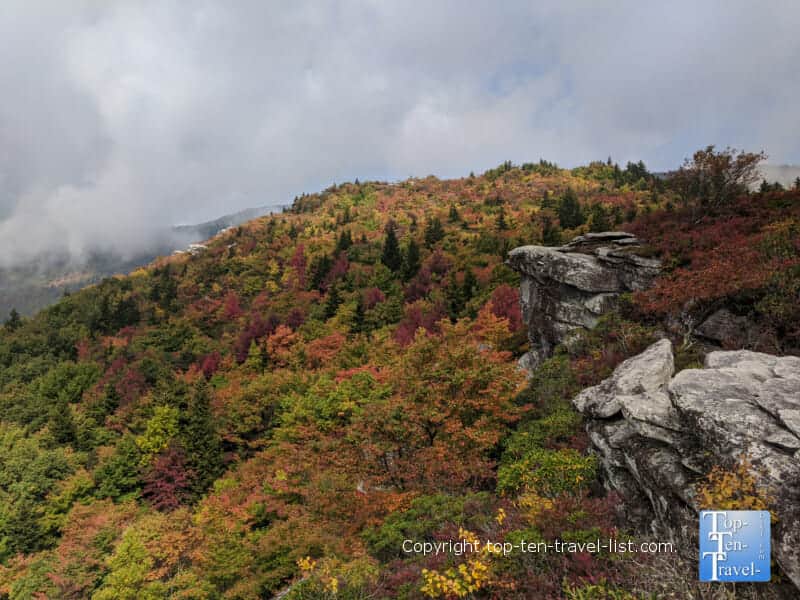
- Highlights: Uninterrupted nature, colorful fall foliage, fantastic mountain scenery, access to many hikes/waterfalls
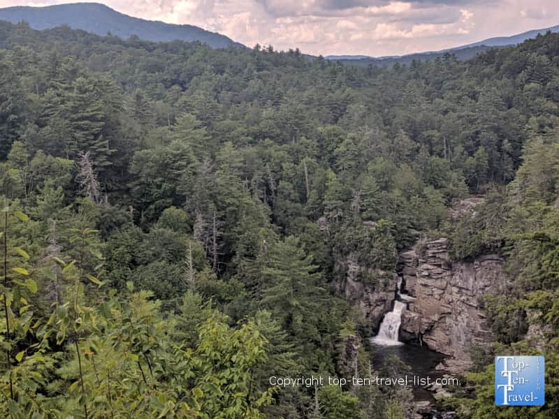
- Attractions: Grandfather Mountain, Linville Falls, Mt. Mitchell State Park, Chimney Rock State Park, Folk Art Center
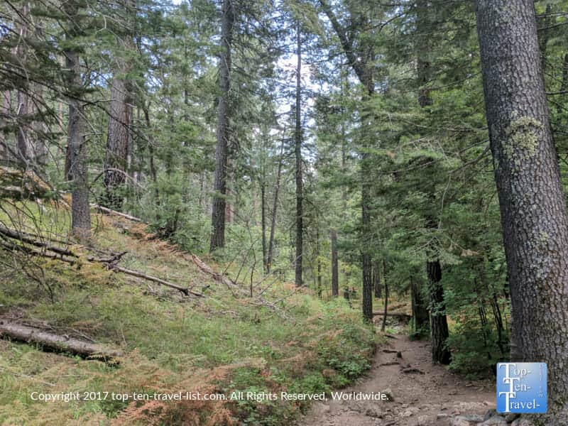
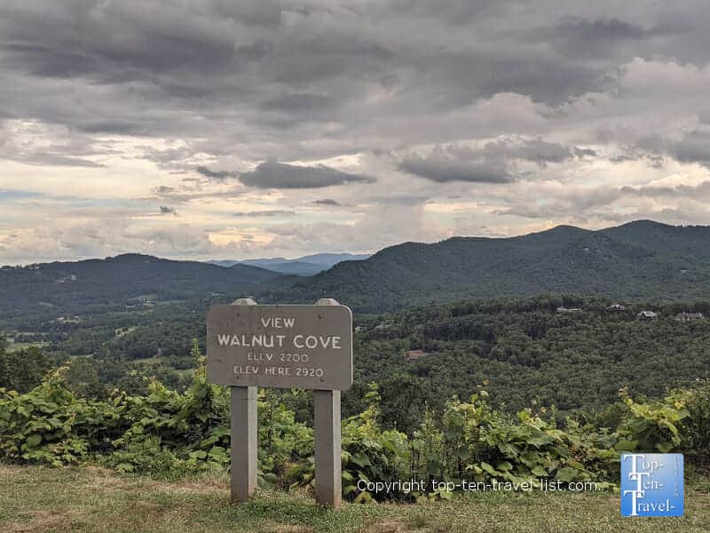
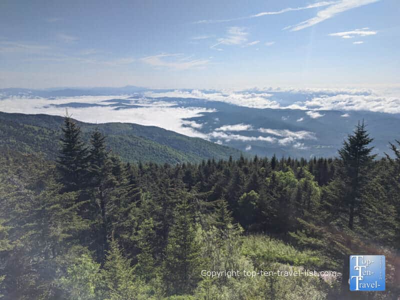
“America’s Favorite Drive” offers much more than simply breathtaking mountain views within its’ 400+ mile course. Spanning a massive distance from Shenandoah National Park in Virginia to The Great Smoky Mountains, there’s much to do and see along the way. Whether you feel like taking a long road trip, or simply exploring a small portion of this drive, do put this one on your bucket list. Uninterrupted views of the beautiful Blue Ridge mountains await you at every turn. There are plenty of hikes to work up a sweat. Or better yet, simply cruise along at a leisurely pace and take in the mesmerizing beauty of nature uninterrupted.
The Parkway is conveniently split into several sections for easy planning. The Pisgah section is incredibly scenic with endless overlooks, hikes, and waterfalls to enjoy. This portion of the drive is located entirely in North Carolina. Asheville (a lively mountain hub) is the perfect base for exploration. I had the privilege of living 5 min from the Parkway for several years and took advantage of it nearly every weekend!
Pisgah Area Attractions
A number of attractions to check out between Mileposts 339.5 to 469.1 are featured below. All of these destinations are within an hour of Asheville, your likely base for exploration in the Pisgah region.
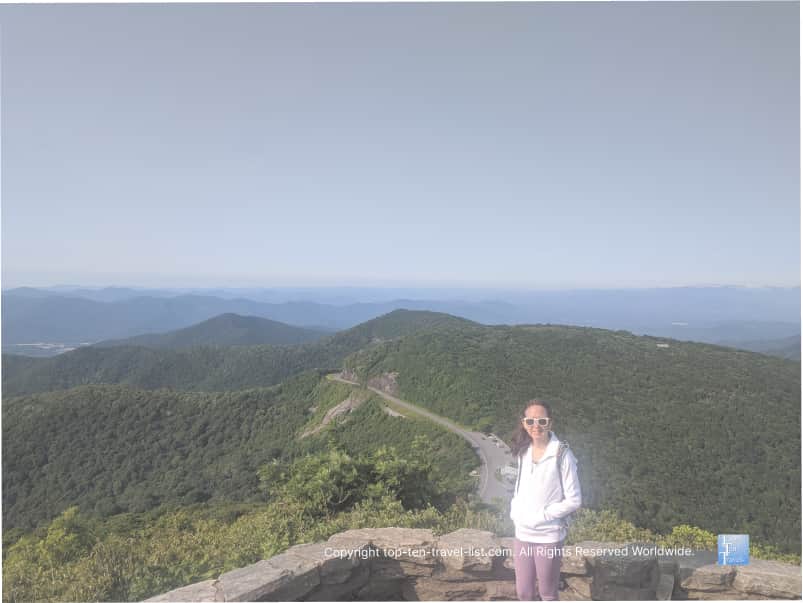
- 355.4 – Mt Mitchell State Park: The highest point east of the Mississippi (6684 ft)
- 361.2 – Glassmine Falls overlook: Scenic overlook of a 800 ft waterfall
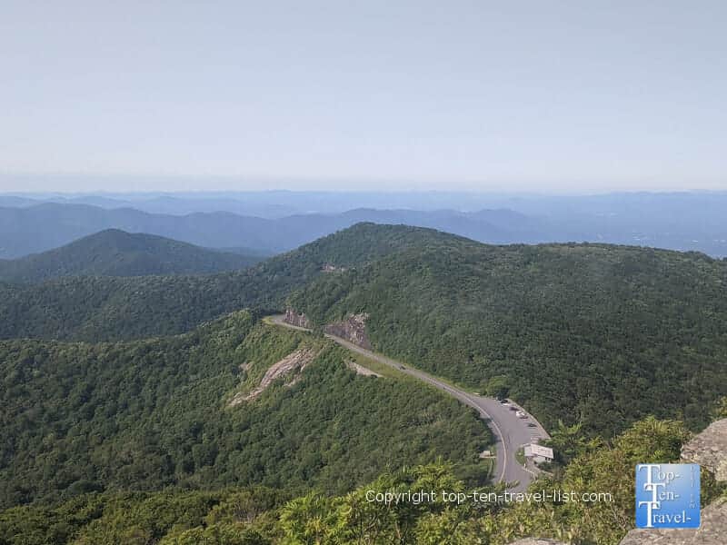
- 364.2 – Craggy Pinnacle trail: Short, steep hike featuring dramatic Blue Ridge mountain views
- 382 – Folk Art Center/Mountains-to-Sea trail: Museum/store of Southern Appalachia arts and craft/mod hike
- 393 – North Carolina Arboretum: Beautiful bonsai garden and 10 miles of maintained hiking trails
- 420 – Black Balsam hike: Stunning hike to a grassy treeless mountain bald. Best views on the Parkway!
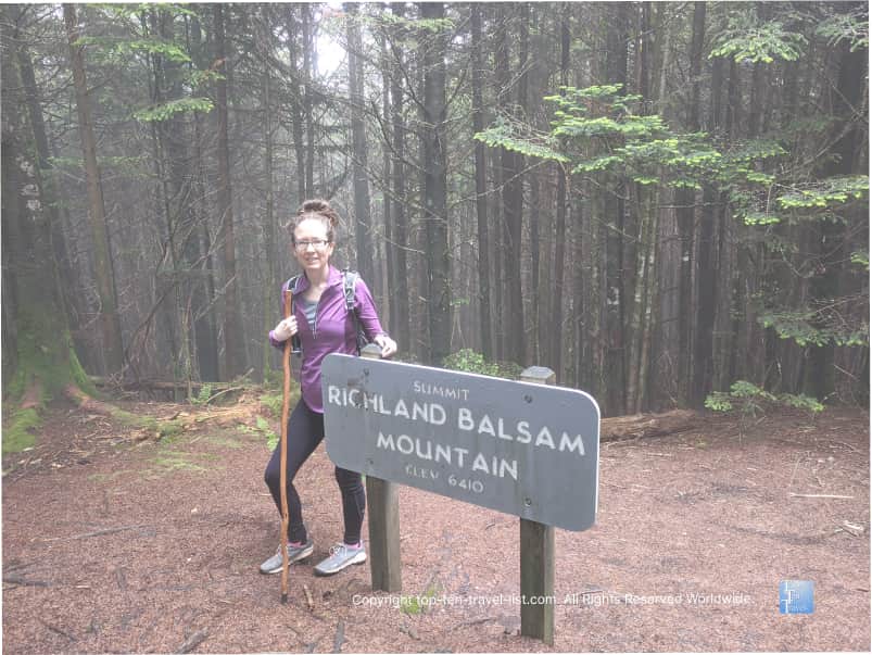
- 431.4 – Richard Balsam overlook: Highest point on the Parkway at 6410 ft/high altitude 1.5 mile loop trail in the pines
3. Mesa Falls Scenic Byway
- Location: Southern Idaho, about 70 miles east of Idaho Falls
- Length of drive: 29 miles
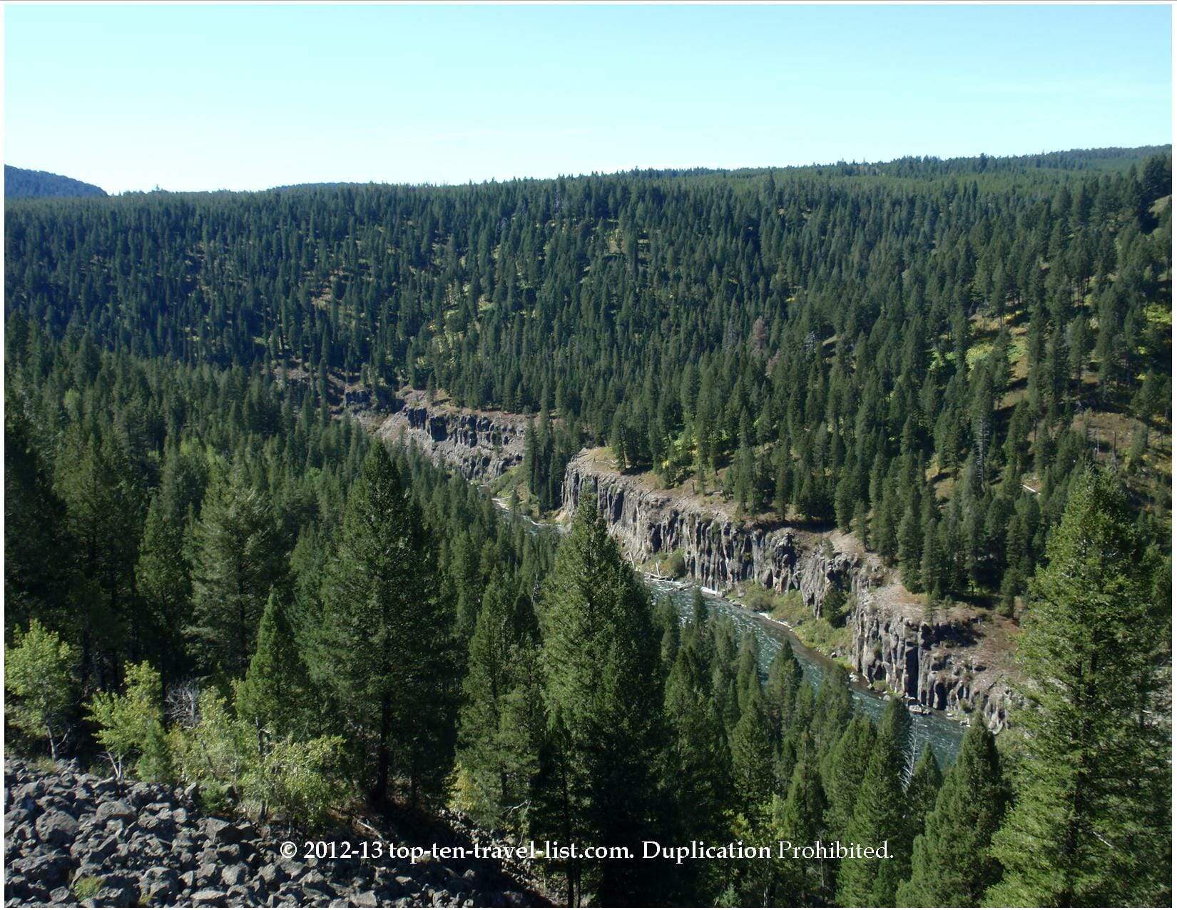
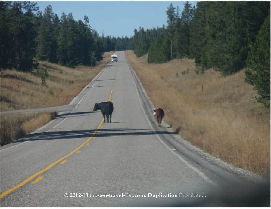
- Highlights: 2 magnificent waterfalls, fantastic views of the Snake River, free roaming cows, open to cross country skiing in the winter, lush views of the Caribou-Targhee National Forest
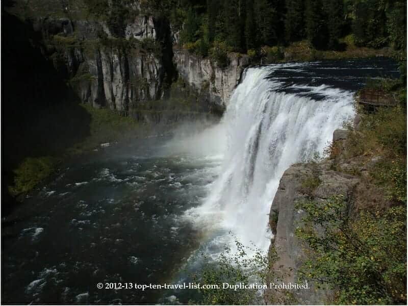
This drive truly is a hidden gem, and easily one of the best things to do in the state of Idaho. However, it is often overlooked by tourists whom head to the bigger attractions. The entire drive is very lush as it winds a scenic course through the Caribou-Targhee National Forest. Spanning 3 million acres and featuring diverse scenery and wildlife, this forest offers year-round recreational opportunities. The most visited site is beautiful Mesa Falls, one of the last major uninterrupted waterfalls in the state.
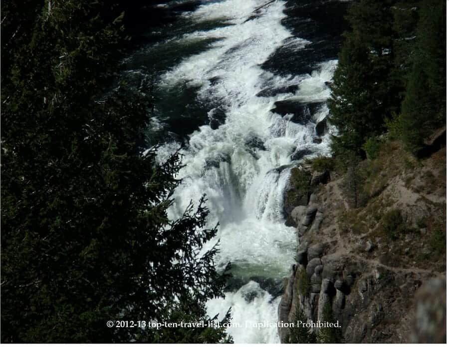
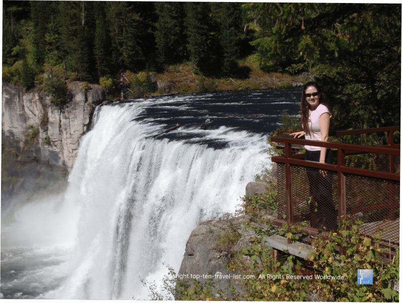
Lower Mesa Falls stands 65 feet and is easily viewed via an overlook, just under a mile from the turn off for the Upper Falls. Even more stunning, the powerful Upper Falls stands 114 foot tall, 200 foot wide. The uninterrupted natural setting and powerful volume make this voluminous waterfall one of the West’s most magnificent. A short paved boardwalk leads you to this natural wonder. Visit in the summer when both waterfalls will be at their most powerful.
4. Zion National Park Canyon Drive
- Location: Springdale, Utah
- Length of drive: 57 miles
- Highlights: Mesmerizing red rock scenery, tranquil views of the Virgin river, access to spectacular hiking trails
- Attractions: Watchman trail, Pa’Rus trail, Emerald Pools trail, scenic overlooks, Grafton Ghost town
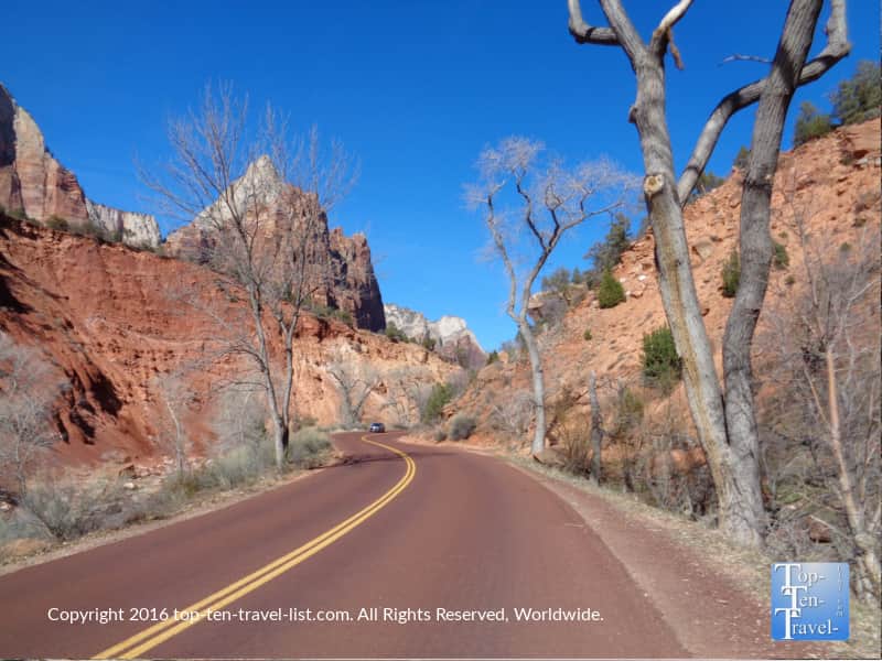
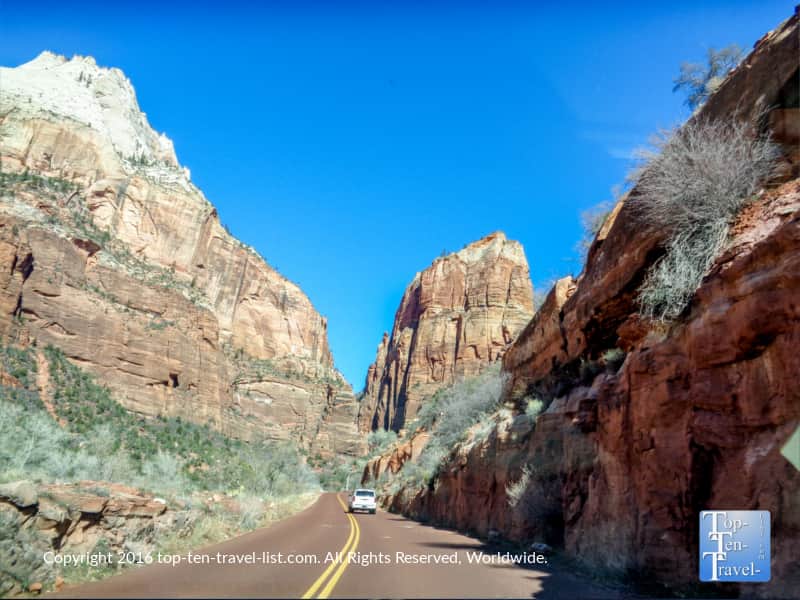
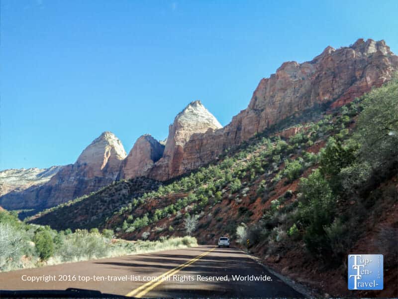
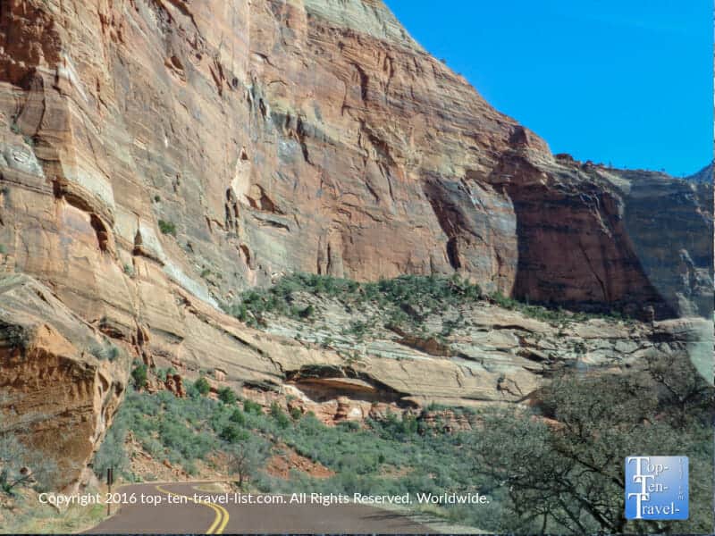
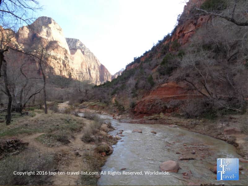
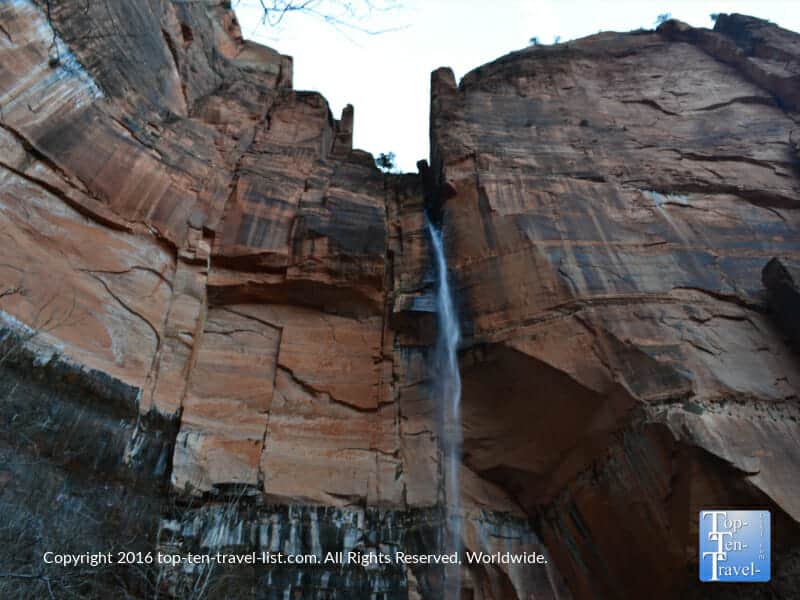
Zion National Park is hands down one of the country’s most spectacular national parks. Anyone who appreciates nature needs to put this gem high on their bucket list. Spectacular hiking trails, waterfalls, and an otherworldly scenic drive offer endless opportunities for sightseeing. For anyone not up for a lengthy hiking adventure, the Zion scenic drive is a fantastic alternative. While Angel’s Landing is an exhilarating hike, it’s also lengthy, rigorous, and considered to be one of the most dangerous hikes in America. On the Zion Canyon drive, you will get to enjoy fabulous views of the million+ year old red rocks from the comfort of your car.
The drive runs a 57 mile long course through many mind blowing red rock formations. There are numerous places to get out, stretch your legs and take photos. Several popular easy/mod hiking trails can be accessed via this route. The Emerald Pools trail features several waterfalls in a unique setting, while the Watchman features the most incredible red rock vistas. The road is only open to the public from November- March, so plan accordingly. Winter is such a peaceful time to visit. The park takes on a tranquil enchanting atmosphere during this barren time.
If you wish to visit during peak season, be aware that the drive will be closed to vehicles. A shuttle will need to be taken to access hikes.
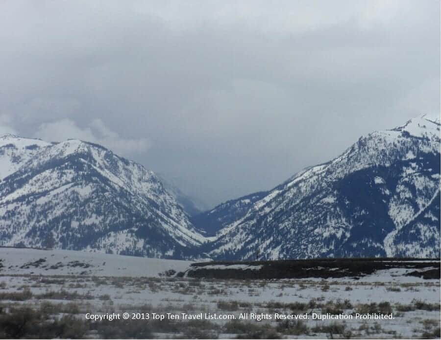
5. Gros Ventre Rd.
- Location: Begins about 10 min outside of Jackson Hole, WY
- Length of drive: 7 miles
Highlights: Beautiful natural scenery, secluded, lots of wildlife, access to recreational activities & camping - Attractions: Grizzly Lake Trail, scenic overlooks
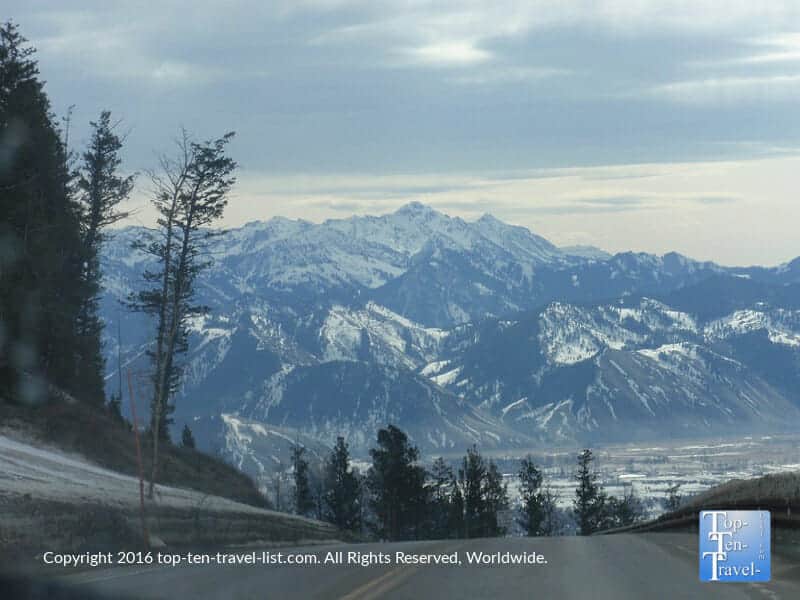
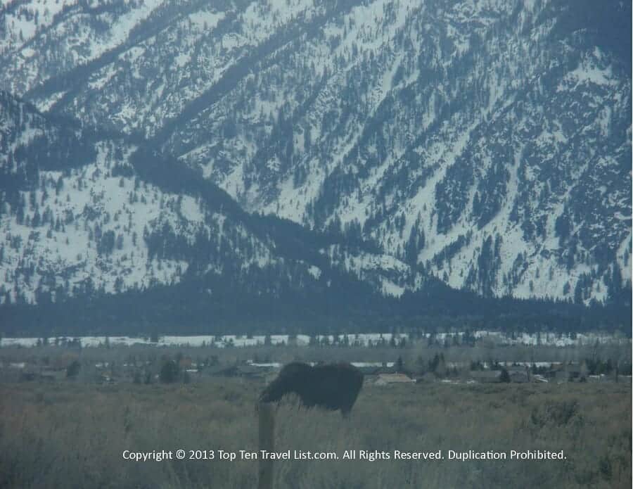
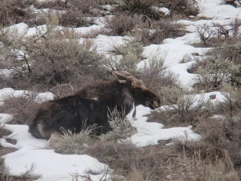
The Grand Tetons NP is an overlooked vacation destination for outdoor lovers. In addition to 100’s of miles of beautiful trails, there are a number of picturesque drives. Gros Ventre Rd. is a prime place for sightseeing and wildlife watching. The road begins about 7 miles outside of Jackson Hole and continues on for 7 miles of immense beauty. Following the course of the Gros Ventre river, the drive takes on a tranquil vibe, even more so during the winter. Wildlife sightings are common due to the lack of tourist traffic. Be on the lookout for moose, bison, and antelope. I saw several moose on my first drive here, so really it is not that rare.
Overall, this drive is a nice alternative to the busier drives located in or near the Grand Tetons National Park. You are almost guaranteed to see some wildlife if you visit at the right time. A number of hikes and recreational opportunities can be enjoyed in this area. Located in the Bridger Teton National forest, the Gros Ventre wilderness area offers a peaceful alternative for hikers looking to avoid summer tourist crowds. Look into the Grizzly lake trail, a popular local’s hike which features fantastic views of the lake via moderate effort.
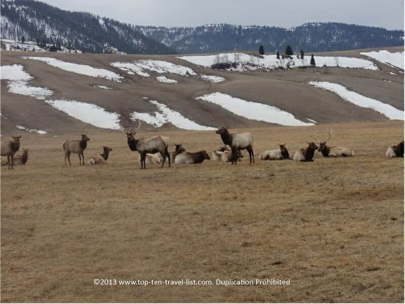
While you are in the vicinity, plan a visit to the National Elk Refuge. Established in 1912, this wonderful refuge provides habitat to one of the largest elk herds (the winter pop is 6000-8000).