12 Stunning Sedona Hikes with Spectacular Views
Disclaimer: We are not paid to promote any restaurant, hotel, activity, product, or attraction. All opinions are subjective and based on our personal experience. Your experience may be different.
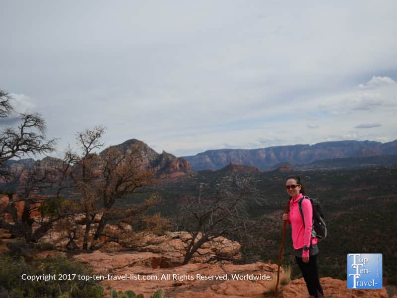
It’s no secret that Sedona is home to some of the most jaw dropping scenery in the country. Known as Red Rock Country for the colorful red rock formations that dominate the landscape, this natural hotspot is increasingly becoming a popular vacation & 2nd home destination for sun seekers, photographers, nature lovers, hikers, & mountain bikers. While daytripping here from Flagstaff, I saw so many tourists lining up for popular trails like West Fork & Devil’s Bridge every weekend (and even more during holiday periods).
You will find hundreds of miles of trails, some easy, some difficult, yet all loaded with magnificent views of the surrounding million year old ancient rocks. Living in the region for several years, I had the unique opportunity to explore many of these amazing trails. Nearly every weekend, I was out there taking in the otherworldly red rock views. I’ve hiked a variety of trails from easy nature strolls to heart pounding climbs. There is a little something for everyone here, no matter your hiking ability. Along with some great ways to take in the scenery without hiking at all.
I love that there are so many hikes to choose amongst, so everyone can enjoy a great view no matter your fitness level. To prevent yourself from unnecessary stress during your vacation (let’s keep it relaxing!), I have compiled a list of my favorite easy-moderate hikes with great red rock views. This was no easy feat as there are so many contenders. Enjoy your vacation!
1. Devil’s Bridge
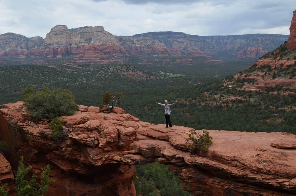
Devil’s Bridge is by far the standout trail. This one is definitely number one if you are limited on time. Unfortunately, it is for most other tourists too so expect a full parking lot (get here early!). While not the easiest, nor hardest trail in town, this one definitely wins the award for offering the most jaw dropping scenery. What makes this trail so fascinating is the incredible ending view of Sedona’s largest natural sandstone arch. This is the only arch that you can actually walk across (that is if you are not scared of heights!). I am not afraid of heights and the arch is pretty wide(~ 5 feet), but still a bit scary to look at the 100+ foot drop beneath you.
The 2 mile round-trip trek is a moderately easy journey with a few steep inclines and scrambling up rocks to get to the ending arch. Note that your overall distance with be 6 miles if you don’t have a high clearance vehicle as you will have to park at another connecting trailhead (Chuckwagon). The hike is relaxing (despite the popularity) with plenty of wide open vistas of the gorgeous rock formations. Standing on the arch while having someone take your photo on the other end is the number 1 must-do in my opinion: a fantastic souvenir photo that beats any man-made souvenir you will find in the tourist shops dominating Uptown.
- Difficulty: Moderate
- Distance: 1 mile out-and-back from the main parking lot (requires a high clearance vehicle & is almost always full) or 3 miles out-and-back from the Dry Creek Vista trailhead
- Location: Dry Creek Rd.
- More info & pics from Devil’s Bridge
2. Cookstove
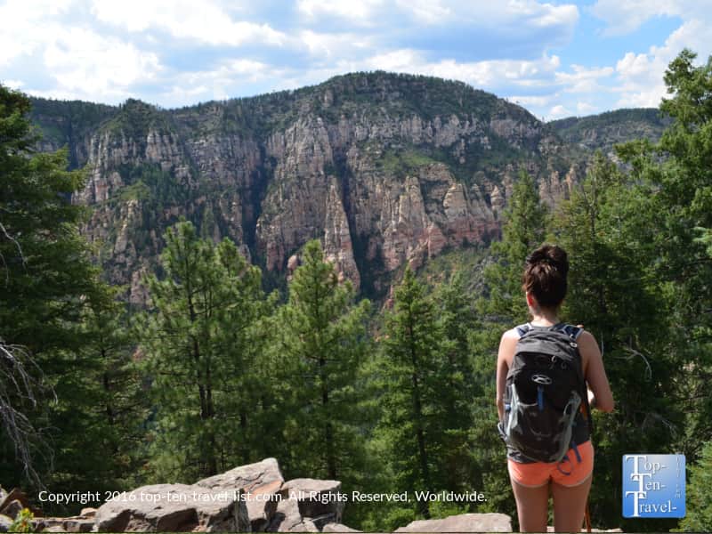
The Cookstove Trail is one of the little known gems in the area, most likely due to the easily missed location along the stunning Oak Creek Canyon drive. Most tourists are so absorbed with the magnificent views (I don’t blame them!) that it is very easy to miss the tiny trailhead sign. Also, most tourists head straight to the very popular West Fork. This is a great trail too but Cookstove wins for the magnificent overlook of Oak Creek.
Featuring amazing overlooks of the entire Oak Creek region, this peaceful hike is a must-do for anyone up for a challenge. And a challenge it is, as this hike requires an extremely steep 0.7 mile climb. As a regular hiker, I found this one to be quite challenging. It’s one of my favorite hikes: I love the challenge, the desolate nature, and the incredible ponderosa pine scenery.
Along with pines, you’ll get to see some colorful rock formations and lush green forests of ponderosa pines, sycamore, and cypress trees. For your immense effort, you will enjoy some of the top views of any hike in this region. And do not forget to fill up your water bottle with natural spring water at the tap located just across the road (also where you will park your car). Tip: treat yourself to a healthy breakfast at Indian Gardens pre-hike, located just a few miles down the road.
- Difficulty: Hard due to the steep inclines & high elevation
- Distance: 1.4 miles round-trip
- Location: Milepost 387 on Hwy 89a (Oak Creek Canyon drive). Notice the parking area near the spring water tap (you will see many other cars parked along the side due to the popularity of this natural spring)
- More info & pics from the Cookstove
3. Teacup/ Sugarloaf Summit Trail
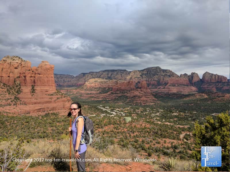
Sedona’s Teacup Trail is what I consider to be one of the best values in town for several reasons. First, this hike is close to town. Second, you do not have to drive down an annoying dirt road to get to the trail-head. Third, this trek offers some stunning scenery without any steep climbing required. At just a little over 2 miles round-trip with just a few minor inclines, it is easy enough for the beginning hiker. The nice aspect of this trail is the unique scenery: you really get to enjoy some views here that you will not find along any of the other trails. I recommend this trail as one of the best options for first time visitors.
This hike in particular will give you the best views of Coffeepot Rock (named as so because it resembles a coffeepot). If you look closely at the photo above, you can make out the coffee spout and lid. Each rock formation is named after its’ shape.
Also, you have the option of connecting this trail with the Sugarloaf Summit trail. This involves a short but steep 0.2 mile climb up to an amazing overlook with more breathtaking 360 degree red rock vistas in every direction. It’s a must-do if you are up for a little more of a challenge. This combined trail is hands down one of my top 10 in the area.
- Difficulty: Easy (Moderate if you combine with the Sugarloaf Summit)
- Distance: 1.3 miles out-and-back or 2 mile loop if combining Sugarloaf
- Location: Buena Vista Drive
- More info & pics from the Teacup/Sugarloaf
4. Airport Mesa
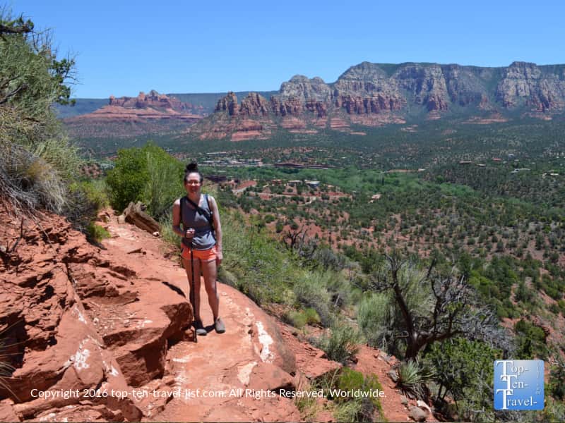
Airport Mesa is one of 4 hiking vortex sites. If you have vacationed here before, then you already know about vortexes. And, if this is your first time, you will likely know what a vortex is before you leave. Pick up any visitors brochure, browse through a local paper, or stop in a specialty shop and you are bound to come across the term at some point. A vortex is basically believed to be an area of intense concentrated energy rising from the earth. Each vortex supposedly can provide healing & energy balancing to whomever comes across it.
Vortexes have become very popular in recent years as more visitors report a sense of healing & inner peace when coming in contact with these powerful natural energy sources. The New Age community continues to grow, and those seeking spiritual healing continue to make Sedona a spiritual vacation destination.
Airport Mesa is a yang masculine vortex (vortexes are masculine or feminine), which means that you may feel energized or motivated while hiking this trail. Feminine yin vortexes (like Cathedral Rock) are reportedly great for those seeking relaxation. Vortex aside, I really love this scenery on this one. You’ll enjoy 360 degree views of many prominent rock formations. This hike is not one for scaredy cats as there are some really steep narrow sections in the beginning, so be forewarned. I recently saw a few people mountain biking and not quite sure how they survived!
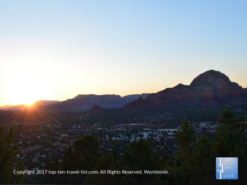
For those who can’t hike, there is a wonderful overlook in this area (perfect for watching a sunset!)
- Difficulty: Moderate (not much elevation gain, but feels long especially with the summer heat)
- Distance: 3.5 mile loop. Note you may have to park in the overflow lot and complete a short side trail to get to the main trail. This will add an extra 1.2 miles to your total)
- Location: Airport Rd.
- More info & pics on the Airport loop
5. Fay Canyon
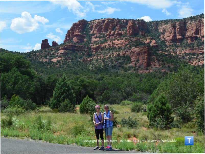
Fay Canyon is an easy little trek which really packs in a lot of big views. This is where I took visiting family members who have never hiked before. This is a short-but-sweet hike if there ever was one. For anyone new to hiking, this would be one of my top picks.
Although it is one of the easier trails in town, it also happens to be one of the most incredible. Highlights include towering red rock formations and a stroll through the lush Red Rock Secret Wilderness (consisting of a diverse ecosystem of plants). This is one of the best trails to see wildlife on (notice the black bear warning signs!). I hiked this trail frequently as a local as it is beautiful, easy, and quiet.
A short detour about a 1/2 mile in takes you to a natural arch. It makes the hike a bit harder, but is worth the extra effort if you are looking for a bit more of a challenge!
- Difficulty: Easy (a bit more difficult if you complete the side arch trail)
- Distance: 1.5 miles out-and-back
- Location: Boynton Pass Rd.
- More info & pics from the Fay Canyon
6. Soldiers Pass
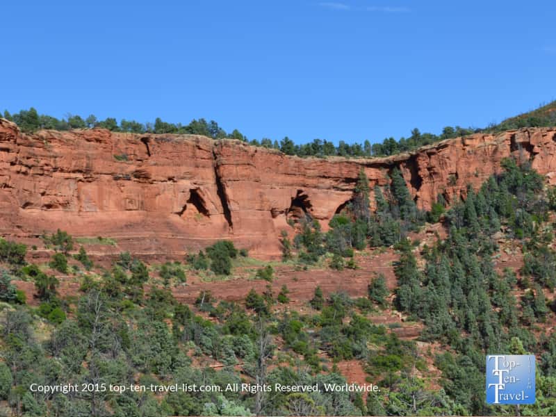
Soldier’s Pass is one of the more exciting trails as you will get to enjoy a number of interesting natural features not found on other trails. These include: 7 sacred pools (a series of 7 natural pools carved out of the sandstone), 3 natural arches, and Sedona’s most active natural sinkhole. On an interesting side note, Apache and Yavapai tribes considered these pools sacred because they were a source of year-round drinking water in the arid desert.
This trail is a bit long at about 2.25 miles each way, although the hike itself is relatively easy. Fortunately, no major climbing is involved. It’s close to town, although stays a bit quieter than the more popular trails. This trail is unique as the landscape changes quite frequently, as you find yourself leisurely strolling through the leafy, shady Red Rock Wilderness one minute, and then venturing out into the wide open vistas and enjoying the amazing red rock formations the next. I really feel lost in a beautiful natural wilderness while hiking this trail.
I love the change in scenery and excitement of coming across these rare natural features. It’s a must-do for anyone seeking a relaxing longer hike with gorgeous diverse views and a little bit something extra.
- Difficulty: Moderate
- Distance: 2.25 miles out-and-back
- Location: Rim Shadows Drive (Drive 0.2 miles on this road until you come across the gated trailhead). Parking is extremely limited. I recommend taking the free shuttle to avoid the hassle.
- More info & pics from the Soldier’s Pass
7. Little Horse
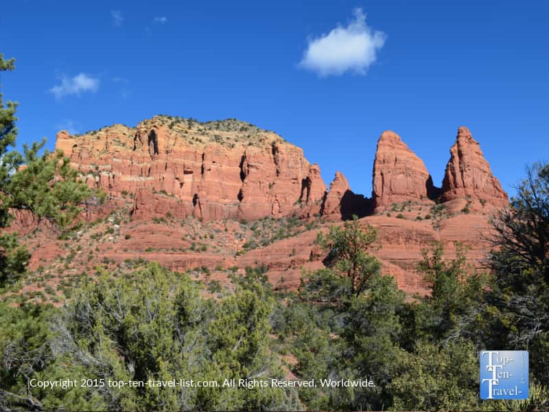
Little Horse is an enjoyable little workout conveniently located along the Red Rock Scenic Byway, a very breathtaking 7 mile drive. This trail is just 3 miles and pretty flat, making it suitable for hikers of all skill levels. Because it is so short, it should not take you more than 1.5-2 hours. This means you will have plenty of time to explore more as opposed to being knocked off your feet for the rest of the day.
I find this trek quite enjoyable thanks to the scenery and ample trail markings (unlike Soldier’s Pass and many others which are so poorly marked). As an added bonus, the trailhead parking lot is rather large, so there is usually no need to wait for a spot.
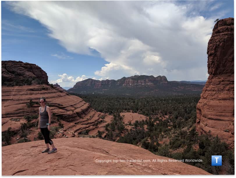
Beautiful views of the notable Courthouse and Cathedral Rock formations will leave you in awe along the entire journey. The ending summit view known as Chicken Point is absolutely stunning with red rocks surrounding you in every direction. The pink jeep tours take away some of the beauty, but otherwise what a stunning overlook. Take some time to savor the views for a bit before continuing on with the return journey!
- Difficulty: Easy
- Distance: 1.5 miles out-and-back
- Location: Milepost 309.8 on Hwy 179
- More info & pics from the Little Horse
8. Doe Mountain
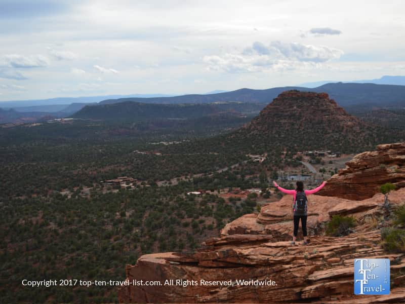
Doe Mountain is a wonderful intermediate trail which involves a very scary 0.7 mile climb to the top of a mesa, with great views going up, and even better views atop. It’s a gorgeous hike requiring a bit of a steep climb up a series of switchbacks, although not all that bad considering the tradeoff of stunning views and limited crowds. Switchbacks do make the hike a little bit less intense, but it’s still a workout for sure.
From the top, you will enjoy 360 degree, uninterrupted views of so many wonderful local landmarks including Wilson and Bear mountain, along with Boynton and Secret Canyon. With stunning red rock vistas, no more than moderate effort required, peace & quiet, ease of parking, and low congestion, this hike is a bucket list contender for sure. This is not the hike for those scared of hikes due to the steep drop offs!
- Difficulty: Moderate
- Distance: 0.7 miles out-and-back (add a mile or so if you plan to take a self guided walk around the top of the mesa)
- Location: 97-99 Callisto Ct
9. Boynton Canyon
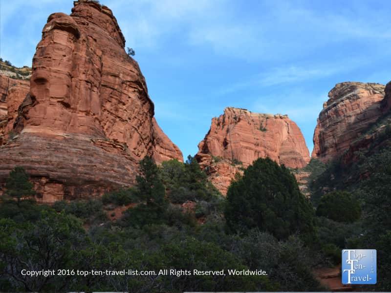
Boynton Canyon, a picturesque trail through a box canyon, is one of the most exciting and diverse trails in the area. As the elevation varies throughout this trail, it is not rare to find yourself sweating in the open red rocks one minute and then possibly walking through a forest of snow the next! I was shocked my first time hiking this one due to the dramatic change in scenery – it was a memorable experience for sure going from hot temps to snow in just a short period of time.
The gorgeous forest scenery includes a diverse assortment of trees including ponderosa pines and oaks, and is one of the few areas to see colorful fall foliage. Black bears and mountain lions both call the area home, although you are unlikely to see these shy creatures who tend to avoid humans. I’ve never seen any evidence of wildlife.
The trail is a bit long (about 6 miles round-trip), although the journey is very relaxing with rewarding views all around, especially near the ending climb. Like the Airport Mesa trail, Boynton Canyon is also a vortex site. Boynton possesses both masculine & feminine energies, providing a yin/yang balance.
Whether any spiritual energy actually exists, the hike itself is energizing and refreshing, giving you the rare opportunity to enjoy a variety of exciting landscapes within one hike, ranging from peaceful wilderness forest one minute to colorful red rock vistas the next.
- Difficulty: Moderate
- Distance: 2.7 miles out-and-back
- Location: Dry Creek Road
- More info & views from the Boynton Canyon
10. Eagle’s Nest Loop at Red Rock State Park
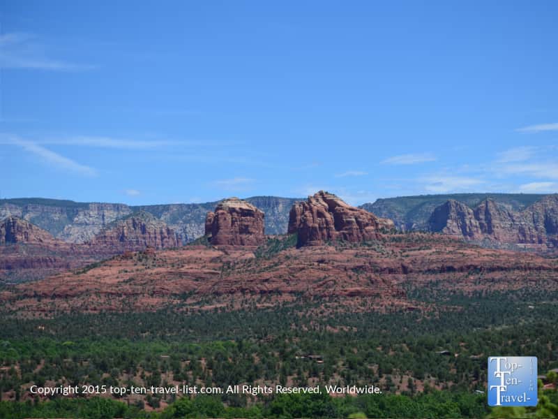
Red Rock State Park shines as one of the region’s overlooked hidden gems. For some reason, it does not draw nearly as much traffic as you would expect. As a local tired of tourist crowds, I appreciated the serenity here. Anytime I hiked here, I rarely saw anyone else which was a nice change of pace.
What I like most here is that the trails are all easy and well maintained. You will come across 5 miles of family friendly trails which are well marked and easy-moderate in intensity. Eagle’s Nest Loop is the most scenic of the bunch. Oak Creek flows through the park and provides a unique habitat for both plants and wildlife. Birdwatching is a popular pastime. Also, you will want o keep a lookout for all sorts of wildlife including javelina and bobcat.
On a side note, Red Rock SP offers a variety of fun family events throughout the year including guided hikes. Be sure to check out the schedule during your visit as these guided hikes are an excellent opportunity to learn more about the diverse flora & fauna found in the region.
My favorite hike, Eagles Nest, consists of a 2 mile trek to the highest point in the park. Nothing too difficult here, and the views are incredible: it’s a great bang-for-your-buck trail! Trails range from a easy 1/2 mile trek to a more challenging climb to Eagle’s Nest, or you can connect them all for a 5 mile loop.
- Difficulty: Moderate
- Distance: 2 mile loop
- Location: 4050 Red Rock Loop Rd.
- More info & pics from the state park
11. Templeton Trail
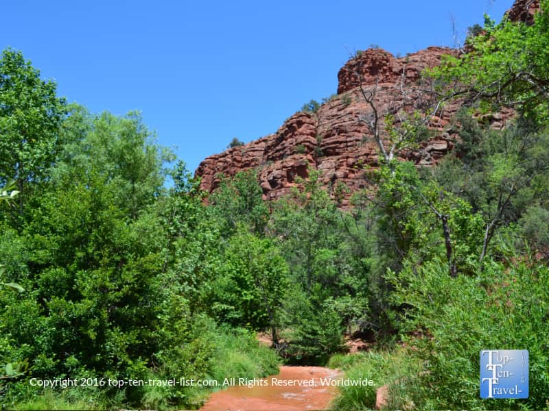
The Templeton Trail at Cathedral Rock is a nice short & less risky alternative than the challenging (and very scary!) scramble up the rock (especially for those not keen on heights). While completing the challenging climb up Cathedral rewards with awe-inspiring scenery, it is a bit scary & even dangerous. I hike all the time and I am not afraid of heights and this trail was so challenging to me. The Templeton is a worthwhile scenic alternative: a hidden treasure passed over by most tourists.
With lush greenery, gorgeous views of flowing Oak Creek, and of course, stunning red rock scenery, this trail is just so relaxing in comparison to others. It’s really easy too (2 miles and completely flat) so a great choice for anyone new to hiking. For me, it wins the award for most relaxing for the picturesque creek views and low foot traffic.
- Difficulty: Easy
- Distance: 1 mile out-and-back
- Location: Back O’ Beyond Rd.
- More info & pics from the Templeton
12. Wilson Canyon
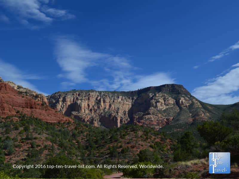
Wilson Canyon is a short enjoyable hike which starts at the very popular Midgley Bridge. This is one of the most popular destinations in the region due to the amazing photo opportunities, access to a number of scenic hiking trails, and short walking distance to the creek to cool down during the hot summer season. Be aware that the parking lot gets packed by mid morning, so you will want to set off on your hike very early to ensure a spot! I recommend stopping at Indian Gardens for breakfast beforehand so you can hit the trail early.
The majority of the time, I come here to hike the beautiful trails instead of looking at the bridge. This is another easy stroll through the shady Red Rock Secret Wilderness. While leisurely strolling this flat 1.5 mile trail, you will be surrounded by shrub oaks and Arizona cypress, making it a perfect shady choice for the warm summer season. Also a nice choice for fall leaf peeping. The trail starts and ends with some magnificent red rock scenery.
Difficulty: Easy
Distance: 1.5 miles each way
Location: Midgley Bridge parking lot of 89a
More info & pics from the Wilson Canyon
Tips for a great hiking experience
- Visit during the off season, if possible. Hiking is much more enjoyable without tons of foot traffic.
- Carry lots of water and snacks on any hike. A camelbak works well in dry desert climates where you need to drink extra water. I also like Gatorlyte for replenishing electrolytes.
- Avoid hiking in the summer season, if possible. It’s really hot and there is not much shade. If you do hike, keep it short, get out there early, and drink plenty of water.
- Purchase a Red Rock weekly pass to save a few bucks. If you plan on visiting multiple national parks in the upcoming year, do consider purchasing the annual America the Beautiful pass.
- Enjoy a healthy breakfast before your hike and a healthy lunch to refuel. I recommend Indian Gardens.
- Check out more great hikes in the Coconino National Forest
More AZ Bucket List contenders
For a guide to more scenic places throughout the state, I recommend looking through my Arizona Travel Guide. While I would say the red rocks are by far the most enchanting sight in the state, there are so many other interesting places to explore especially for history buffs and nature lovers.