15 Most Picturesque Trails in Arizona
Disclaimer: We are not paid to promote any restaurant, hotel, activity, product, or attraction. All opinions are subjective and based on our personal experience. Your experience may be different.
It’s really hard to narrow down the list of most scenic trails in Arizona. Really, the entire state is gorgeous and loaded to the brim with amazing mountain and cacti scenery. I enjoyed every second of my 4 years living in the state. Both the weather and landscapes vary dramatically across the state, and thus, the hikes also vary in scenic beauty. This leads to an incredible diversity of options when it comes to hiking. Fortunately, I had the opportunity to live in both southern (2 years in Tucson) and northern Arizona (2 years in Flagstaff) at different points. Whether you are seeking incredible mountain vistas, cacti as far as the eye can see, or even a gorgeous forest of green pine and aspen, Arizona offers it all. Enjoy my guide to the 15 most stunning hikes throughout this beautiful state.
1. Camelback Mountain
Hiking Camelback Mountain has long been the iconic must-do for any hiker/outdoor lover visiting Phoenix. While this is one of the most popular hikes in the state, it is also one of the hardest. The trek is just 3 miles round-trip although it’s a rough one that involves maneuvering up and down loose rocks and an intense 1000+ foot elevation gain. For all your effort, you are rewarded with the most incredible overview of the region. Start your hike at sunrise for the best views and avoid the hot summer season at all costs.
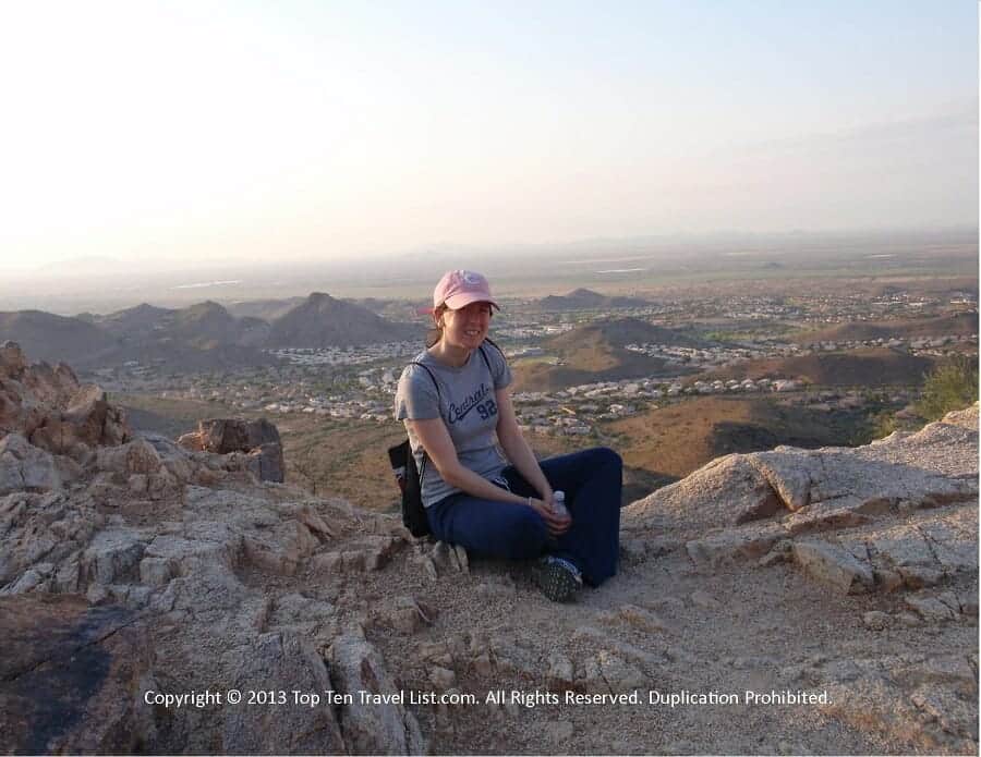
- Location: Phoenix (Park along the street on Invergordon Rd)
- Cost: Free
- Highlight: Best views of Phoenix
- Distance: 3.5 miles RT (Choose between the Echo Canyon or Cholla trail to the summit. Most say Cholla is the easier of the 2).
- Tip: Get here early to ensure parking. Do not attempt hike in summer.
- More info on hiking the Camelback trail
2. Bowen Hidden Canyon trail
Although Hidden Canyon may not be one of the most talked about hikes in Tucson, it surely is one of the most scenic. This really is Tucson’s best bang-for-your-buck hike as there is barely any elevation gain and the trek is just over 2 miles roundtrip. Living in the Tucson metro, this was my go-to weekend hike when not traveling elsewhere. It’s so beautiful and quiet! Not only are the views out-of-this-world with the majestic Tucson mountains and unending cacti comprising the backdrop along the way, but the lack of crowds oftentimes mean wildlife sightings. I’ve seen lots of deer and even several bobcats! And if that isn’t enough, parking is free!
- Location: JW Marriott Starr Pass Tucson (3800 W. Starr Pass)
- Cost: Free
- Highlight: Incredible views of the Tucson Mountain range
- Distance: 2 mile loop
- Tip: Grab breakfast at Seis tacos after your hike.
- More info on hiking the Bowen Hidden Canyon trail
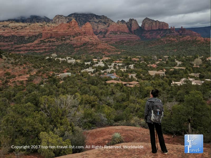
3. Devil’s Bridge
This is the standout trail in Sedona, the one all the tourists flock to, and for good reason. As the largest natural sandstone arch in Sedona, Devil’s Bridge is truly a unique sight to behold. After a relatively easy 2 mile walk filled with jaw dropping red rock views, you will get to put your fear of heights to test and walk across this seemingly narrow arch. In reality it is not quite as narrow as it looks (8-12 feet wide) but still quite an unnerving feat due to the 100+ drop below. On any given days, dozens will wait in line for this perfect photo opp.
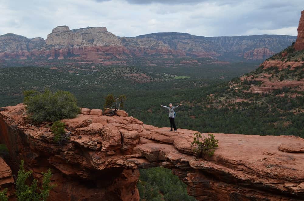
- Location: Sedona (Park on Dry Creek Rd to access the Dry Creek Vista trail which will connect to Devil’s Bridge).
- Cost: Free
- Highlight: Walk across Sedona’s largest sandstone arch
- Distance: 1 mile each way (you may have to park in the Dry Vista Lot and add on a 1 mile connector trail if you do not have 4WD).
- Tip: Hike in the off season (fall/winter) to avoid crowds.
- More info on hiking Devil’s Bridge
4. Inner Basin
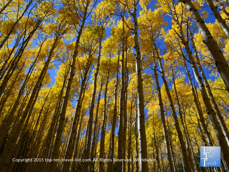
Flagstaff is a beautiful mountain community in the northern part of the state that I had the privilege of living in for over 2 years. It’s my favorite place I’ve ever lived. No region offers such incredible outdoor recreation activities. The massive Coconino National Forest offers incredible hiking opportunities for every fitness level. Many are unaware that this part of the state sees a gorgeous autumn season and that the resulting foliage rivals that found in New England. Phoenix residents flock up here each weekend come fall to enjoy the cooler temps and brilliant foliage.
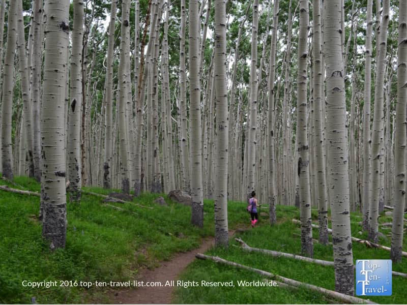
Inner Basin, a steep 1.5 mile climb up to the heart of the San Francisco Peaks (Arizona’s highest mountain range), is the most mesmerizing hike by far. In fall, the trail is ablaze in the most tremendous golden foliage you will lay eyes upon.
- Location: Flagstaff (Forest Rd 552).
- Cost: Free
- Highlight: Amazing fall foliage
- Distance: 1.7 miles out-and-back
- Tip: Check the Flagstaff Leaf-O-Meter for prime foliage dates.
- More info on hiking Inner Basin
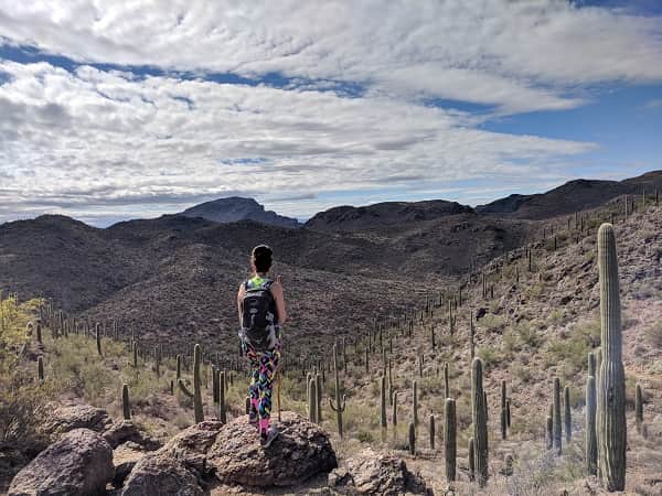
5. Canyon Loop Trail
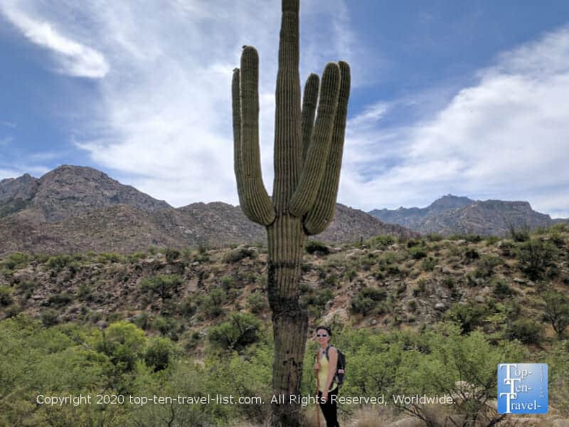
Catalina State Park is the most beautiful place to hike within the Tucson metro. Located in quiet suburban Oro Valley, this quaint, undervisited park is the best place to immerse yourself in the desert beauty minus hefty tourist crowds. The beautiful Catalina Mountain range provides an enchanting backdrop for all hikes. Add in jaw dropping views of hundreds of Saguaro cacti, and you have one incredible hiking oasis. I lived in an apartment literally right across the street and enjoy access to one of the most beautiful state parks I’ve ever visited. If you love cacti, you have to put this one on your bucket list!
New visitors will want to hike Canyon Loop Trail, a relatively easy 2 mile loop featuring breathtaking mountain scenery. Entrance is just $7 per car vs. $25 at Saguaro National Park, and thus, Catalina is the perfect budget friendly hiking alternative.
- Location: Oro Valley (11570 N. Oracle Rd)
- Cost: $7 per car
- Highlight: Amazing views of the Catalina mountains
- Distance: 2.3 mile loop
- Tip: Stop by for a coffee at Savaya, a fantastic local coffee roaster just across the street.
- More info on hiking at Catalina