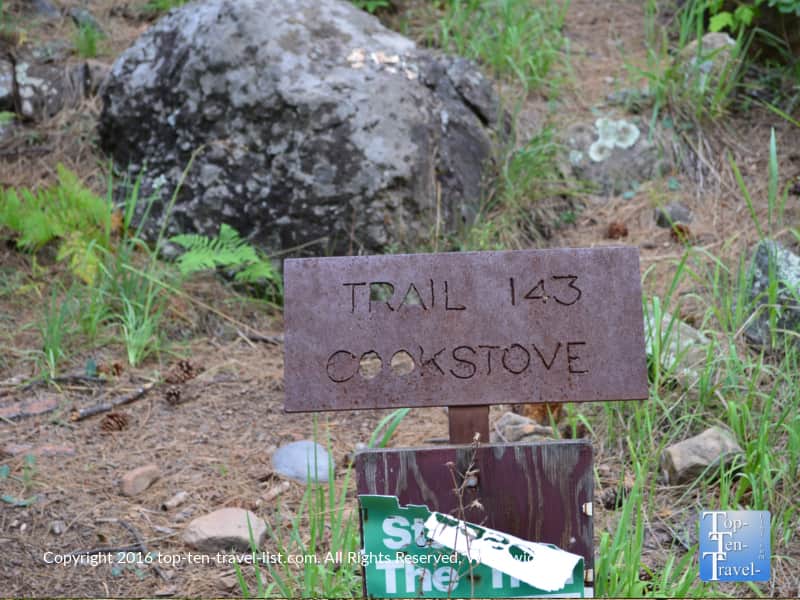
Hiking Sedona’s Oak Creek Canyon: The Spectacular Cookstove Trail
Disclaimer: We are not paid to promote any restaurant, hotel, activity, product, or attraction. All opinions are subjective and based on our personal experience. Your experience may be different.
If you have ever been on vacation to Sedona, then you probably already know about Oak Creek Canyon. For those who don’t, it’s basically an enchanting area of the state home to dense green ponderosa forests and towering multi-hue sandstone formations. There is a 14 mile long drive which connects Sedona with the equally beautiful Flagstaff. My first time driving this incredible route was such an awe inspiring experience. Fortunately, I lived about 5 minutes from the start, so I began exploring nearly every weekend. It’s so much more than a simple drive. One of my favorite things to do is to explore the underrated hikes which most of the tourists skip over.
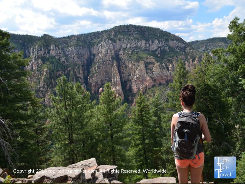
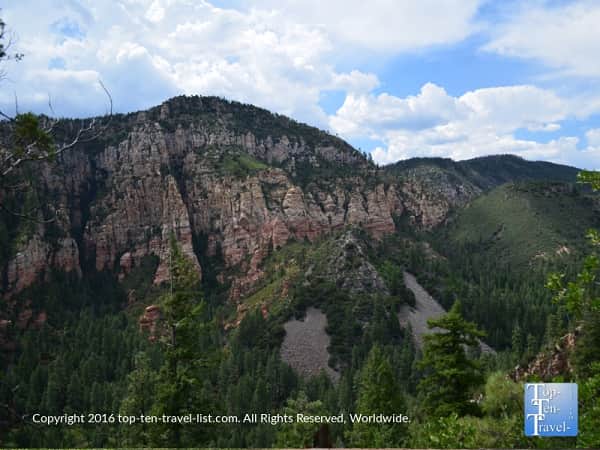
A number of hiking trails are available to soak in the views of this incredible area, which happens to be the second most popular tourist attraction after the Grand Canyon. I ran across this amazing trail called the Cookstove one day: it became one of my favorites in the region. At the end of this hike, you reach this incredible overlook of the entire pinec covered Canyon, and really the views really can not be matched elsewhere.
A challenging workout
This trail is quiet and super scenic. It’s also a fantastic cardio workout offering fitness buffs some of the best views in the area. Although the 0.7 mile out-and-back trek will take no longer than an hour, it’s quite a tough workout, especially in the hot summer months. This wouldn’t be my top choice for newbies due to the intense climb, but it’s definitely a contender if you been here more than a time or 2.
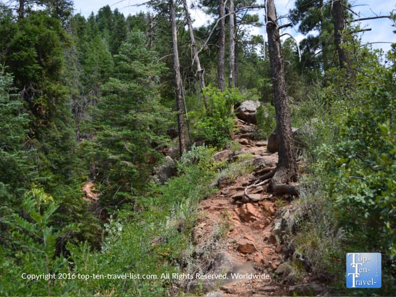
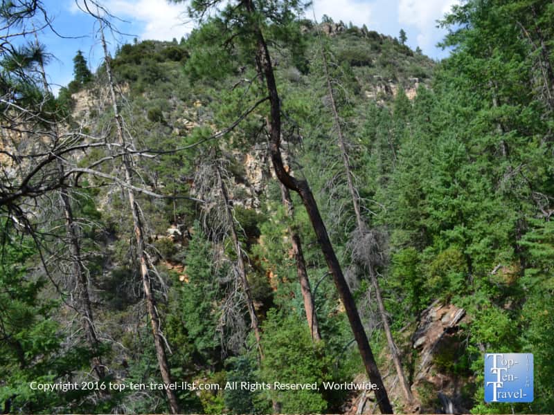
The trail begins with a series of very steep switchbacks up the East side of the canyon. In certain sections, the trail is so steep that staircases have been put in. With an elevation gain of almost 1000 feet, your legs will be feeling it. It’s no little feat, but then again the views are so enchanting. The effort is well worth it in this case.
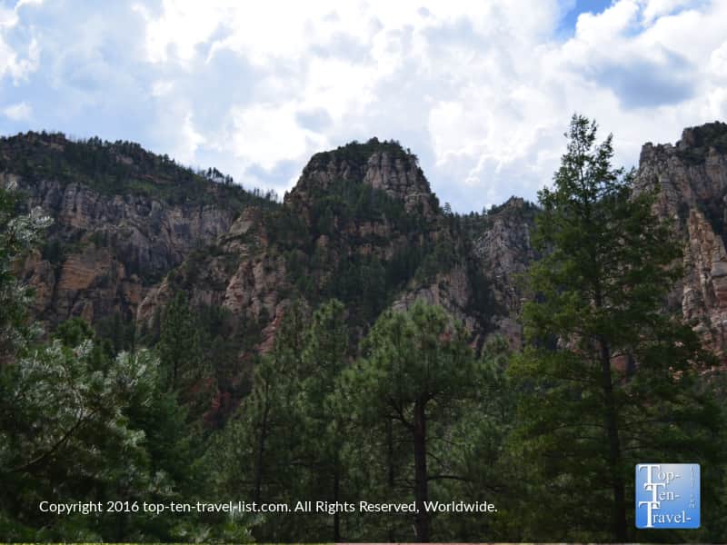
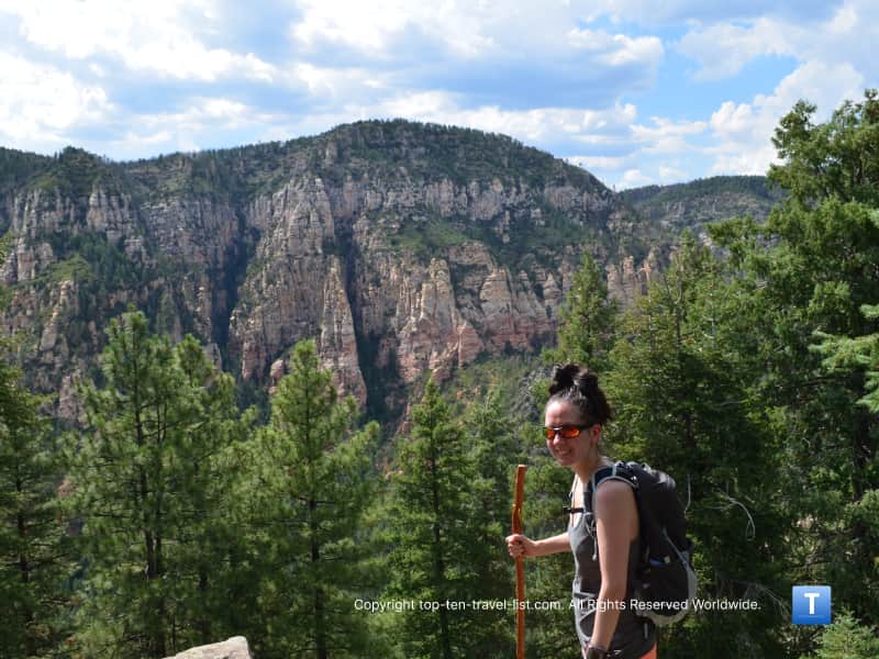
That being said, anyone up for an extreme cardio challenge will be rewarded with some pretty nice scenery as a trade off for their hard work. Great views of the colorful rock formations pop up at many points along the uphill climb. It’s just over a half mile up, although it feels much harder due to the steepness.
Taking a few much needed breaks along the way will allow you to take some great photos and fully absorb the breathtaking scenery. A note of caution to those scared of heights – the first section of the trail includes a number of steep drop offs!
Here is a look at the uphill portion of the trail. Sort of hard to see from the picture, but believe me it is a rocky and steep journey.
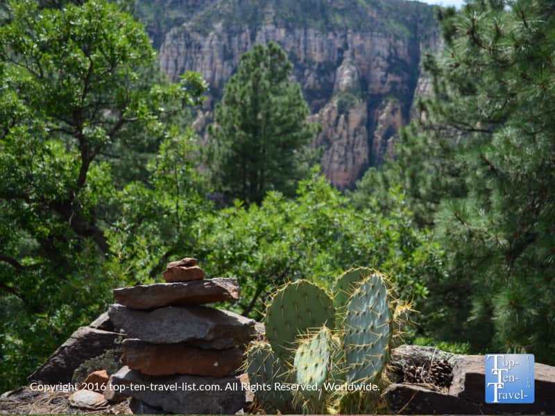
All that uphill climbing is worth it in the end. Check out these views – it doesn’t get much better than this! I would say this is one of the best viewpoints in the entire region and I’ve hiked some incredible trails in my years living here.
Diverse plant and animal life to keep things interesting
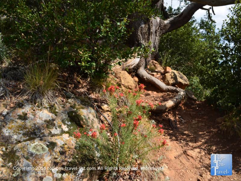
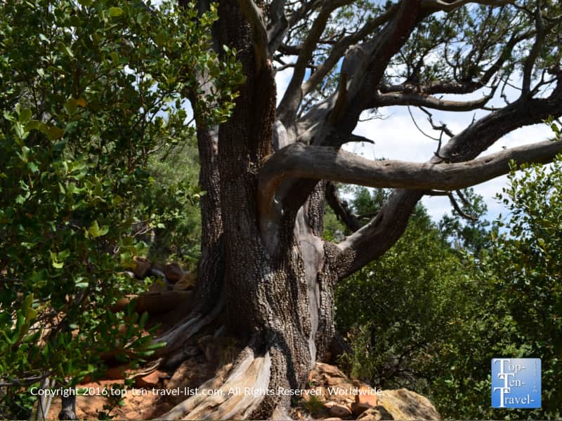
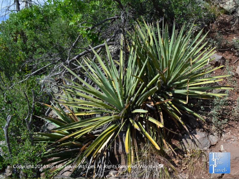
This trail offers a rare glimpse into the diverse trees and plant life which make up the canyon. You will see more pine trees on this one vs. the typical cacti and scrub views you will encounter on the majority of Sedona hikes. This high desert area supports a wide range of plant life which is one of the things that makes hiking here so interesting. I am originally from the Midwest so I love enjoying the new-to-me scenery. Oak and sycamore trees provide plenty of shade, making this one of the more bearable summer hikes.
Oak Creek also happens to be one of the best areas in Northern Arizona for fall leaf peeping due to the variety of deciduous trees. Summertime around August, you may be lucky to see some gorgeous wildflowers. Prickly pear cacti are abundant as these sturdy plants can thrive in all different climates and grow in altitudes up to 9000 feet.
On a side note, the area supports a diverse range of wildlife including black bear, mountain lion, and javelina. Personally, I have never seen any wildlife, however, I’ve seen reporting of sightings so be aware at all times!
A great non-touristy option
As I mentioned earlier, this is one of the quieter trails as it is often overlooked by tourists too busy taking in the amazing scenery along this drive. It’s also hard to miss this trail parking area as there is no big sign. Understandably, it’s hard not to fully immerse yourself in the natural splendor. In fact, if you aren’t paying attention, you may miss the parking sign. Fortunately, the lack of popularity means that you will likely have the entire trail to yourself.
The serene walk through the forest combined with a lack of crowds definitely place this one high on my list of “less touristy feeling” hikes. On one slight downside, it can be a bit noisy at the beginning due to the heavy road traffic on Hwy 89a. Don’t worry – the noise begins to wear off as soon as you climb up because at this point you will only be paying attention to the intensity of your workout and the magnificent views!
The best views of the ponderosa pines
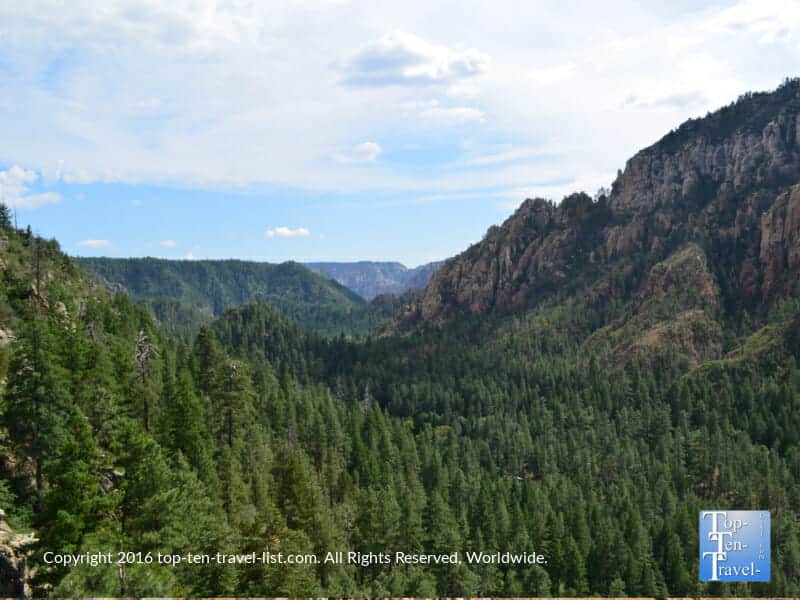
Upon reaching the summit, you will have the opportunity to take in the most amazing views in the region. This hike is located within the Coconino National Forest which is home to the largest strand of ponderosa pine forest in the country. Stay awhile and enjoy the otherworldly scenery.
From here, you can venture back down for a quick out-and-back hike of just under a mile, or you can connect to the Harding Springs trail to make it a more challenging, longer loop trail. I recommend taking it easy if you are hiking during the hot summer months and simply completing the out-and-back for a nice scenic, short & sweet hiking adventure.
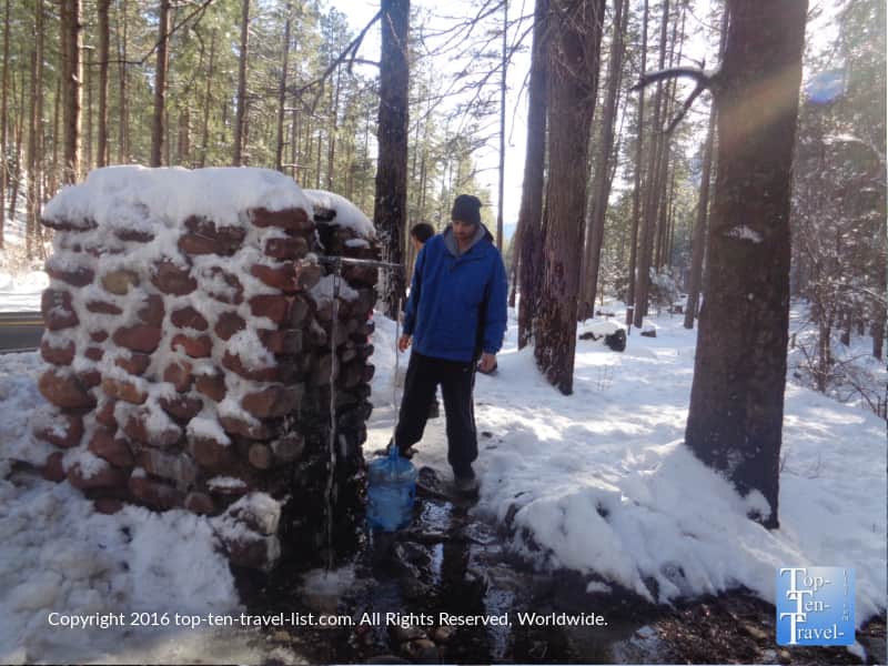
Take a break and recover from the strenuous climb before completing the much easier trek downhill. As you arrive back, you will be greeted with the smell of campfires coming from nearby Pine Flats Campground. This definitely adds to the rustic nature of the hike. And by the way, there is an awesome free spring water station just near this campground. It used to be a hidden secret amongst locals by the secret is out.
On one more interesting side note, this trail was originally built to give firemen access to the canyon’s wooded slopes. Today, it is used recreationally by hikers. Hands down, one of my favorite hiking experiences thus far since moving to Flagstaff.
Tips for a great hike
*Be aware that the intense summer heat can make any steep hike at high elevation feel that much harder. Unfortunately, it does not matter if it is a dry heat – it’s very hot either way, especially when climbing uphill at high altitude. If possible, plan this hike for fall or spring – it will be much more comfortable!
*Plan your hike early in the morning. Temps will be much cooler, traffic will be less congested, and it will be easier to find parking.
*Bring lots of water for this trail. The short distance is misleading – this is a moderate-hard hike. Wear a camelbak or bring several water bottles. Like I said, fill up at the spring station located directly across the street from the trail for the most delicious water ever!
*Stop for a relaxing breakfast at Indian Gardens, located just a few short miles up from where the hike begins. This fantastic local gem offers a great menu of healthy breakfast favorites and the best espresso drinks in town. The beautiful natural setting includes a shady outdoor patio with a hint of red rock views. I stop here 90% of the time before any hike – it’s just too good to pass up on.


*Wear hiking shoes with good traction and always carry a stick for extra balance. You can find one at any local hiking store in addition to the Visitor’s Center located next to Indian Gardens.
*Take frequent breaks when climbing uphill. The uphill elevated climb, combined with hot weather, makes this hike a lot harder than it appears at first glance.
*Cool down at Slide Rock State Park, a unique attraction featuring natural waterslides made out of the red rock. For a cheaper alternative, the creek can be accessed via the Huckaby trailhead. I prefer the free creeks as Slide Rock gets really busy and often has unhealthy bacteria levels (check for warnings before heading out).
Hiking details
Distance: 0.7 out-and-back (1.4 miles roundtrip)
Difficulty: Moderate-hard depending on your current fitness level and time of year (summer heat= harsher conditions)
Location: This trail is easy to miss if you do not look up directions in advance. Hence, its’ appealing secluded nature. Drive down scenic Hwy 89a until Milepost 387. Here, you will see the Harding natural spring water station on the right side of the road. You will see plenty of people filling up water jugs and there is also a popular campsite right next door. You can park your car in any of the pullouts and simply cross the road to begin the hike.
There is no fee to park in this area.
More trail info via the Forest Service webpage.