Lost Dog/Ringtail Loop: An Easy & Scenic Trek in Scottsdale
Disclaimer: We are not paid to promote any restaurant, hotel, activity, product, or attraction. All opinions are subjective and based on our personal experience. Your experience may be different.
My favorite thing to do in the Phoenix metro is hiking. Despite the many chains, gimmicky attractions, and malls overpopulating this sprawled out region, the real asset of living here is enjoying the close proximity to the exotic Sonoran Desert. I lived in Tucson about 8 years ago and spent many weekends day tripping to Phoenix to enjoy the beautiful desert hiking trails. In my opinion, the best area for new tourists to explore is the wonderful Scottsdale McDowell Sonoran Preserve.
The trails at this preserve are well marked, there is various terrain available for all skill levels, and the views are magnificent. Plus, it’s a quick drive to the touristy restaurants and shops in Old Town. All these factors make it the perfect hiking destination if this is your first time visiting the metro.
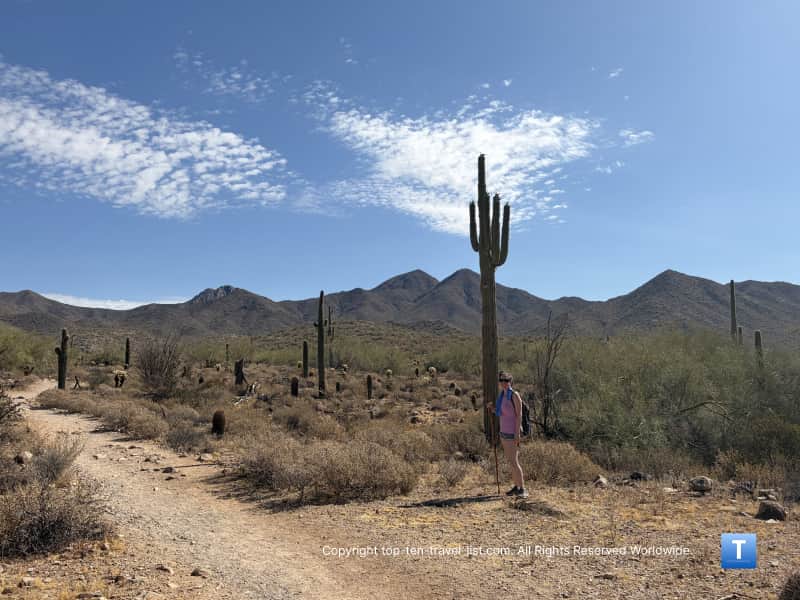
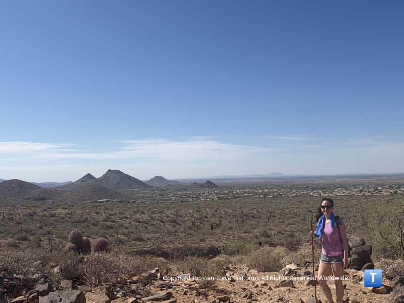
Shortly after recently relocating to a Phoenix suburb and settling in, Mike and I decided to head over to this preserve. We hiked pretty everywhere last time we lived here and this is our favorite spot. I love the gorgeous cacti and mountain scenery and the quiet vibe. It’s my favorite place for a weekend workout. We decided to go with a short trek along the Lost Dog/Ringtail loop which comes in just over 2 miles.
There are a number of short and easier treks for first timers and anyone else looking to squeeze in a quick workout before the sun and heat gets too intense. Note that it is way too hot here during the summer season to hike. I recommend not hiking at all, but if you do, keep it short, leave the dogs at home, and hit the trails as soon as the preserve opens (hours vary from 4:49am to 7:02am depending on the season). Check the preserve site for more details.
Lost Dog/Ringtrail loop: A short trek which is big on views
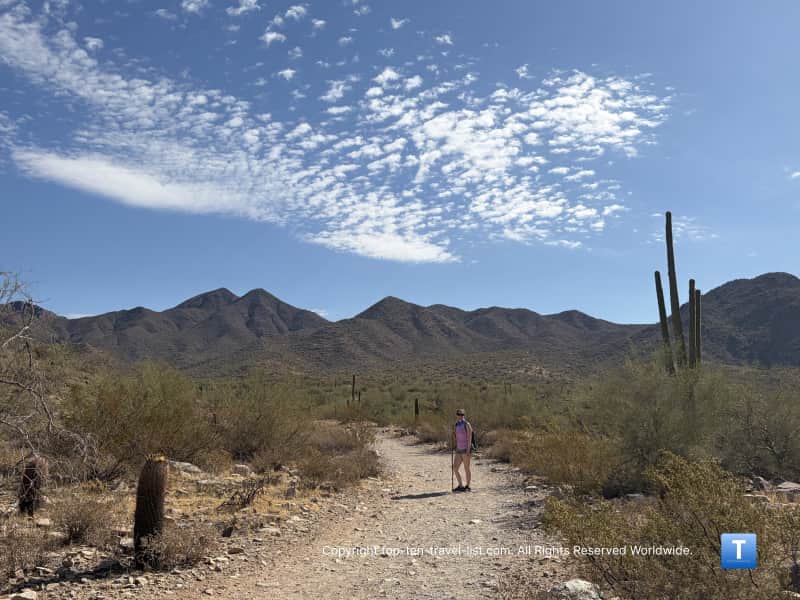
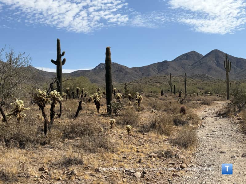
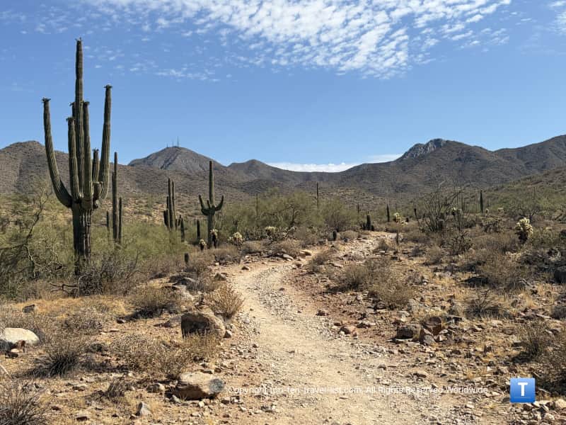
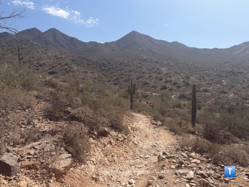
One short trail which is pretty scenic despite the short distance is the Lost Dog/Ringtail loop, a mostly flat 2.4 mile trek which offers some stunning vistas of the mountains and cacti. It’s located on the southern end of the preserve which is closer to the Old Town area so a great touristy pick.
This trailhead is located only about 25 min from the city. The trails on the north end of the preserve are more desolate so the better choice if you are trying to avoid crowds, particularly during the fall and winter season when more local hikers will be out and about. Hiking at the southern end of the preserve is more ideal during the hotter season so you can get here earlier.
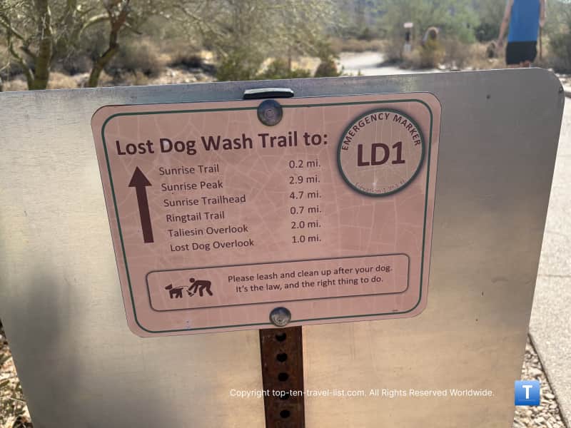
You can look at the sign at the trailhead for more details but basically you will hike ~0.7 miles to Ringtail, go 0.3 miles to the Lost Dog Wash overlook, turn on to Sunrise for ~0.7 miles, and then follow the signs back to the trailhead. It’s pretty well marked in comparison to other trails where we have gotten lost. You don’t want to get lost in this type of heat so please bring extra food and water just in case and follow all the signs. Never venture off the trail or set out to hike more than you can handle.
I wish all preserves in this area would mark the trails better – it’s really unsafe to get lost in such harsh hot and dry conditions. I’ve heard stories of many hikers getting lost and suffering heat exhaustion and dehydration. Here are some tips I’ve rounded up after years of hiking in the desert.
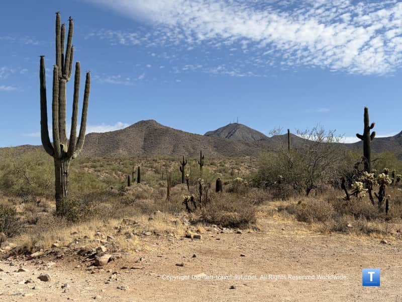
There are some nice big open vistas along the way especially at the Lost Dog overlook. Check out this view!
We arrived in mid may which honestly is way too hot for hiking anytime of the day, however, we were eager to get on a few trails before the triple digit heat sets in for the next 5 months. The preserve was empty at 8 in the morning and we found ourselves alone on the trail.
It was extremely hot even this early and I had to pour water over my head on multiple occasions. Fortunately, the elevation gain is minimal (~250 ft) so it was a mostly flat trek. I always bring a big water bottle with cold water to throw over my head in case I overheat.
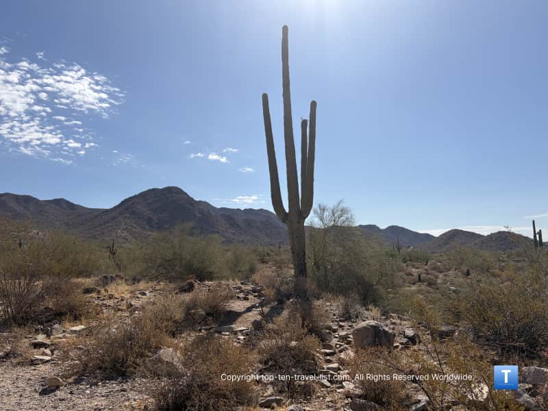
It was a gorgeous hike and I couldn’t stop taking pictures the entire route. The mountains views are much more grandiose here than more popular tourist spots like South Mountain. Cacti of every variety surround you in every direction. I never tire of seeing the tall Saguaro – the desert truly is an enchanting and inspiring landscape. If you come from any area of the country besides the Southwest, you will likely be in awe too.
Notes
Leave the dogs at home when temps are over 90 degrees. You could be charged with animal cruelty.

Rattlesnake bites are rare but have occurred. They are the most active from March-October. Keep your distance, do not put your hands by any rocks, and do not wear headphones so you can hear the rattling. Here are some tips from the Arizona Game and Wildlife. I recommend looking them over before you set out. Fortunately, I’ve seen no evidence of any snakes in my 4 years of hiking all over the state.
This trail takes about an hour to complete, longer if you take more breaks or stop for a lot of photos.
It’s not recommended for cyclists due to the rocky nature of the trail.
Tips for a great hike
Fill up with a hearty breakfast prior to your hike. Butters is a great local choice. Before this hike, we stopped at one of our favorite Phoenix cafes on the way (Scramble) but Butters is great too.


I recommend bringing plenty of water and also an electrolyte drink (I like Gatorlyte because it has more magnesium and calcium and less sugar than Gatorade) as you will be sweating more as a result of the direct sunlight/cooling mechanism. Bring more water than you think you need.
I recommend a cooling towel. They work wonders to cool you down – I put mine around my neck for this hike and it stayed cool for 3 quarters of the hike. You can find them at any sporting goods stores. You basically wet them down and then put them in the freezer overnight and they are ready to go in the morning.
Bring with a hiking stick for extra traction. Wear appropriate hiking shoes and fitness apparel. I usually wear a small backpack to carry essentials. A camelbak (which holds 1-3L of water) also comes in handy especially for longer hikes.
Wear plenty of sunblock and sunglasses. The preserve also recommends long socks and a hat.
Location & parking info
Address: This trailhead is located at: 12601 N. 124th Street.
Parking: Free. There is a reasonable sized lot although it may fill up faster in the cooler season.
What to do nearby:
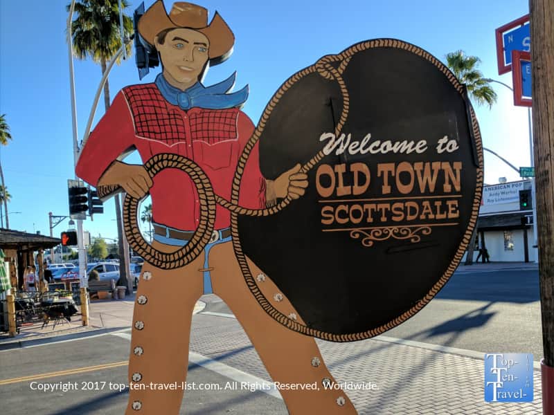
Explore Old Town Scottsdale. This is a touristy area home to many galleries, shops, and restaurants. I recommend lunch at Cien Agave, a Tex Mex restaurant serving surprisingly great food for a tourist place. For those who don’t want to spend much money, check out my Scottsdale freebie guide.
Visit the Western Spirit Museum. We recently checked this place out because it was free with our Bank of America Museums On Us promotion. This is a cool place where you can explore the history of the Southwest. I especially love all the colorful paintings.

Cool off at the Odysea Aquarium. It’s a beautiful space and also one of the largest aquariums in the Southwest. If anything, you’ll get to hide in the AC for a few hours. See more pics from our visit.

Stroll around San Tan Village. This is a beautiful upscale outdoor shopping center home to a lot of great shops and restaurants. Cool off with a scoop of gelato from Frost – it’s the best in the area.

Additionally, I recommend checking out my Phoenix travel guide for more info on things to do in the metro. In this guide, I highlight a diverse range of activities from restaurants, to hikes, to shopping malls and waterparks.