6 Fantastic Hiking Areas in Phoenix
Disclaimer: We are not paid to promote any restaurant, hotel, activity, product, or attraction. All opinions are subjective and based on our personal experience. Your experience may be different.
Although most of us associate Phoenix’s seemingly endless triple digit heat summer season with hiding indoors as much as possible, the milder fall and winter months are the time to get out there and explore the beauty of the Sonoran Desert. To be fair, there are lots of great indoor attractions to combat the heat, but I love exploring the outdoors most.
While the metro is home to lots of malls, chain restaurants, and seemingly endless suburban congestion, there are also many great hiking areas where you can completely escape the suburban jungle for a peaceful trek in the exotic cacti filled desert. This is what I love most about the outdoors in this city; there is always a great place to get back to nature somewhere close by. I really fell in love with the Sonoran desert after my first visit. Nothing compares to hiking next to a beautiful tall Saguaro cactus.
I have loved the metro and all the wonderful attractions since my first time visiting over 15 years ago. Normally, I despise heat, but the cacti and desert landscapes are just so enchanting, plus I love hiking! The dry weather does in fact make outdoor exercise more tolerable.
Believe me I have lived in both humid Florida and dry Arizona so I have experience exercising year round in both area. It can be overwhelming as there are hundreds of miles of trails available. I’ll get you started with a few few of my top picks.
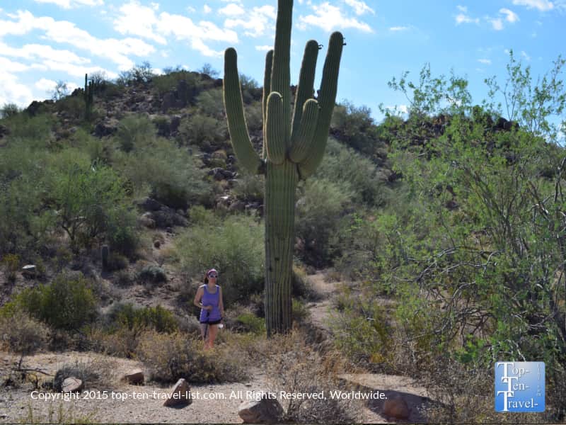
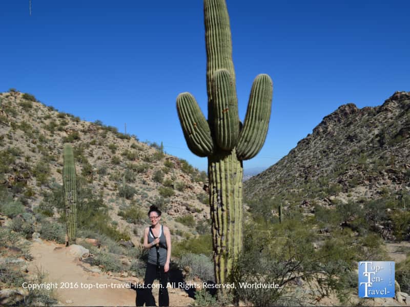
McDowell Sonoran Preserve
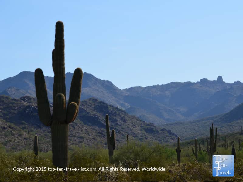
The Scottsdale McDowell Sonoran Preserve is by far my favorite place to hike. It’s quite aways from the city, and thus, it maintains a really peaceful vibe all the time. This massive preserve is never overly crowded, clean, and the trails are well-maintained and properly marked.
As one of the country’s largest urban parks, you will find over 180 trails to choose amongst, all of varying difficulty, so you can take it easy with a nature or birdwatching walk, or go all out with an all day cardio session. There are endless options which is why I love this one. I can go all out or keep it simple.
The mountain views are fabulous and stunning cacti of all types line all the trails. Even the drive over is scenic as you will pass plenty of gorgeous open desert land! I look at all the beautiful houses in this area and imagine it would be a dream to live out this way.
Several trails are open to mountain bikers and horseback riders. I recommend the Lost Dog’s Wash Trail and the Gateway Trail.
South Mountain
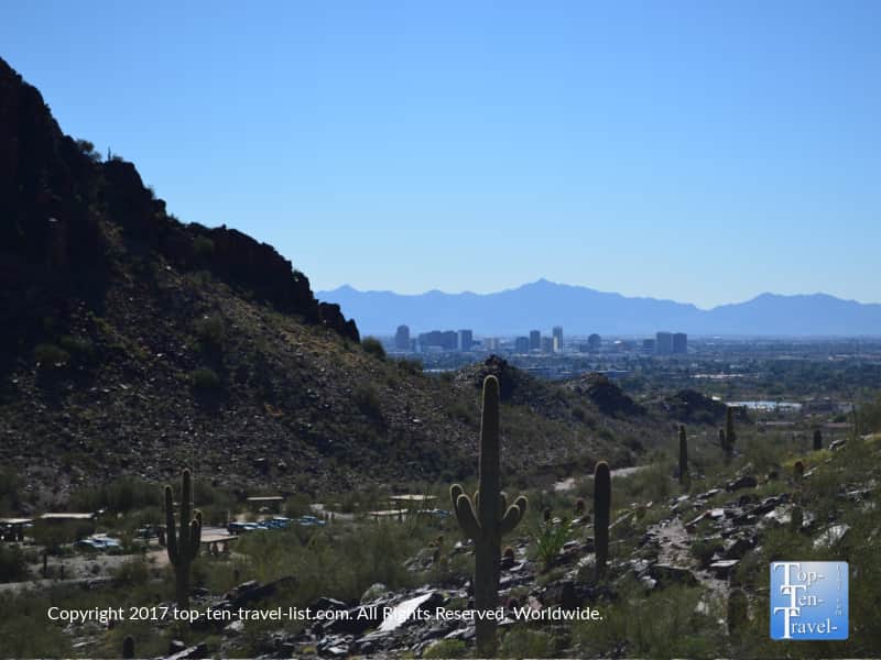
Like the McDowell Sonoran Preserve, South Mountain is another massive urban park. This one features over 16,000 acres of land, making it another one of the country’s largest urban parks. Asides from 51 miles of beautiful trails which are perfect for mountain biking or hiking, you will also find a scenic drive.
This drive features panoramic views of the city and desert. Dobbins Lookout, at 2,330 feet, is the highest point in the park. Fortunately, this point can be accessed via trail or scenic drive. If you aren’t up or able to hike, at least consider driving up to this pretty viewpoint.
South Mountain is fantastic because even non-hikers can enjoy the outdoors with a scenic drive, picnic, and gazing out at the scenery via various overlooks. One of the most popular trails within the park system and my personal favorite is the Kiwanis trail.
This scenic hike is one of the few that I would even consider during the brutal summer season. That being said, it is better left to the cooler seasons. The scenery along the way is beautiful, consisting of a mix of both urban cityscapes and peaceful desert views.
Camelback Mountain
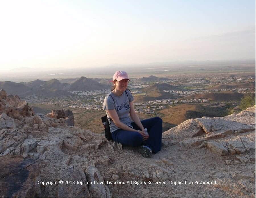
Camelback Mountain is the hardest trail in this area, as well as one of the most difficult in the country. Thus, it draws avid hikers from all over. I had a relative take me on this hike a long time ago and it’s still one of my most memorable experiences. I fell in love with the area after this hike.
The rough terrain combined with an elevation gain of over 1200 feet mean this is not one for the faint of heart. You have the choice of hiking one of 2 extremely challenging trails (the Cholla and Echo trail) which both arrive at the same summit. The summit sits at 2714 feet and offers a pretty fantastic overview of the valley. Many visitors underestimate the harshness of these trails, with rescues and multiple deaths occurring every year.
Out of all the hikes, this is one that you want to totally avoid during the summer season – it’s just too hot and dangerous with the risk of dehydration and heat related illnesses too high to chance it. I’ve heard many sad stories over the years.
However, if you do decide you are up for the challenge (during the cooler season of course), it’s a pretty spectacular hike with the most city overlooks. It’s challenging and extraordinary at the same time. On an interesting side note, the name comes from its’ shape which resembles the hump and head of a camel.
Usery Mountain Regional Park

I’ll always remember this park as the first time I got stung by a cactus. That being said, this is a quiet gem that I come back to time and time again despite the pain of pulling all those needles out. It’s quite small, however, there are plenty of beautiful trails of varying difficulty to enjoy.
Surprisingly, the area draws little traffic despite being home to more than 20 miles of gorgeous trails. Trails range from under a half mile to 7 miles, so there is always something for everyone, regardless of fitness level. Usery is home to a number of short treks, so you can still get out there early in the morning during the hot months if you want to get in a light workout. I really love the mountain scenery at this one and the diversity of cacti (so many different types creates a visually stunning setting).
If you are looking to escape the city congestion, Usery Mountain is as good a place as any to do so. I recommend starting with the Merkle Trail. It’s short, very scenic, loaded with diverse desert plant life, and offers fantastic views of the mountains including the unique Phoenix air marker.
This is the hike to do if you are limited on time, looking for something short on a hot day, or simply seeking to take it easy. Usery also offers an interesting lineup of annual events including fun night hikes, so be sure to check the calendar.
Dreamy Draw Recreation Area

The Dreamy Draw Recreation Area is home to a number of easy and moderate hikes. A great choice if you are seeking a nature stroll as most of the trails are pretty short and moderate at most in terms of difficulty. It’s also a popular destination for trail runners and dog walkers, most likely due to the easy terrain.
The views are so-so, with the main benefit of hiking here being the easy access from the city, so you can get in a quick workout without a major time commitment.
One interesting aspect of this area which makes it stand out from all others is a supposed alien landing 60 years ago. According to local legends, a 36 foot spaceship is buried beneath the dam. In 1947 (the same time as the Roswell crash), 2 UFOs were also sighted in the Phoenix area. One was in the Dreamy Draw area and another in Cave Creek. To add to the mystery, this hiking area is located on a road called Arizona Highway 51. Whether or not aliens actually landed here, it makes a visit more intriguing for sure. Read more about the supposed crash via this Fox 10 Phoenix article.
Also in the area is the super challenging trek up Piestewa Peak. The strenuous 1.25 mile climb up to a 2,608 foot summit will challenge even the biggest fitness buffs. It’s harder than Camelback in my experience and I barely made it my first time despite hiking almost every weekend. This is a really tough one, but the views are pretty even if you only go out a little bit.
Papago Park
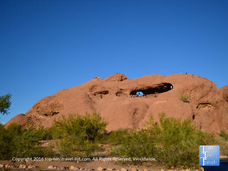
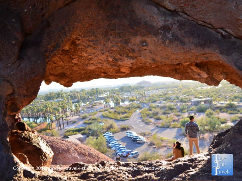
Papago Park is a small park adjacent to the zoo. There are a handful of easy trails here which are perfect for hiking, jogging, or beginner mountain biking. The views are quite different here – I love the towering sandstone formations.
Hole-in-the-Rock is a unique eroded sandstone rock within the park. Ancient tribes used this rock to mark the summer solstice. It’s a short little trek up in return for some great city views. You can take all sorts of unique photos here so you’ll see a lot of tourists lined up.
Other amenities at Papago include a stocked fishing pond, picnicking tables, golf courses, and the Desert Botanical Gardens. The trails here offer no shade, so save this one for the winter season!
Learn more about various amenities at Papago
More AZ hiking areas and attractions: For my full guide to must-see attractions in Phoenix and elsewhere in the state, take a look at my Arizona Travel Guide.