Hiking to the Top of Slate Mountain: The Best Trail Near Flagstaff
Disclaimer: We are not paid to promote any restaurant, hotel, activity, product, or attraction. All opinions are subjective and based on our personal experience. Your experience may be different.
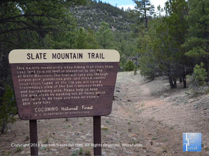
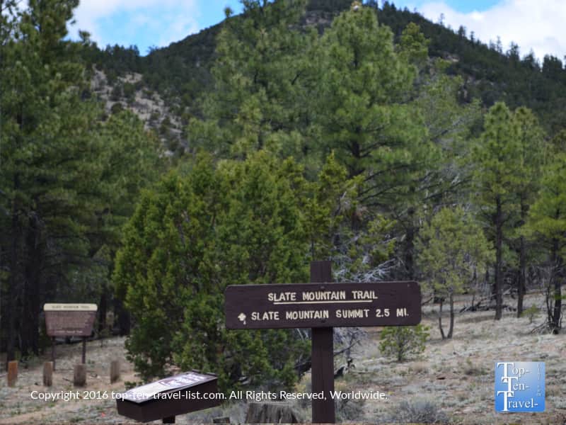
The Slate Mountain Trail, located 40 minutes outside of Flagstaff along Hwy 180 enroute to the Grand Canyon, is one of the area’s most under appreciated hikes. The gradual 2 mile climb to the top is quite a workout, although the views are some of the most amazing in the region. I was so impressed by this hike that I can say 100% that I recommend the quick daytrip out of the city for this one.
The trail’s elevation gain is more than 800 feet, beginning at 7362 and reaching 8215 feet at the top. Hiking in high altitude areas can be tough on your body and make a hike feel much harder than usual. It took me several weeks to adjust to the elevation after moving here. I would not start with a high uphill trek like this one, but it is a great choice once you are used to the conditions. Here are some tips to prevent altitude sickness – I highly recommend checking them out before visiting.
On the bright side, the 2 mile stroll down is really easy and allows you recover from that uphill climb while soaking in the mountain scenery. I have hiked a lot of amazing trails after living in the region for several years, and I have to say that this one was easily one of the most memorable and breathtaking. In my opinion, this is the #1 hike for mountain views, no question.
A hard hike with a big payoff!
Although this hike is typically rated as moderate, it’s almost entirely uphill one way. Also there is less oxygen to breathe due to the thin air, and thus, a greater chance of dehydration. Also, keep in mind that hiking uphill for 2 miles straight is quite the endeavor, even for the fittest hiker. As an avid hiker, I admit this trail seemed much harder than moderate to me, so I can’t imagine what a beginner would thing. It’s a workout for sure, but if you are up for adventure, totally worth it for the fabulous views.
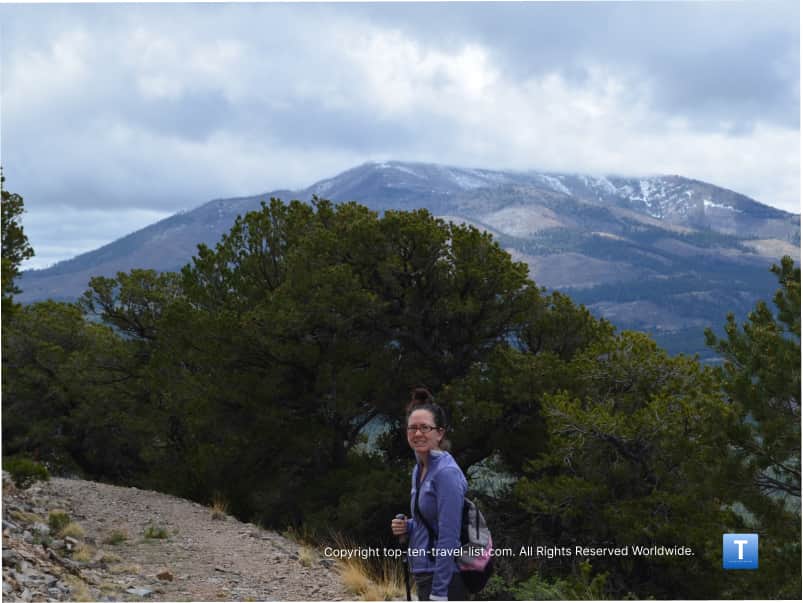
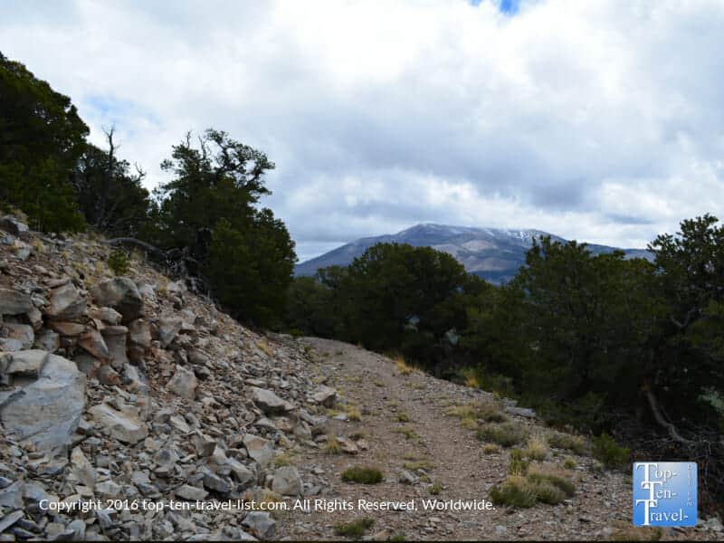
After a very steep climb, the views do not disappoint. From the top, you can see the San Francisco Peaks, Red Mountain, Kendrick Mountain, the Painted Desert, and even the Grand Canyon!
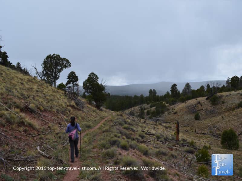
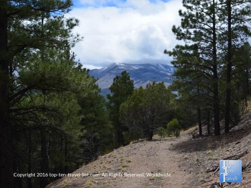
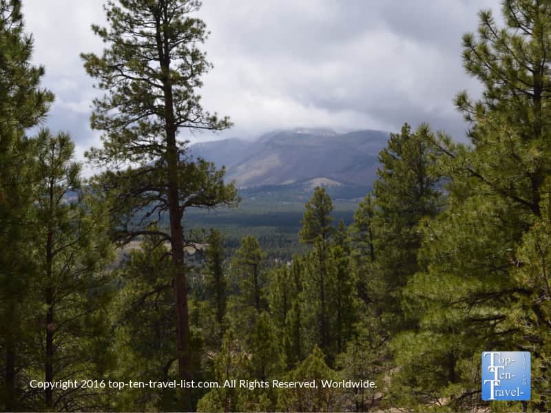
The trek up is quiet and scenic with lots of tall pinyon and ponderosa pine trees lining the trail. You will see evidence that many animals call the area home (lots of deer and elk prints can be seen). This may make the journey more interesting or more scary depending on your viewpoint. If you were ever to see a bear or mountain lion in the area, I would think this isolated trail would be one of your best bets due to the secluded setting. To be honest, I was a little nervous we might see a bear being the only ones on the trail. I’ve read a lot of stories about attacks (and seen a few too many movies), so I get a little leery if I don’t see anyone else around for a while.
A secluded gem
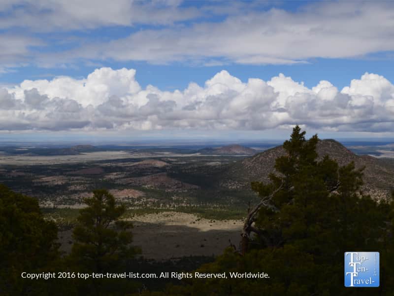
On any given weekend, you will probably only see a handful of hikers at most. In fact, many times you will be the only one out on the trail. It truly is the best regional choice for any outdoor/nature lover wanting to take advantage of the solitude. It’s the perfect place for photography too with the absence of any crowds blocking the stunning views. We had no problems taking any pics as we were totally alone. I can’t count many times in this area that we had such a beautiful viewpoint to ourselves, so I will consider us lucky.
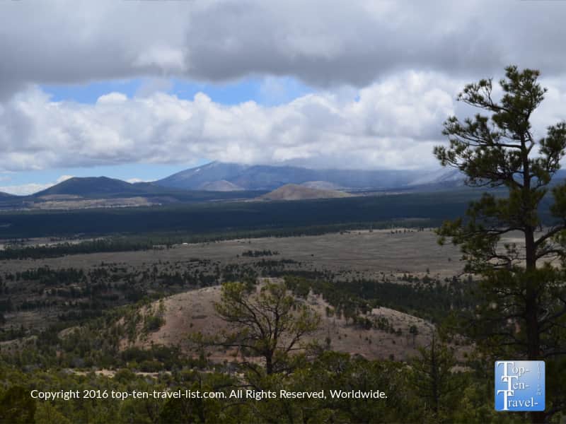
The best views of the San Francisco Peaks
Once you reach the summit, you will be able to gaze out at the most incredible viewpoint of the San Francisco Peaks: by far the most dramatic views from any area hike. The only other places that comes close in terms of mountain scenery are Snowbowl (the chairlift rides are pretty scenic) and Buffalo Park (a wonderful city park that I use year-round).
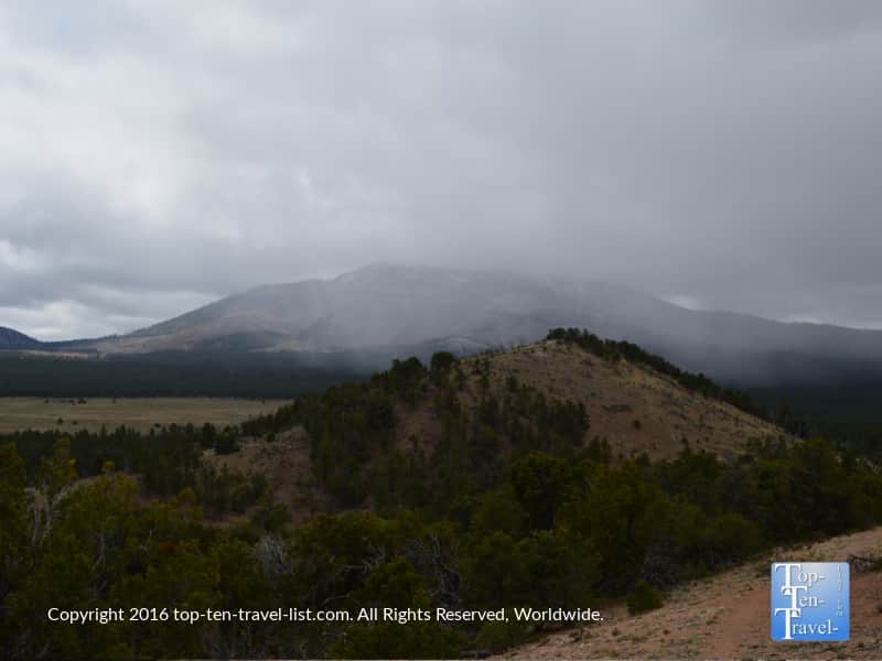
We were lucky enough to hike this trail just a few hours prior to a storm, which led to some nice photos. It even started to snow a bit on our way back (in mid-May!). The weather changes here are pretty exciting: it’s been fun! Be aware that the weather can change any time at high altitude. We have run into our fair share of monsoons while hiking in the region. If you are not from the area, monsoons are basically intense desert storms that occur almost daily during the summer. Also, it can be much colder as you travel up in elevation, so it’s best to wear layers.

Overall, I would recommend this hike to anyone seeking a fantastic workout accompanied by incredible mountain scenery. Being that it is located right off Hwy 180, this hike is a nice little side trip on the way to/from the Grand Canyon. Then again, it’s worthy of a trip on it’s own, as it is that spectacular. I recommend stopping for an espresso drink at Late for the Train, also on Hwy 180, after your hike to warm up and recover a bit.
Update: This location unfortunately closed (ther other Late for the Train is still open downtown). However, there are many more coffeeshops (check out my guide to the best local coffee) to enjoy after your hike.
Directions
To get to the trailhead, you will drive 35 miles north of Flagstaff on US 180. Pay close attention and turn left when you see FR 191 sign (no 191C!). You will drive about a mile or so down 191, which is a gravely road, so drive slow and take it easy if you do not have a high clearance vehicle. There are no fees to park.