15 Scenic Hikes in Tucson
Disclaimer: We are not paid to promote any restaurant, hotel, activity, product, or attraction. All opinions are subjective and based on our personal experience. Your experience may be different.
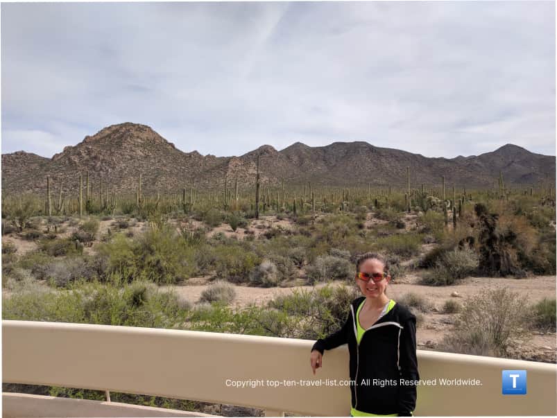
With 4 prominent mountain ranges surrounding the city, Tucson offers no shortage of fascinating desert hikes. These ranges consist of: Tucson Mountain Park, the Rincon Mountains, the Santa Catalina Mountains, and and the Santa Rita Mountains. There are numerous parks and preserves within each of these mountain districts. The most stunning views are found within the state and local parks in the Catalina Mountains, located northeast of the city near the suburb of Oro Valley. I had the privilege of living in this gorgeous suburb for several years, with easy access to the most amazing hikes throughout the metro.
While many trails here are very long & challenging, others take you on a relaxing trek through the desert. There are a number of easy-moderate trails which will allow you to take in the desert scenery without going all out. As a local, these are the trails I came back too most often. Keep in mind that much of the year it’s way too hot to be outside for too long. I recommend first time visitors keep it short as the harsh conditions of the desert make a seemingly easy trail that much harder.
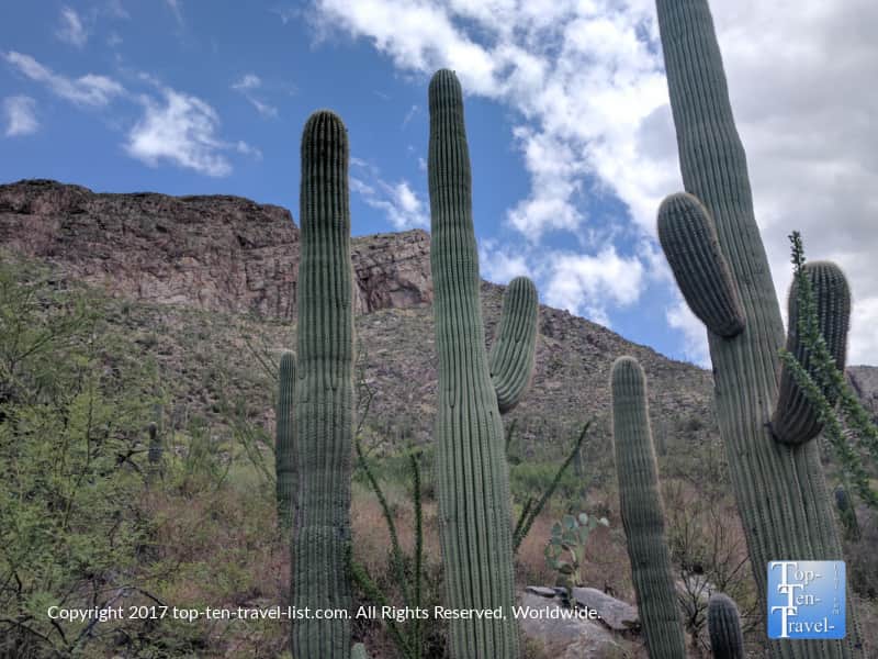
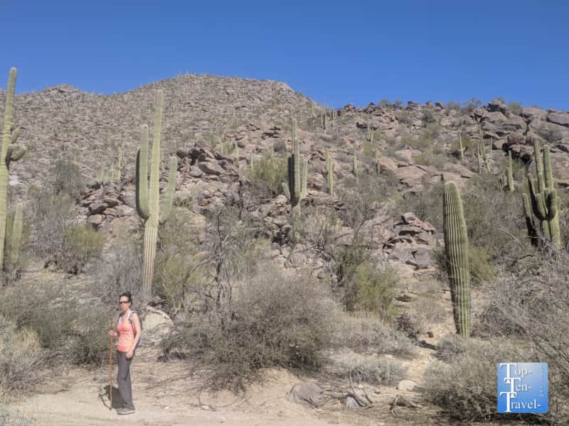
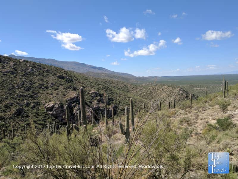
All of the trails I feature here in my guide will give you a glimpse of diverse desert plant life including the stunning Saguaro, native only to the Sonoran Desert. I would rank each as no more than moderate in intensity.
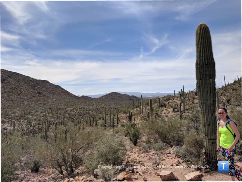
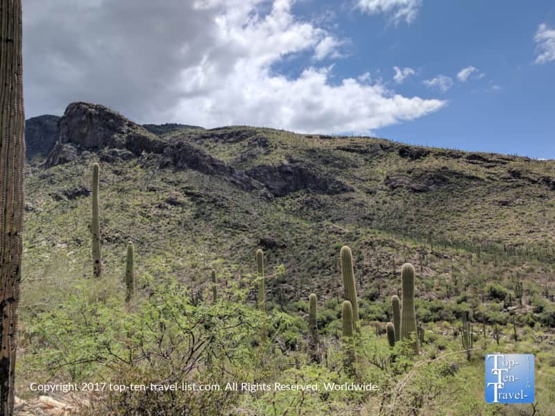
1. The Hidden Canyon Trail
- Distance: 2 mile loop (400 ft gradual elevation gain)
- Difficulty: Reasonably easy due to the gradual elevation increase of just 400 ft
- Location: Starts at the JW Marriott Starr Pass Resort (3800 W Starr Pass Blvd.). Free side street parking.
- Pet policy: No dogs
Despite being located at a prominent resort just outside of the downtown region, the visually spectacular Hidden Canyon trail barely sees any foot traffic. I don’t think I’ve ever seen more than a few people while hiking here. In this case, the name of the trail rings true as this is definitely one of the city’s hidden gems.
On this secluded 2 mile loop within the Tucson Mountains, you will get to enjoy endless views of the unique Saguaro cacti covering the hills. This is my favorite hike to see lots of cacti – I just love looking out at all the beautiful desert plants covering hte mountains. The elevation gain is minimal and very gradual, and thus, this hike is one of my easier picks. Wildlife is abundant. I’ve seen many deer and even 2 bobcats crossing the road.
My experience hiking Hidden Canyon
2. Tumamoc Hill
- Distance: 1.3 miles out-and-back (700 ft elevation gain)
- Difficulty: Moderate (Hard going up, easy going down)
- Location: W Anklam Rd & Tumamoc Hill Rd. Free parking along the road.
- Hours: 4am-10pm
- Pet policy: No dogs

Tumamoc Hill is an iconic preserve owned by the U of A Science Department for observatory use, and fortunately, also open to the public daily for hiking from 4am-10pm. As a local, it was my go-to trail for a vigorous workout. It’s a super steep 0.7 mile climb with 700 feet in elevation gain and a great cardio workout. As a fitness buff, I enjoyed some hill training here for my 5k races.
Views are best near sunrise and sunset. The silhouette of the cactus at these times is enchanting. If you would like to tone the hike down a bit, simply go out to the halfway point and turn around for a relaxing picturesque trek back to the start. There is a water station at the mid way point. You will see many tourists only going out to this halfway point – luckily the views are beautiful the entire trek. A little bit is better than nothing! Tip: Definitely treat yourself to some amazing breakfast tacos at Seis at Mercado before or after your hike.
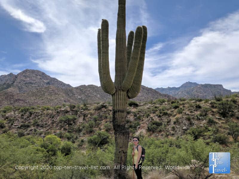
3. Linda Vista trail
- Distance: The shorter loop is just under a mile. Add another 1/2 mile or so for the longer loop
- Difficulty: Easy (minimal elevation gain)
- Location: 730 E. Linda Vista Rd Oro Valley. Free parking.
- Pet policy: No dogs allowed
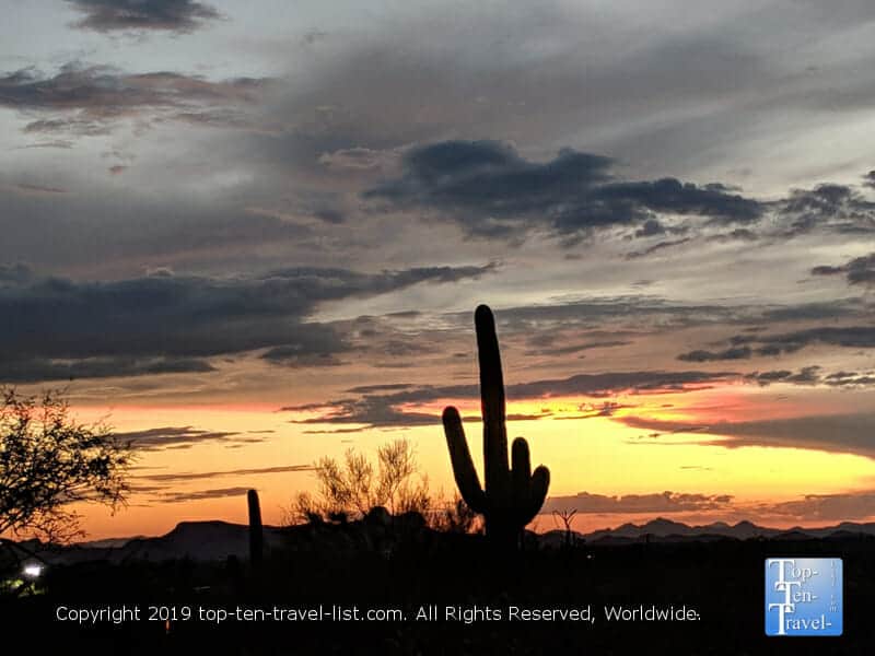
Linda Vista is my favorite short and easy trail in the metro. This one is located in Oro Valley, an attractive suburb about 20 minutes north of the city. I lived in this area for several years and hiked this trail several times a week for both convenience and because the views are awesome.
It’s so short (~2 miles for the full loop) but the Catalina Mountains are so stunning that I often hike it twice. If you want great mountain scenery, any hikes in this area are the best. Wildlife is abundant and I’ve seen a bobcat right on the trail on more than one occasion. It’s also a protected bighorn sheep habitat but I have not personally seen any. This hike is a great free alternative to Catalina State Park, which is located just down the street.
It’s also my favorite sunset watching destination within the city. Oftentimes, I plan my hike right at sunset to enjoy the silhouette of the cactus. Although the trail begins just a few steps from an apartment complex, you would never guess it as the trail is quiet and almost always completely desolate. Overall, a must-do if you are seeking gorgeous mountain vistas and/or a spectacular place to watch the sun setting over the mountains.
My experience hiking Linda Vista
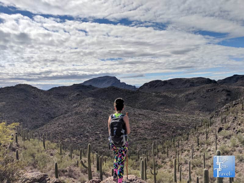
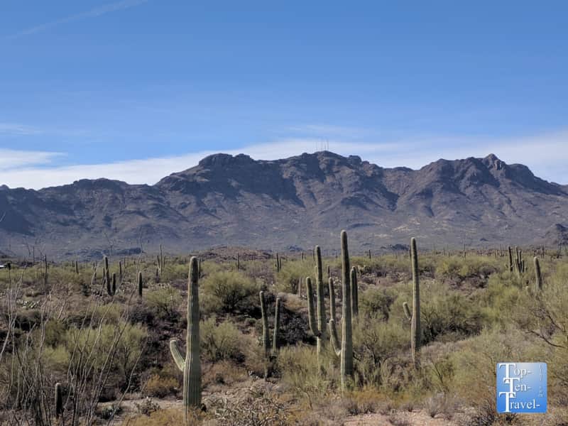
4. Pima Canyon trail
- Distance: 3.2 miles out-and-back to the Lower Dam, add 2 miles if you continue on. Note that the hike becomes increasingly difficult at this point
- Difficulty: Moderate until the lower dam, very difficult if you continue on
- Location: 1610 E Magee Rd Tucson. Free parking (the small lot fills up fast).
- Pet policy: No dogs allowed
Pima Canyon is a breathtaking hike within the Catalina Mountain range. The trailhead is located just north of the desirable Catalina Foothills neighborhood. Although the trail is moderate and pretty easy to follow, hiking the entire trail (just under 7 miles) is difficult in harsh desert conditions.
Fortunately, you can go out to your comfort level and simply turn around at any point. I typically go in just a few miles to enjoy the scenery. The trail is beautiful all around, with numerous overlooks of the spectacular mountains, and of course, serene views of the desert plant life at every turn. This is another great pick if you love seeing cacti up close.
My experience hiking Pima Canyon
5. Canyon Loop trail at Catalina State Park
- Distance: 2.3 mile loop
- Difficulty: Mostly easy with a few steep sections
- Location: 11570 N Oracle Rd. Oro Valley Admission is $10 per car.
- Hours: 5am-10pm
- Pet policy: Dogs allowed. Must be leashed (6 foot or shorter).
- Amenities: Visitor center, restrooms, gift shops, drinking water
Catalina is a gorgeous suburban state park which features incredible views of the dramatic Santa Catalina mountains. This park is a great alternative to Saguaro National Park if you happen to be staying in northwest Tucson, or alternatively if you are looking to keep your trip budget friendly (you will save $20 over the national park).
Trails are multi use and open to hikers, bikers, and horseback riders (with the exception of the Romero Pools trail). All trails are well-marked, which is a must in dangerous desert conditions. This is a big bonus for newcomers in my opinion as some of the trails out here could use some extra signage.
You can pick from intense all day adventures or simply nature walks here so it appeals to everyone. My top pick for first time visitors is the moderate 2 mile long Canyon loop trail. You will get in a great workout and take in some beautiful desert scenery without risking heat exhaustion and dehydration. For advanced hikers only, the Romero Pools trail is an interesting option due to the rare presence of seasonal streams and pools. This trail is really long at over 7 miles, although you can go out as far as you like and turn back.
Be careful during monsoon season as many hikers have to be rescued due to flash flooding! Late spring-early summer, while brutally hot, is a great time to see the cacti blooming.
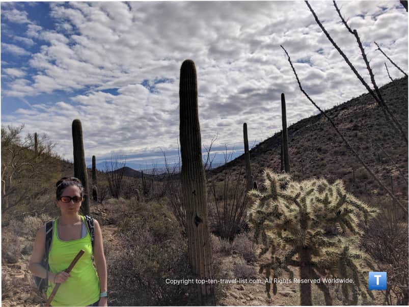
6. Saguaro Vista trail at Sweetwater Preserve
- Distance: 11 miles of interconnected trails
- Difficulty: Easy-moderate depending on how far you go
- Location: 4001 N. Tortolita Rd. Free parking (the small lot fills fast).
- Pet policy: Leashed dogs are ok.
Sweetwater is a newer trail system, conveniently located nearby downtown in the eastern foothills of the Tucson Mountains. This system is great for tourists as most of the trails are short and well-marked. Although it’s really close to town and you can even see a few housing developments at the start, you quickly enter the solitude of the desert as soon as you begin your hike. You can combine several trails (from the Saguaro Vista trail) to form a loop of your preferred distance.
The mountain views are really gorgeous and a diverse variety of cacti line all the trails. Although it appears to be quite crowded at first glance of the parking lot (especially on weekends!), in my experience foot traffic disperses out as there are a number of trails to choose amongst. There are 11 miles of interconnected trails total, so you can hike to your heart’s content. Mountain biking and horseback riding are options as well. It’s not my favorite place to hike but a decent option if your day’s activities take you out this way.
7. Valley View Overlook trail at Saguaro National Park West
- Distance: 0.8 miles out-and-back
- Difficulty: Easy
- Location: 2700 N Kinney Rd Tucson. The fee is $25 per car for a 7 day pass.
- Pet policy: Only a few trails allow pets. See the NPS website for more details.
- Amenities: Visitor center, ranger programs, restrooms, water fountains.
The Western Section of Saguaro National Park is located within the Tucson mountain range. Although the mountain scenery here is not as dramatic as at the Rincon (East) entrance, the park is home to large uninterrupted strands of Saguaro cacti.
The views from the deck of the visitor’s center (featuring 100’s of cacti) are so mesmerizing. On the downside, this park is a bit smaller than the Eastern district and the Bajada scenic drive is inconveniently unpaved. On the bright side, the trails here are scenic and well-marked.
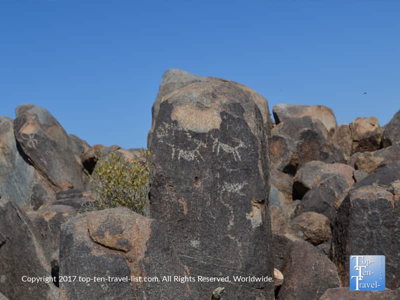
The Valley View Overlook is a nice easy trail choice which leads you to an impressive overlook with views of various regional mountains including Picacho Peak. If you have time, Signal Hill is another quick trek worth a look to see interesting ancient pictographs.
Another great aspect of visiting the Western district of SNP is that you are nearby other popular attractions like Old Tucson and the International Wildlife Museum, so you can save some driving time! All of these attractions are located on the same scenic drive which is lined with all sorts of exotic cacti on both sides of the street. Really, the drive is an attraction in and of itself!
My guide to visiting Saguaro NP
8. Lower Javelina Loop at the Wild Burro trailhead
- Distance: 1.7 mile loop (360 ft elevation gain)
- Difficulty: Moderate
- Location: The Ritz Resort (15000 N. Secret Springs Drive Marana)
- Free parking is available. Enter resort and follow directions of attendant.
- Pet policy: Leashed dogs ok.
The Wild Burro trailhead is another fantastic resort trail system, this one located at the exclusive Ritz Carlton at Dove Mountain in the quiet suburb of Marana. There are several trails here, the best being the Lower Javelina Loop which is just under 2 miles total and still offers tremendous views of the Tortolita mountains.
The trail is quiet and peaceful as the Ritz is located pretty much out in the middle of the desert. The views on the drive over are amazing as well.
*Watch out for javelinas on the trail and bring with plenty of water as there is absolutely no shade. Note that javelinas are super dangerous. I have not seen them personally on this trail but I have seen them elsewhere in this area. Do keep your distance.
More info on the Wild Burro trail
9. Tanque Verde falls trail
- Distance: 1.8 miles out-and-back
- Difficulty: Moderate-Difficult
- Location: 14999 Redington Rd. Free parking (4wd recommended).
- Pet policy: Leashed dogs ok.
- Amenities: Restrooms, picnic tables
The Tanque Verde waterfall trail is known to be the oasis of Tucson hikes. I do not necessarily agree, as there are many more scenic hikes in the area, although this trail is a nice add on if you have extra time and would like to challenge yourself to a rough adventure. The trail to the seasonal waterfall is a very difficult journey, although worth it if you are up for a challenge. This trail is not for the faint of heart and I also would only recommend hiking it in the cooler seasons.
The trail is only 1.8 miles each way although the journey requires lots of rock and boulder climbing and the intense sunshine makes it even more brutal. The poor trail markage does not help either. Alternatively, you can just go out a mile or so and enjoy the various ponds and streams and nice canyon scenery. Of course, it’s a nice treat to see any water in a barren desert environment like Tucson!
10. The Meadow Trail
- Distance: 2 mile loop (400 ft elevation gain)
- Difficulty: Moderate due to the steepness & high altitude
- Location: 12856 N Sabino Canyon Park, Mt Lemmon (General store)
- *Stop by the visitor’s center or general store for a hiking map & directions to the trailhead.
- Pet Policy: Leashed dogs ok.
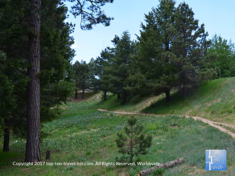
Hiking the Meadow trail high up on Mt. Lemmon is quite a different experience. Instead of cacti, this high altitude trek takes you through strands of gorgeous pine forest. Sadly, some of the trees are burned as a result of several wildfires over the past few years.
Located on the base of Mt. Lemmon (one of Arizona’s Sky Islands), temps up here are typically 20 degrees cooler than Tucson during the brutal summer months. Obviously, this is a drastic difference when temps climb past the 100 degree mark on a daily basis for months on end in the Sonoran desert. This is a place I drove up to frequently when I didn’t want to make the 4 hour trek to the cool pines of Flagstaff.
To access the trail, you will need to venture out of the city a bit. Fortunately, the drive up the 27 mile long Mt Lemmon Scenic Byway is gorgeous. You’ll see the scenery change from Saguaro cacti, to ancient hoodoos, to towering pine and aspen forests.
I recommend making a whole day out of this one by combining this hike with a scenic chairlift ride at the ski resort and lunch at the Iron Door restaurant.
- 1
- 2