Attraction of the Week: Tonto Natural Bridge State Park
Disclaimer: We are not paid to promote any restaurant, hotel, activity, product, or attraction. All opinions are subjective and based on our personal experience. Your experience may be different.
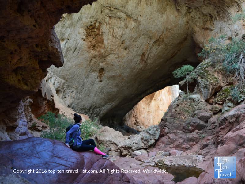
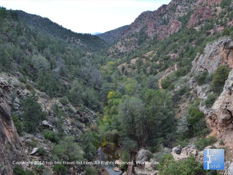
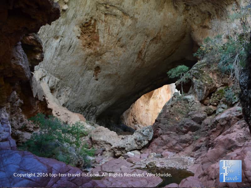
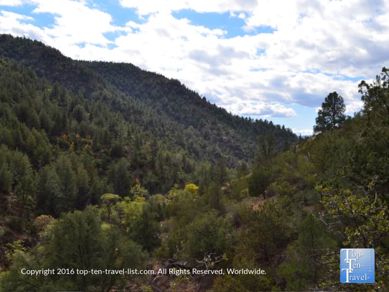
Tonto Natural Bridge State Park, home to the world’s largest travertine bridge, is one of the most unusual and mesmerizing parks I’ve encountered out West. Located in between the tiny central Arizona towns of Pine and Payson, this breathtaking natural wonder is an easy day trip from Phoenix, Tucson, and the Flagstaff/Sedona area. We have been taking a lot of daytrips to explore natural wonders since moving to the area. This is one of the main perks of living here.
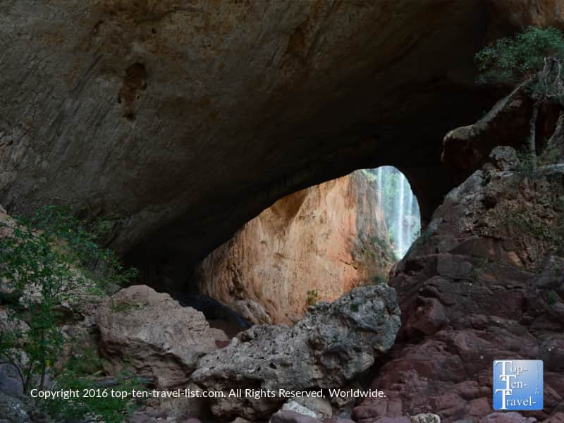
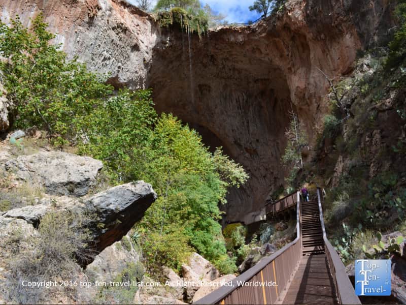
The park gets its’ unique name from the bridge, which towers 183 feet tall over a 400 foot long tunnel, which is 150 foot wide at its’ widest point. A natural spring waterfall falls down into the creek below, creating a one-of-a-kind rare setting that you really will not find elsewhere in this desert state. Beautiful forests of pines create a gorgeous backdrop. I would consider this a hidden gem worthy of putting on your bucket list especially if you are living in or visiting the Flagstaff or Phoenix area as it is an easy drive.
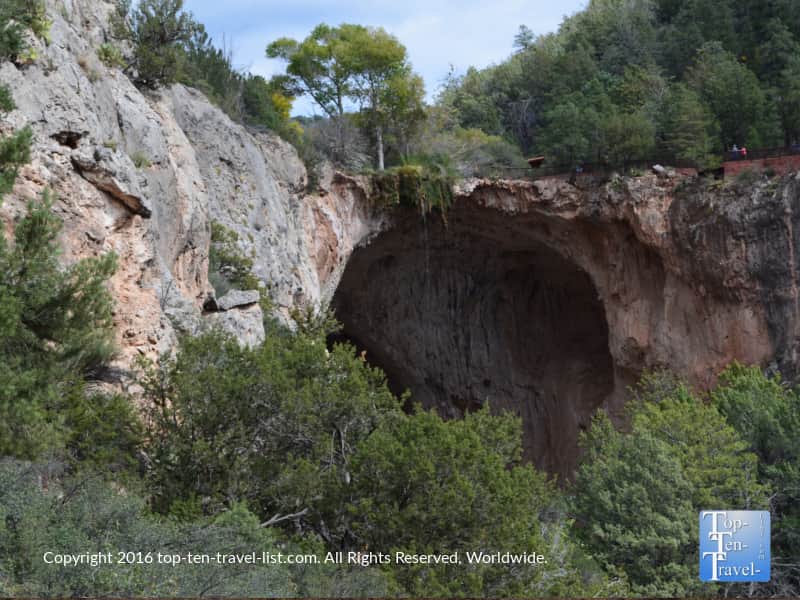
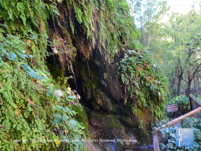
The majestic waterfall cave
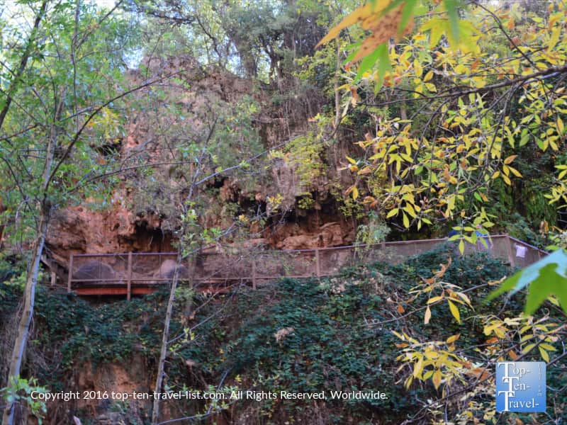
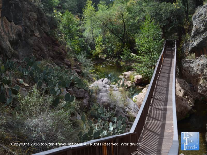
Both the bridge and waterfall can be viewed via a hiking trail, or by way of 4 viewpoints. I highly recommend going the natural route and hiking along one of the picturesque trails. By choosing to hike, you get to enjoy all the sights and sounds of nature, while also getting in a nice refreshing workout.
As an added bonus, you get to enjoy a gorgeous front row view of the waterfall and creek which you can not see from the viewpoints. Even better, if you have enough time, you can hike the trails and take in the scenery from the viewpoints – and you might as well since you paid to get in!
Check out the magnificent scenery from the overlooks. You can enjoy these beautiful views without hiking.
Below is an overview of the hiking trails at this park. Fortunately, there is one for just about every fitness level.
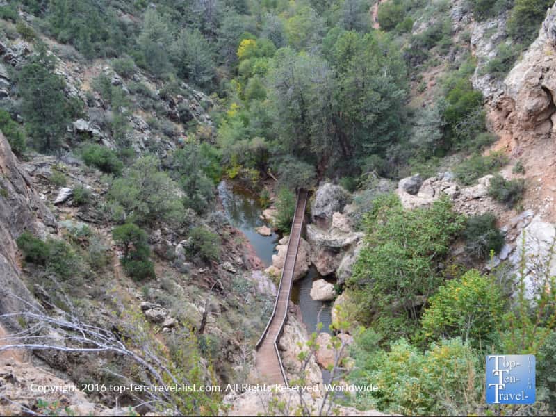
Hiking the Pine Creek trail
The Pine Creek trail is an incredibly picturesque hike that takes you on a wonderful trek through nature, before finally reaching the natural bridge & waterfall. The developed portion of this trail is 1/2 mile to the creek bottom. From here, you will need to use some rock climbing skills to make it over the huge boulders surrounding the creek. There is lots of maneuvering required. And thus, it helps to have 2 people so you can help each other get on top and around some of the larger/more slippery rocks.
Be prepared to get dirty – you will be sliding down many rocks. If you are at all squeamish about heights/rock climbing, you can simply return for an out-and-back hike before reaching the creek (the views are still outstanding!) or alternatively consider the Gowan trail which involves no climbing, however this trail is a lot steeper and more of a cardio workout.
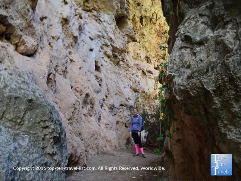
A few beautiful pics via the Pine Creek trail
You will notice the beautiful early fall foliage in my pics. Surprisingly, this area still sees a bit of fall color (although nowhere near as spectacular as Flagstaff).
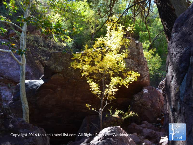
This trail is quite interesting as you get to walk through a few caves and navigate through rocks and streams, before finally reaching the waterfall.
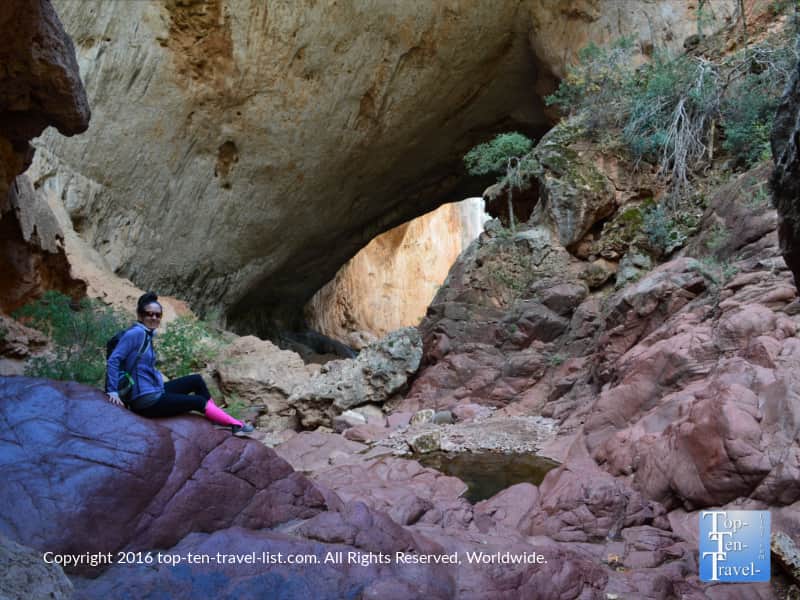
For all your effort climbing over these slippery, slightly treacherous rocks, you will be rewarded with the most picture-perfect view of the bridge, waterfall, and creek.
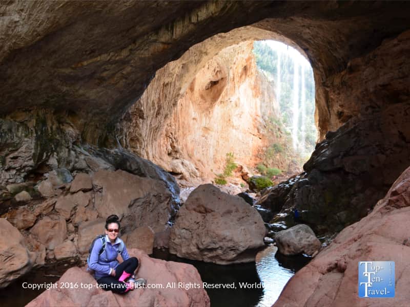
A great trek for the adventurous!
The journey along Pine Creek is rustic and peaceful -the ending scenery like a scene out of The Goonies movie. If you are up for a time consuming hike with lots of climbing, sliding town rocks, and skipping stones across the creek, then this adventurous trail will be lots of fun. For any adventure lovers and outdoor buffs out there, this trail is an absolute blast – so much more exciting than an ordinary trail!
All in all, I would say this is my favorite trail within the park. The burdensome trek is worth it for a close view of this geologic wonder – pics really do no justice. Getting to the bridge via this trail is a really memorable experience that will lead you with a lifetime of memories and wonderful pictures!
After making it across the creek, relax and take in more gorgeous views from the observing area. Instead of going all the way back the way you came, simply connect to the 1/2 mile Gowan trail. It’s a steep climb up, however, much faster and less of a hassle then going back the way you came.
The Gowan trail
This trail is another means to get to the bridge and waterfall viewing point. While this trail is steeper than the Pine Trail, it is also much shorter and involves no climbing over big rocks. It’s the way to go for anyone uncomfortable trekking across tall boulders.
The short climb downhill leads you to the same observation area as the Pine Trail. While not as peaceful, quiet, or scenic, the ending view is the same view of the travertine bridge. You will get a nice short cardio workout going up and down the hilly trail. If you are limited on time, this hike is the perfect way to see the waterfall and natural bridge within an hour max time frame.
This trail is named in honor of David Gowan. He ventured across the bridge back in 1877 while being chased by the Apaches. In 1898, he convinced his family to settle the land.
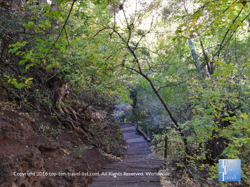
The Waterfall trail
This tranquil trail is the shortest within the park. It does not lead you to the bridge, but rather to a beautiful little waterfall cave. This trail is really short (just 300 feet or so) and will only take about 10 minutes. Steps leading down to the waterfall are a bit steep, however, nothing too challenging.
You will notice beautiful views of the forest and even a hint of fall foliage in October/November. We didn’t time our hike exactly at peak but it was still pretty colorful for Arizona. Overall, I would say this is a great add on trail, but not necessarily the standout.
Check out the tranquil scenery – this one is a super leafy and relaxed trek through the forest. On a really hot day, I imagine this would be the best option.
Anna Mae trail
This 500 foot long trail connects to the Pine Creek Trail. I recommend skipping out on this one and hiking the Pine Creek/Gowan Trail instead. This trail is just unnecessary work. Hiking Pine Creek & Gowan will take you through the best scenery the park has to offer.
Overall, Tonto Natural Bridge State Park is a unique place to explore if you find yourself seeking a great daytrip destination from Flagstaff or Phoenix. There are many incredible geologic wonders to explore throughout the entire state with this park being just one more to add to your bucket list. With easy access from many popular tourist destinations throughout the state, it would be silly to skip out on this one if you are in the vicinity.
Tips for a smooth visit
*Bring plenty of water. Remember that you are in a dry desert climate, so you need to drink extra. I recommend at least 1L per person or preferably, a camelbak to ensure you have enough for the whole journey.
*Plan at least a few hours if completing the entire Pine Creek Trail. Although it is short, it takes a while to climb across the rocks. Plus, you will want some time to relax and enjoy the scenery!
*Follow the trail signs. Even in the undeveloped sections markings are clear. For safety concerns, stick to the trail.
*Leave the hiking stick at home for this trail. Climbing over the big boulders requires 2 hands in most cases. In this circumstance, a stick will just get in the way. And because you need both hands, a nice hiking backpack will work much better than attempting to hold a water bottle the whole time.
*In my opinion, fall is the best time to plan your visit due to a number of attractive features. These include: fewer crowds, cooler temperatures, and even an opportunity to see a bit of fall foliage.
*To see the best views in the park, hike the Pine Creek trail and connect to the Gowan Trail.
*Bring your camera to capture this stunning natural wonder. If bringing a DSLR, put it in a camera backpack as opposed to carrying it the entire time. This not only inconvenient but almost impossible on the Pine Creek Trail.
*Be aware of the many natural hazards involved with hiking at this park. These include: possibly falling from a slippery boulder, a rock hitting you from a cliff overhead, and dehydration from lack of hydration in this desert climate. All of these can be avoided by proper preparation. Follow trail signs, take your time and do not fool around on treacherous parts of the trail.
*Leave pets at home – they are not allowed on trails.
How to dress
Wear hiking shoes! You really need good traction for most of the trails here, especially to navigate the slippery rock crossings on the Pine Creek trail. I saw a lot of visitors wearing boots and other dress shoes – don’t do it! I also saw many visitors wearing jeans!
Remember that you will be getting wet and dirty, so be sure to wear fitness apparel. You can also move much easier with the stretch fabric of workout apparel. Also keep in mind that you may need to wear layers in the cooler months.
Temp averages:
- Summer – high 80’s/low 90’s
- Spring – mid 60’s-Upper 70’s
- Fall – low 60’s-mid 70’s
- Winter – mid/upper 50’s
Address & admission
Tonto Natural Bridge State Park is located on Hwy 87 in Pine, Arizona. You will see signs pointing to the park. Or put the following GPS coordinates in: Latitude: N 34 20.090, Longitude: W 111 25.264
Hours are 7 days a week, 9am-5pm. Last entry at 4pm.
Entrance fees are $10 per adult and $5 for kids ages 7-13. Pricing current as of 2026 – please check the website for updates and special events.