Attraction of the Week: Petroglyph National Monument in Albuquerque
Disclaimer: We are not paid to promote any restaurant, hotel, activity, product, or attraction. All opinions are subjective and based on our personal experience. Your experience may be different.
Petroglyph National Monument is quite an interesting addition to any Albuquerque vacation. On our recent trip to the historical city, exploring this underappreciated attraction was one of our highlights. Most tourists will be busy feasting on authentic New Mexican cuisine in historic Old Town, taking a scenic ride on the Sandia Peak tramway, and/or enjoying a narrated Breaking Bad tour. These activities are all great but there are also a lot of gems which go unnoticed.
Here, you will get the unique opportunity to explore 400+ year old petroglyphs, enjoy some peace & quiet in the desert, and also get in a little workout by completing a few of the park’s short hiking trails. If you are at all interested in history, then I recommend putting a visit here on your bucket list.
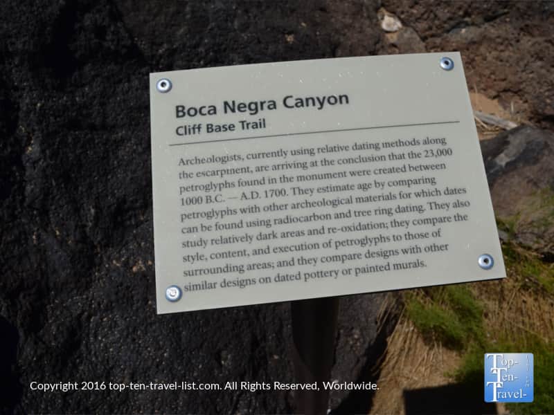
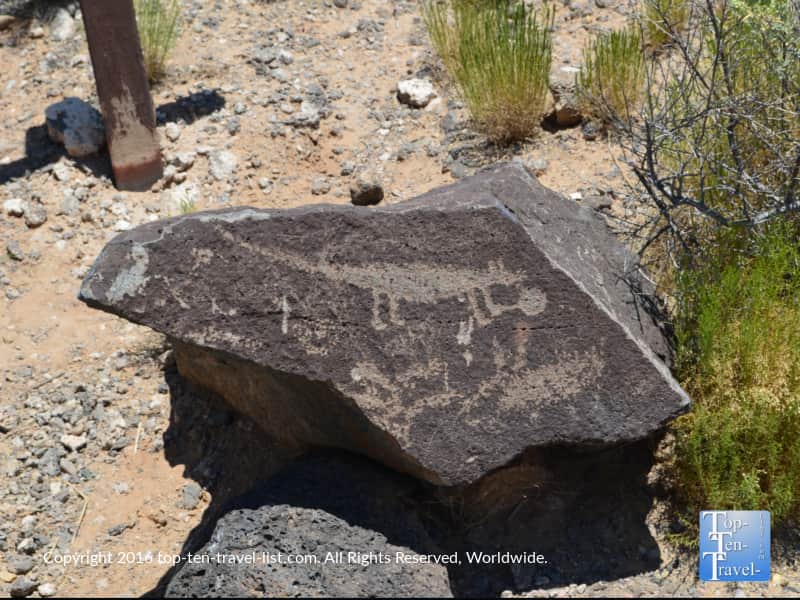
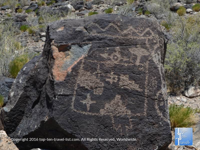
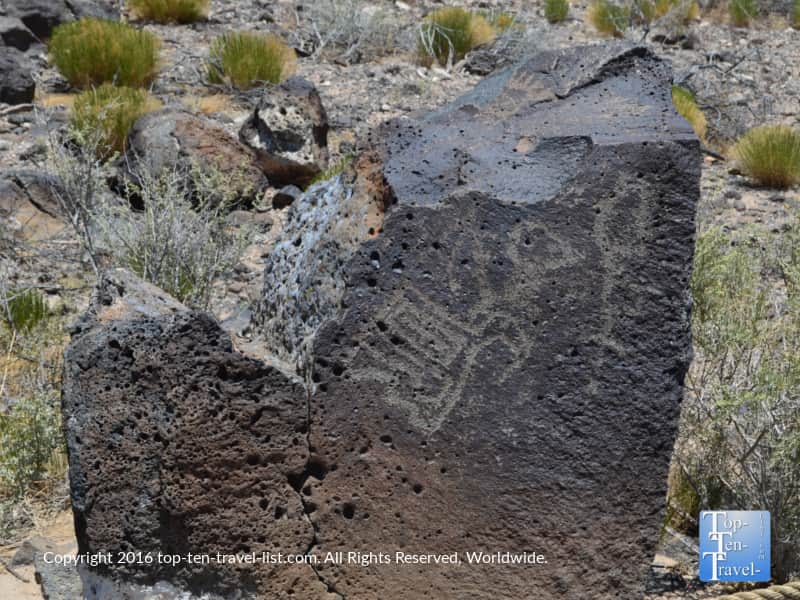
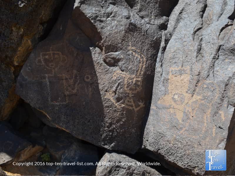
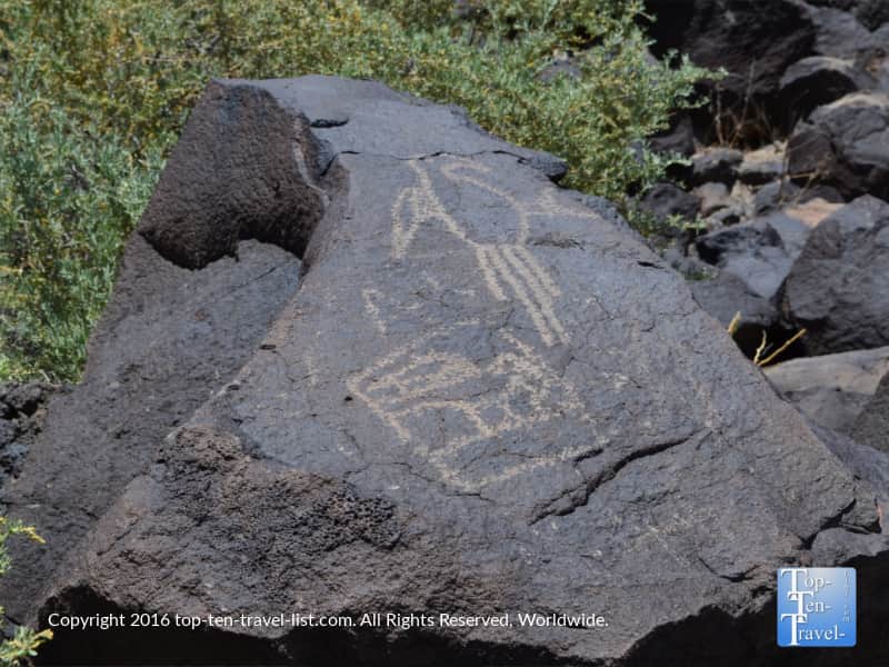
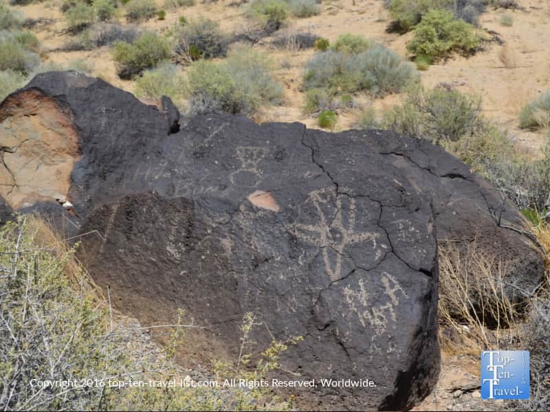
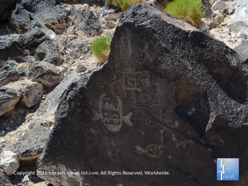
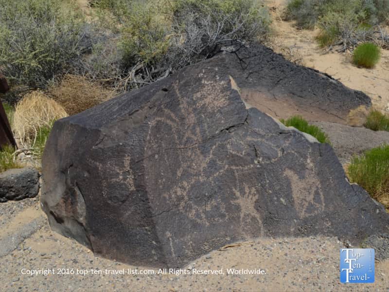
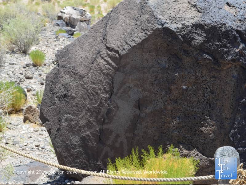
There are over 20,000 ancient carvings to explore within a relatively small space. According to the NPS, this park is one of the largest preserved sites of these ancient drawings. It is estimated that Native American and Spanish settlers carved these drawings between 400-700 years ago. Several hiking trails within the park will give you an up close look at many of these unique symbols. The park estimates that you can see 100 in just an hour! Since living in Arizona, I have seen a lot of these drawings but the sheer volume here was impressive. If you are planning a trip to Northern Arizona, I recommend checking out Picture Canyon and the Petrified National Forest (also home to an impressive collection of petrified wood).
Below are a few of the interesting petroglyphs we saw on the Boca Negra Canyon trail. Some are obviously really faint and worn down, so you will get a much better look in person. It was also a sunny day (as it usually is in the desert) so the pics did not come out quite was well as I hoped. It’s just one of those things which is better seen by your own eyes. We had a fun time trying to guess what the different drawings represented.
Hiking Options
For summer visits, I recommend completing the nature trails of Boca Negra Canyon. Three different trails are available for a total hiking time of about an hour. As these hikes are a bit shorter than others within the park, you can sneak in a quick hike during the summer months without overheating.
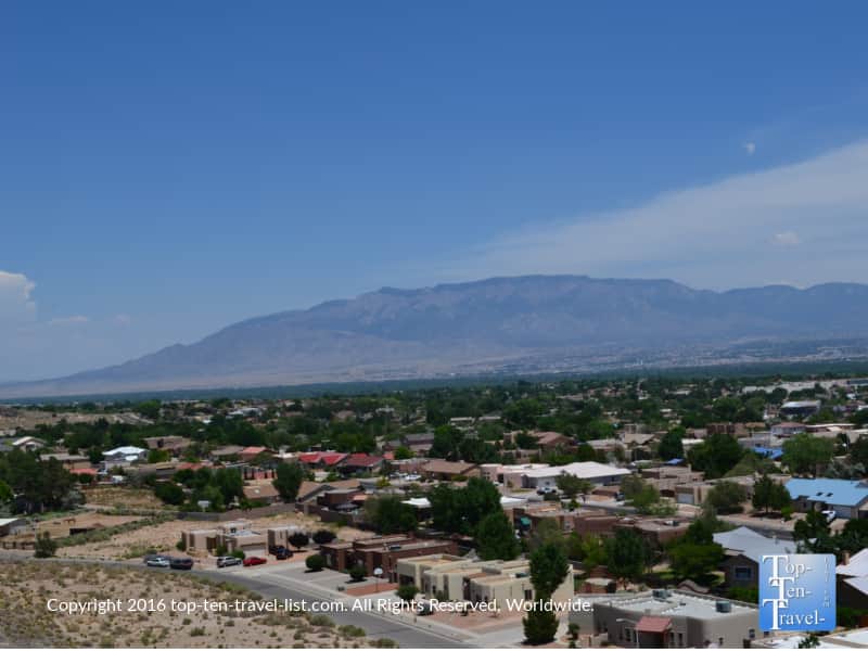
Be aware it can easily soar into the high 90’s during the summer season and there is absolutely no shade on any of the trails! Fortunately, we visit Phoenix frequently so we are accustomed with what type of weather to expect. For everyone else coming unfamiliar with desert summer climates, be prepared. Start early in the morning and drink plenty of water. If you are up for it, climb the Mesa Point trail (very short, but a bit steep) for amazing views of the Sandia mountains!
Longer hiking options better suited for the cooler months include the 2.2 mile long Rinconada Trail and the 1.5 mile long Piedras Marcadas Canyon Trail. These hikes are a bit harder, although you will see many more ancient drawings I would love to come back and hike the Rinconada trail outside of the summer of course. You can check out the p.ark’s hiking guide for more details on each trail and the estimated time commitment.
Besides the ancient pictographs, views along the trails mostly consist of various desert plants. The scenery is just average at best, although it is interesting to see native desert plant life upclose. Rattlesnakes are commonly seen so take precaution! You will see many signs along the way alerting you of their presence. Despite hiking frequently in the desert, I have actually never seen a snake.
Pricing/additional details
Entrance is free. Parking is $1 on weekdays, and $2 on weekends. Hours are 8:30am- 4:30pm (last entry at 4). Dogs are not allowed on the Boca Negra Canyon trails, however, they are allowed on the Rinconada and Piedras trails.
You will need to drive several miles to the trailhead from the visitor’s center. I recommend stopping in and picking up a map as well as directions from the ranger on how to get to your intended trail. In addition, you can read a little more history about the park.
Address
Enter the following coordinates into your GPS: Latitude: 35.139 Longitude: -106.711. Or take 1-40 to Unser Blvd. exit (#154) and continue 3 miles until you arrive at Western Trail. Turn left on Western Trail and proceed until you reach the visitor’s center.
Visit the National Park service website for more details about the park’s history