Devil’s Bridge: Sedona’s Scariest Hike
Disclaimer: We are not paid to promote any restaurant, hotel, activity, product, or attraction. All opinions are subjective and based on our personal experience. Your experience may be different.
Mike and I recently relocated to Flagstaff and we have been overwhelmed with the number of amazing national wonders nearby. We have been exploring various hiking trails in the area nearly every weekend. Fortunately, we live minutes from the start of Oak Creek Canyon drive, a scenic drive loaded with red rock views which takes you into Sedona. One of the first trails we hiked after moving here was Devil’s Bridge, an iconic hike which takes you to the largest sandstone arch in the city.
We quickly figured out that this was the most popular trail as the parking lot was completely full in the early morning hours. It probably wasn’t the wisest choice to plan this as our first red rock hike, but nevertheless, we were enchanting by the scenery.
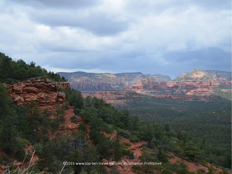
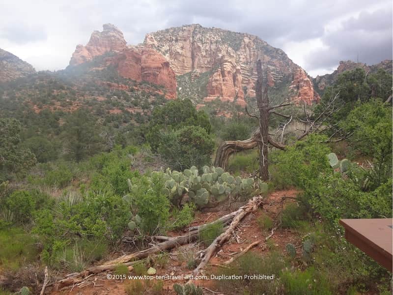
This entire area is a recreational paradise with hundreds of miles of hiking and mountain biking trails, each one offering slightly different fantastic views of the colorful million plus year old rocks. The beautiful Coconino National Forest offers endless opportunities for exploring the region’s ponderosa pine forests and jaw dropping rock formations.
Hikes in the area range from easy to various difficult. I would consider this trek to be moderate due to the bit of scrambling up rocks required at the end.
Update: After exploring this entire region fully over a multi year period, I would definitely place this hike on my list of my favorite trails in the region. The great thing about this area is that there are so many different trails. You could literally go on hiking forever. We drove into the city nearly each weekend from Flagstaff and always had a new trail on our list (although we returned to our favorites again and again).
The scenic trek to the iconic arch
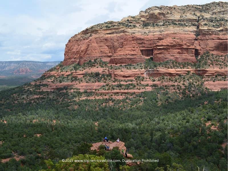
This hike is very famous for its’ 50 foot sandstone arch. I would say that this hike is semi challenging. It begins at an altitude of 4600 feet. Hiking at high altitude can be a challenge for your body if you are not used to it. We are living in Flagstaff where the elevation starts at 7000 feet so we are already accustomed to hiking with less oxygen in the air. For anyone new to the region, you may want to look at some hiking in high altitude tips before heading out (mountain sickness is a thing here).
The total elevation gain along the way is almost 400 feet, so not the hardest, nor easiest in town. We got in a workout, but didn’t feel totally burnt out. Fortunately, the elevation gain is gradual so a bit more doable for casual hikers than the more steep summit climbs. While the hike is just under 2 miles RT, your hike can be longer depending on where you park (more on that later).
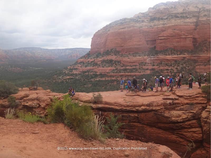
As the most popular hike, you will see all sorts of people out here, not just fitness buffs. We even saw some people wearing jeans and dress shoes which was crazy! I definitely recommend workout appeal and hiking shoes (gym shoes at the very least).
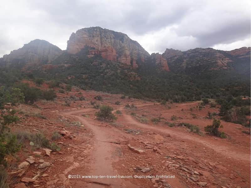
After a relatively easy stroll with nice scenery throughout, you come to the part of the trail that requires a bit of climbing. The walk up is moderately difficult, moreso because you have to be careful about where you step. You may have to use your hands or slide on your butt if you are nervous climbing (don’t worry you will see lots of other people doing so!). After going up a final staircase you will reach the bridge.
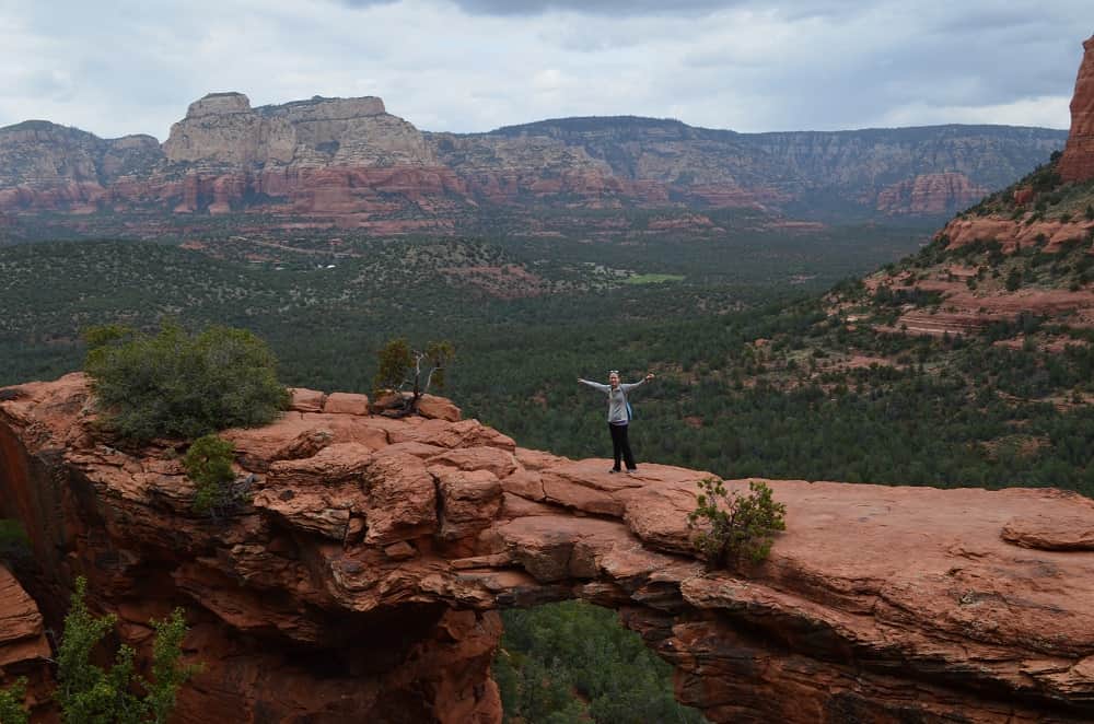
Walking across the bridge: For those not scared of heights only!
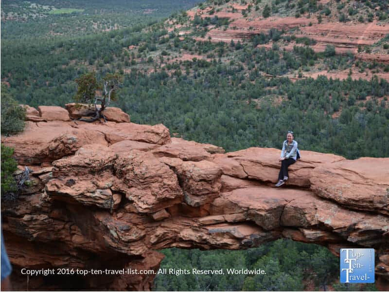
If you are brave enough, you can dare to walk across and have someone take your photo. You will see daredevils taking all sorts of crazy photos on the bridge. Although it looks pretty narrow from far away, the bridge is much wider than it appears. At its’ narrowest point, it is about 5 feet.
I am not scared of heights, but looking down it’s a big drop. To be honest, I was a bit nervous even though the arch is really wide. Nevertheless be sure to use some common sense. I would definitely recommend skipping out on this hike if you are at all squeamish over heights. There are many tamer hikes in town for you.
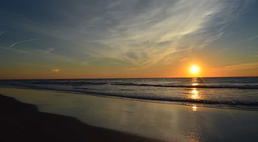
In my experience, the wait was well worth it for these one-of-a-kind views! As my first hike in the area, I was totally enchanted by the red rocks. I moved here from Tampa, so the scenery is really something different (in a good way!). Update: I always get so many comments on this photo asking me where it is from. Let’s just say that it is a great free photo memento of your trip.
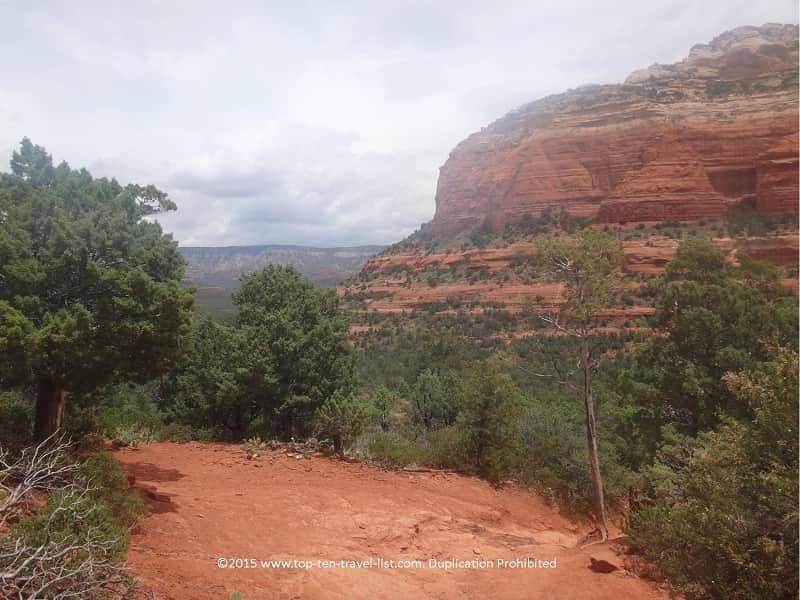
Here are a few more fabulous views you will experience at this point. I am so glad that I traded in those beaches and flat nature preserves for views like this!
This hike is free, fun, & scenic, so there is no reason to skip out unless you are afraid of heights or not able to complete a moderate hike at this time.
Update: For anyone looking for something easier, I recommend looking at my easy trail guide for starters. There are great views everywhere in Red Rock Country, this being one of just many breathtaking trails. You can always come back to this trail at any time – the red rocks aren’t going anywhere.
How long will this hike take?
Although the hike isn’t that long, I would plan a few hours as you will likely be taking many photos along the way. In addition, the line to take your picture will probably be very long as it was for us. Don’t worry – it’s worth it, just plan the extra time and eat a big breakfast beforehand.
The Chuckwagon trail: An alternative starting point (for those without 4WD)
On a side note, you need 4WD to park in the main parking lot. If you don’t have 4WD or if the main lot is filled, your walk can be as long as 4 miles as you will be starting on another trail called the Chuckwagon. This is where we started.
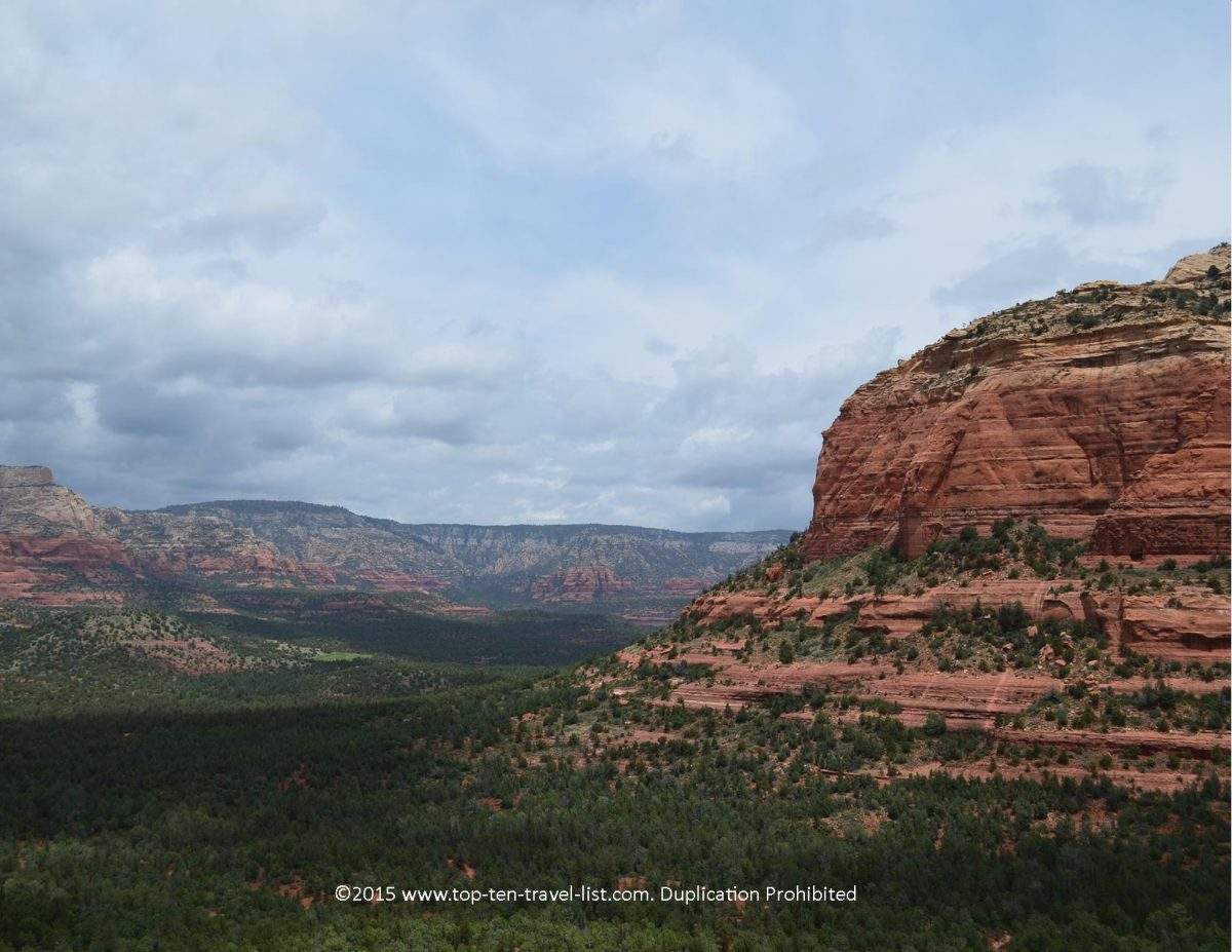
The first section of the Chuckwagon is pretty easy as the wide path was originally built for jeep travel. After a mile or so on this trail, you will start the mile or so hike to the bridge. I actually found the scenery attractive, so I didn’t mind the extra mileage. Just a heads up so you know.
As you can see, there is no shortage of fabulous viewpoint on the Chuckwagon
Hiking essentials in Red Rock Country
Sunblock is a must! At high elevation (4500 feet), you are much more likely to burn even on cloudy days.
Dress in Layers. The weather is unpredictable especially during summer monsoon season.
Carry lots of water. The combination of dry weather and high altitude means you need to drink more water. I bring a camelbak on most hikes and sometimes an electrolyte drink (Gatorlyte packets are fantastic).
Pack a few light snacks. It helps to keep a few small essentials like fruit, pretzels, trail mix, or a granola bar on hand as you will be on your feet for several hours.
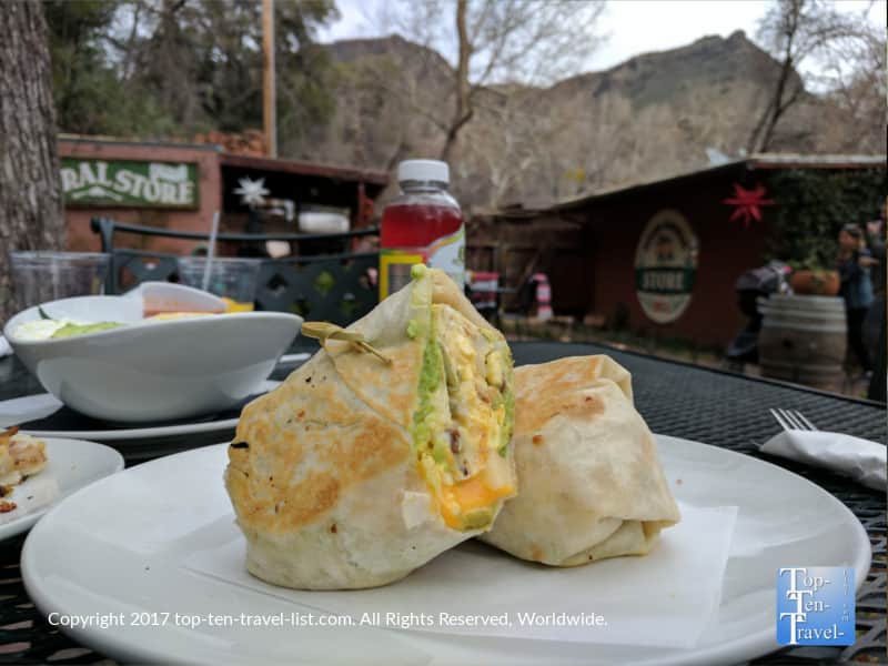
Eat after your hike. Update: We have dined at so many wonderful local restaurants since moving here. I am a vegetarian and I absolutely love the options. There are so many fresh, healthy places to enjoy a great meal after working up a sweat. Check out my best restaurants post for further details.
Wear a GPS watch. I like to keep track of the distance and time. This is especially helpful if you have additional activities on your itinerary for the day.
If possible, plan your hike early in the morning before all the tourists arrive. By mid morning, the small parking lot was already full. Weekdays are the best time to hike any trail in the area as weekends see heavy traffic from Phoenix. Update: My most recommended place to get breakfast is Indian Gardens, a gem along Oak Creek drive. They serve amazing espresso and pastries. I really love their breakfast burritos and Grains and Greens bowl. And you can’t beat their shady patio. Get here early – it gets packed by mid morning and parking is a pain!

Additional details
Address: For trail-head parking information, visit the Coconino National Forest website.
Note: As I mentioned earlier, you need a 4 wheel drive/off road vehicle to park at the closest trailhead (this hike is 2 miles compared to 4) as the road is really rough, otherwise you will have a bit longer overall hike starting at the overfill lot for Chuckwagon (a little over 4 miles round trip).
Distance: 4 miles (with Chuckwagon), 2 miles RT (with 4WD)
Difficulty: Moderate
Pet friendly: Dogs allowed, but they have to be on a leash
Update: The trails in Flagstaff are just as incredible. After living here for years, I can recommend my favorite trails. This city is located in the country’s biggest ponderosa pine forest and the scenery is just as nice as the red rocks in my opinion. As a bonus, the temps are much more attractive during the summer season.