A Non-Hiking Alternative: The Southern Scenic Drive at Bryce Canyon
Disclaimer: We are not paid to promote any restaurant, hotel, activity, product, or attraction. All opinions are subjective and based on our personal experience. Your experience may be different.
The great thing about national parks it that they typically offer a number of activities for everyone, not just hikers. As Bryce Canyon is one of the most gorgeous Western National Parks (check out more of my favorites), you will definitely want to check this one off your bucket list. I was really impressed with the scenery, ease of getting around via shuttle, and most of all, the park’s stunning scenic drive.
While hiking here is an amazing experience (If you have the stamina, I recommend a hike into the amphitheater for an up close look at the hoodoos), there are a number of non hiking related summer activities to enjoy including: horseback riding, biking, taking in the majestic hoodoos via 4 scenic viewpoints, and enjoying a leisurely cruise.
For those of you who don’t want to work up a sweat but still want to enjoy the breathtaking scenery, the Southern Scenic Drive is the way to go. This drive is 18 miles long (the first 3 miles are part of the Park’s amphitheater), stretching from the park entrance to Rainbow Point.
Along the route, you will get to enjoy 9 stunning overlooks. It’s a slow drive that will take at least 2 hours as you will be getting in and out of your car to enjoy the fabulous hoodoo scenery. Plan some extra time for this lengthy drive as it truly is incredible. We thought about skipping out on it as we were so tired by our 3rd day, but I am glad that we decided to squeeze it in. Even if you have a number of hikes planned, I highly recommend making room for this picturesque route (the overlooks are magnificent and consist of views you won’t see in the park).
From 7000+ feet to over 9000 in just 18 miles
The elevation increases as you travel further south along the road. According to the park’ website, the visitor center sits at 7894 feet while Rainbow Point at the end of the drive towers at 9000 feet. This is the result of uneven tectonic forces.
The plant life changes from ponderosa pines in the beginning to Douglas fir and aspens. You will also notice the temperature drop near the end. I wish I would have brought a sweater – it was quite cold at the Rainbow Point overlook! Earlier in the day it was quite hot (70’s and super sunny) so I still had my shorts and tshirt on. Definitely bring with layers!
Also, keep in mind that temperatures in the early morning and evening are typically much cooler in the desert. So basically, the higher altitude plus lower morning and evening temps will both bring forth much cooler temps.
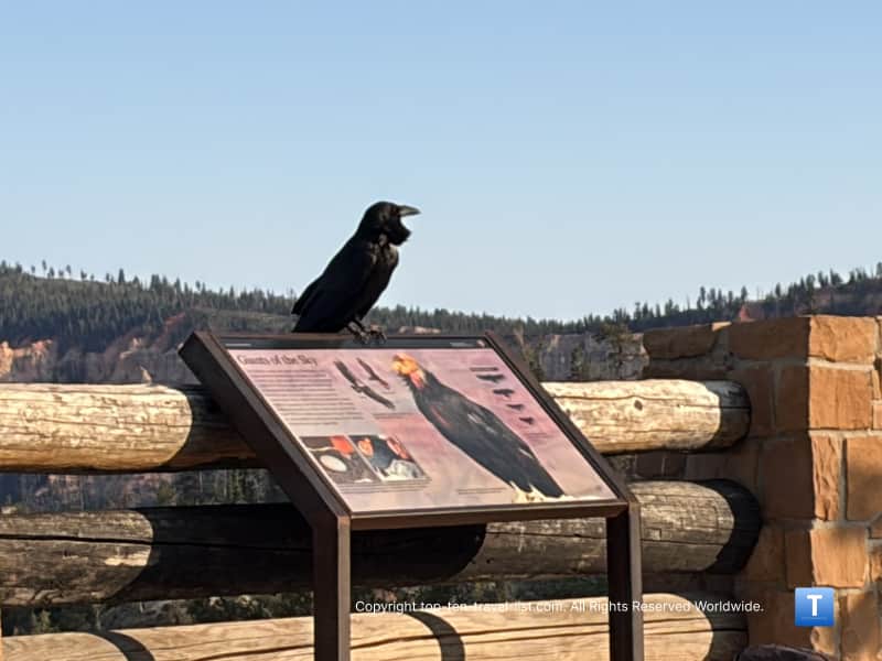
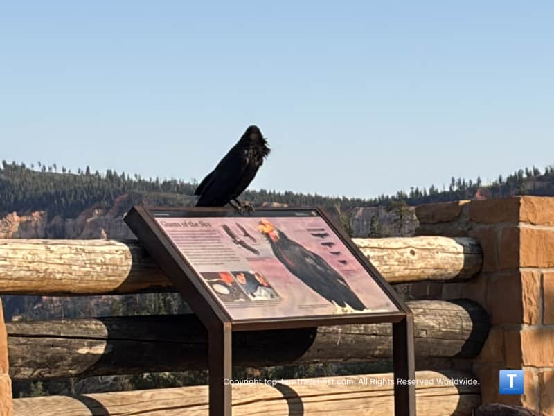
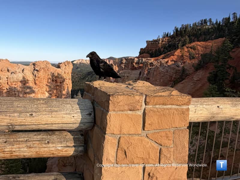
Wilife sightings also become more common as you travel further south. You may see a black bear, elk, or mule deer. Peregrine falcons and California condors are occasionally sighted especially at the Fairview Point overlook. We saw a number of Common Ravens but no other evidence of wildlife.
The Overlooks
The drive itself is just so-so in terms of scenery. The big views come via the scenic overlooks (there are 9 in total). You will want to get out of your car and walk over to each. Each overlook is just a few steps from the parking lot. There is a railing due to the steep drop offs. Compared to hiking, I would say this drive is a much better option for those scared of heights as there are no unguarded steep drop offs.
Swamp Canyon: A beautiful mix of hoodoos and green plants earned it its’ current nickname. With 2 creeks and a stream, it remains wet all year and provides habitat for tiger salamanders and wild irish. According to the park, the Swamp Canyon loop hike is a great place for birdwatching especially Songbirds.
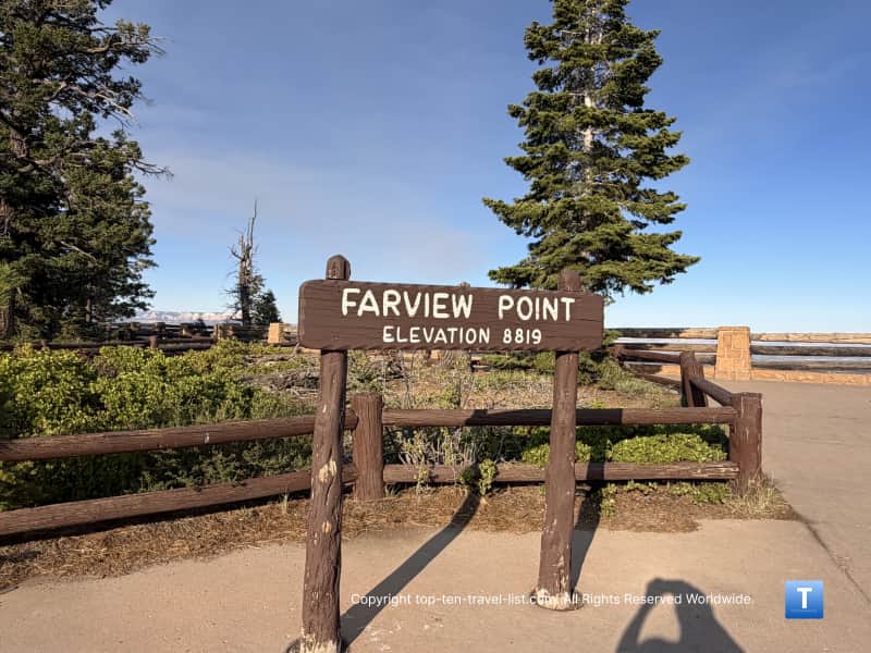
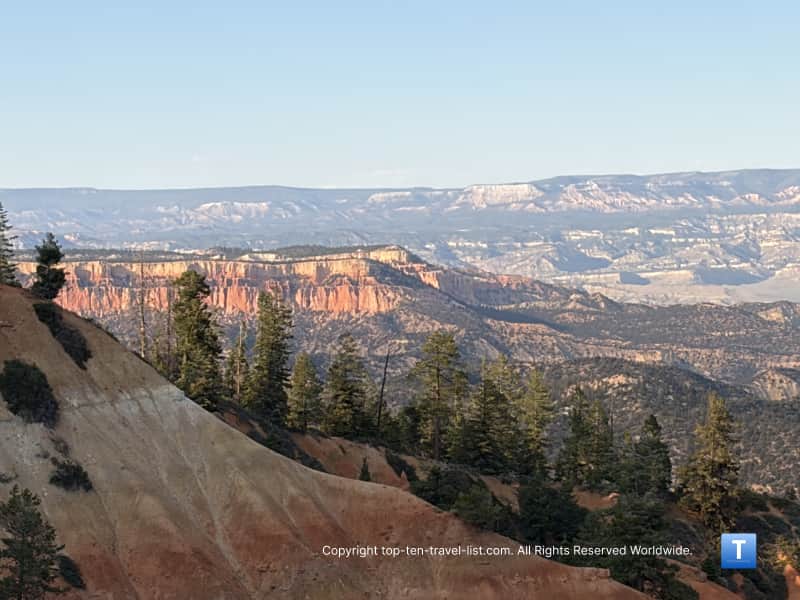
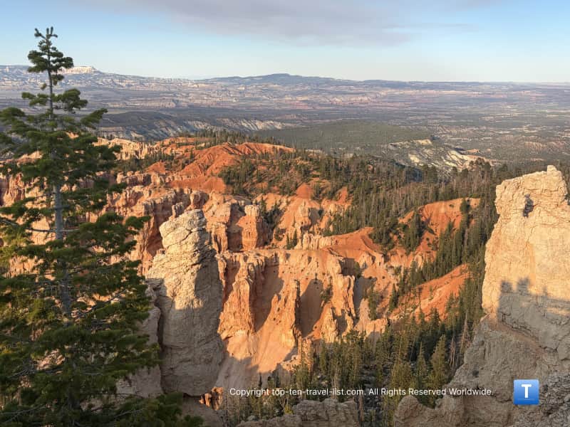
Fairview and Piracy Point: On a clear day, you can see 10,388 foot Navajo mountain in the distance.
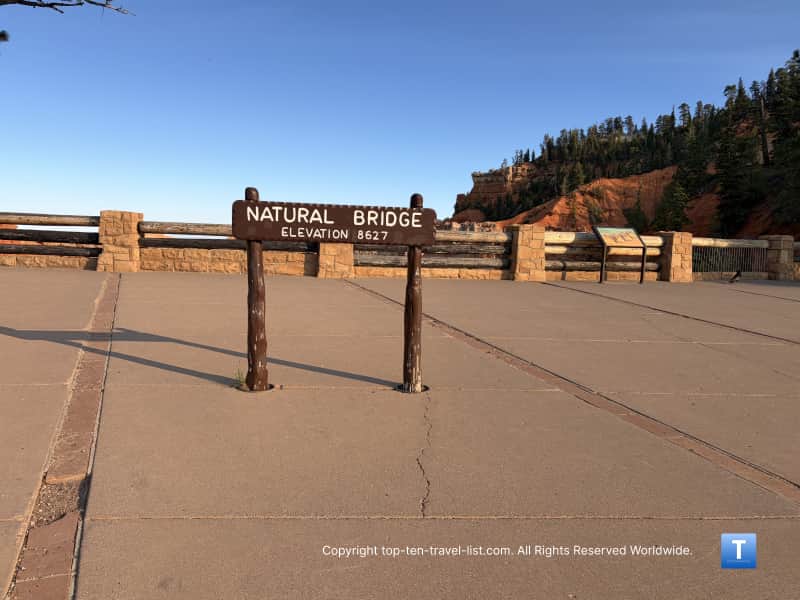
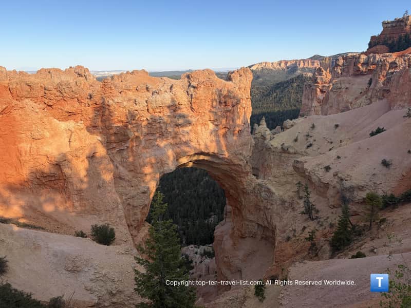
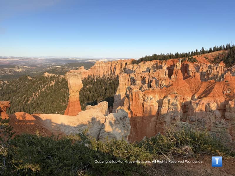
Natural Bridge: It’s actually an arch carved by ice expansions due to cracks. This is one of the most photographed spots according to the park.
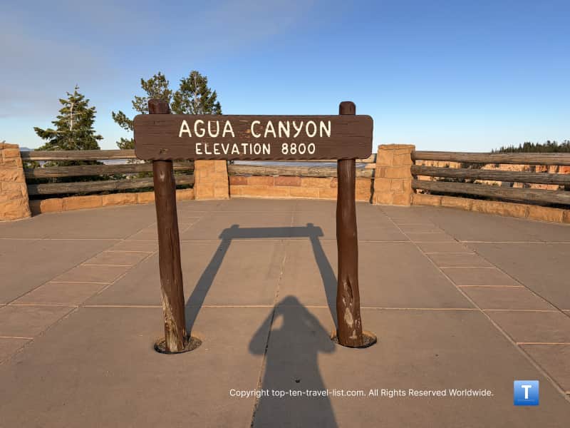
Aqua Canyon: You can see the famous “Hunter” and “Rabbit or Backpacker” hoodoos here. According to the park, they no longer name the hoodoos because so many have broken apart and no longer resemble their original name.
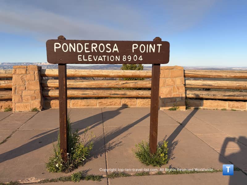
Ponderosa Point: Named for the many ponderosa pines that cover the canyon floor. Some are over 150 feet tall and 5 feet wide according to the park service.
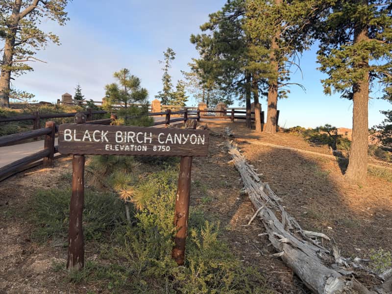
Black Birch Canyon: This canyon was named after the birch trees found here. Later, they realized they mistakenly identified them as birch when they are in reality aspens.
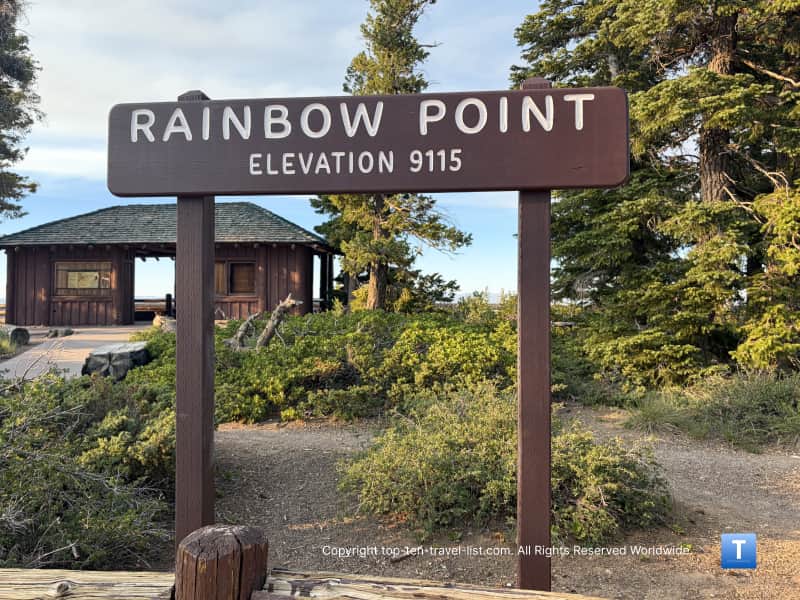
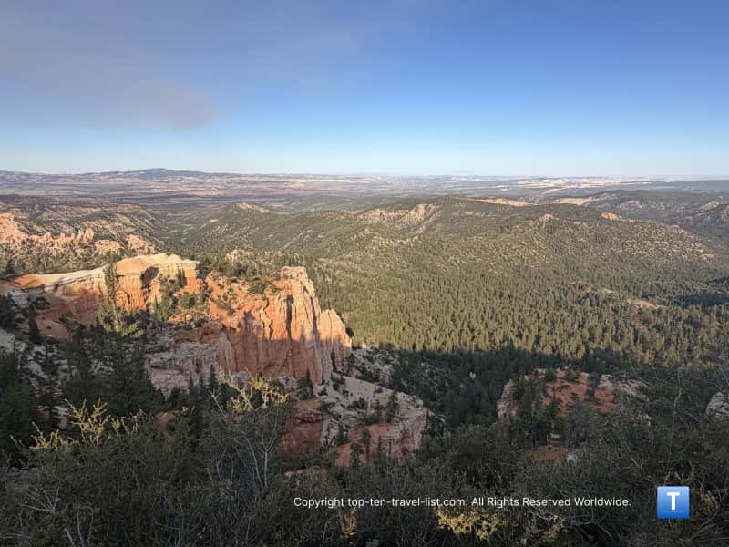
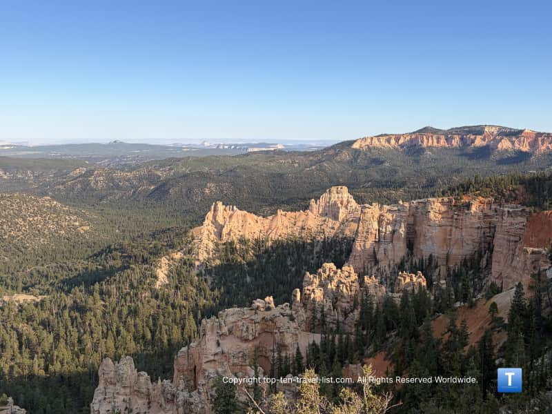
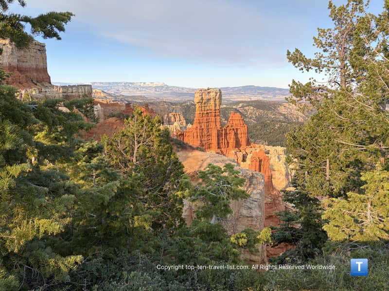
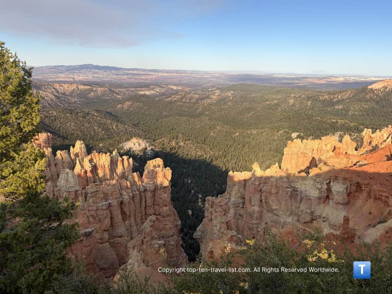
Rainbow Point & Yovimpa Point: The highest points in the park at 9115 feet. You can see the Paunsaugunt Plateau, Markagunt plateau, Sevier plateau, and Tushar mountains from here. These were created via volcanic activity.
You can learn more about each of these viewpoints on the NPS page. My favorite viewpoints are: Natural Bridge, Rainbow Point, Ponderosa Point, and Agua Canyon. For those with time constraints, I recommend at least stopping at these 3.
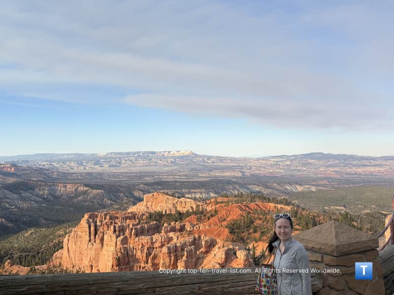
Seeing all the colorful hoodoos was such an amazing experience. We lucked out and basically had the view all to ourselves (with the exception of busy Rainbow Point) thanks to our late 6pm starting time.
Here are some pictures we took at each. Agua Canyon and Natural Bridge had the most interesting rock formations in my opinion. I also loved the dramatic views at Rainbow and Ponderosa Point.
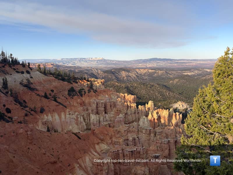
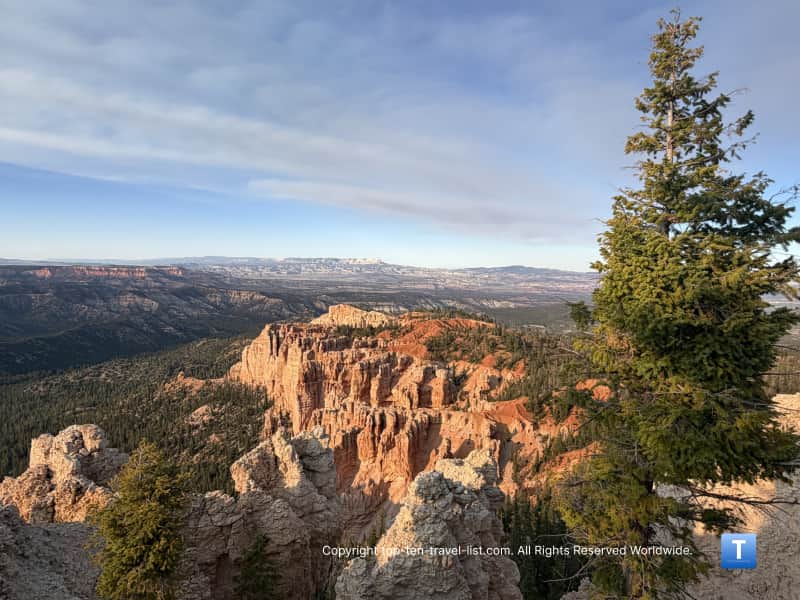
Fairview Point
Natural Bridge
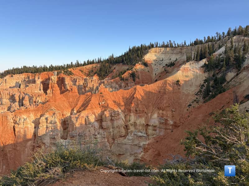
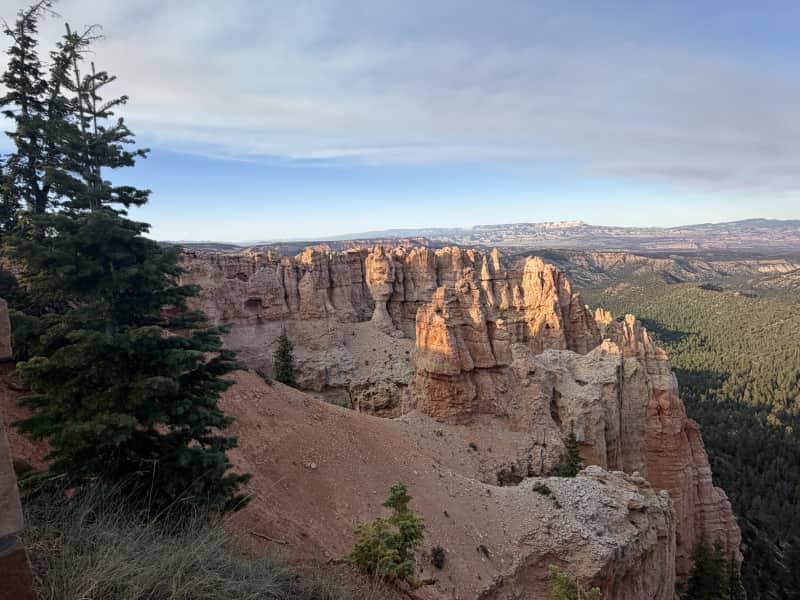
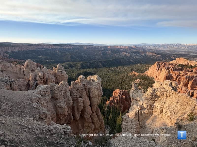
Agua Canyon
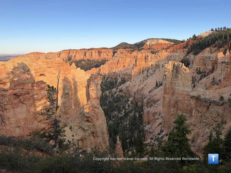
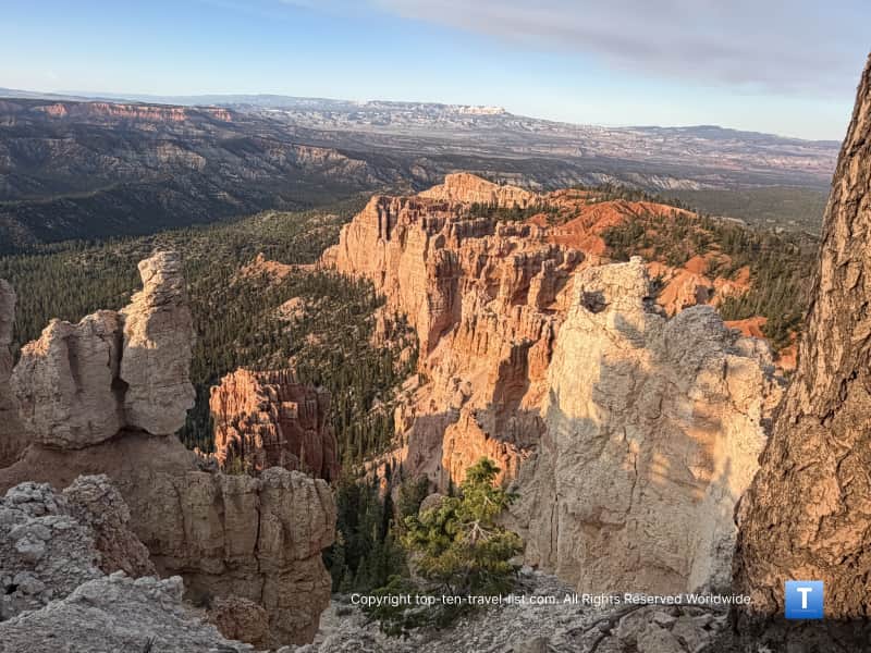
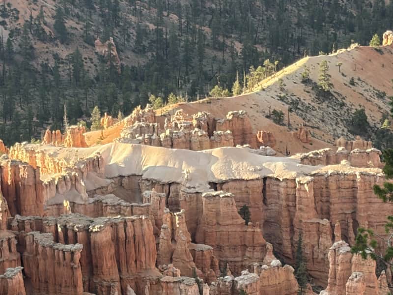
Ponderosa Point
Black Birch Canyon
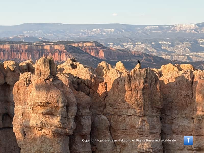
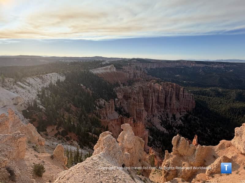
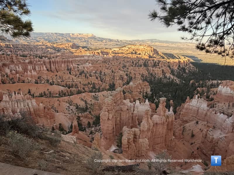
Pics from Rainbow Point
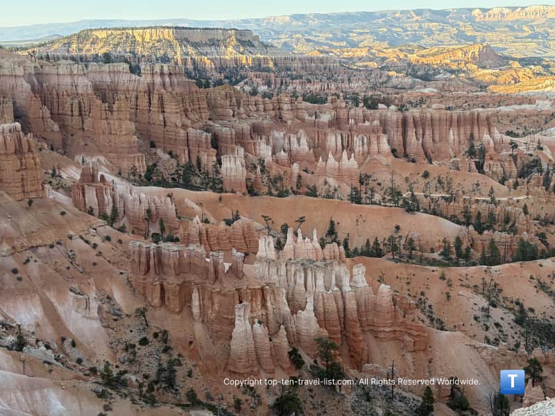
What are hoodoos?
If you have never visited this park or others in the West with hoodoos, you may be wondering what they are. Basically, these are tall and skinny, sometimes oddly shaped rock formations caused by erosion.
Because of their unique shapes, many of these hoodoos have been named i.e. Wall of Windows, Cathedral, and even Alligator (a real cool one which you can see at the Bryce Point overlook).
The red/orangish color actually comes from the oxidation of iron. If you visit the park near sunrise or sunset you will notice that the colors appear brighter and the hoodoos stand out even more. According to the park this effect which they call the “Golden Hour” happens due to a number of factors including light scattering, the low level of the sun, and the natural mineral composition.
This park is actually home to the highest concentration, although you can also see some at Arches, Yellowstone, and one of my personal favorites – Chiricahua in southern Arizona.
Things to know
You need to purchase a National Parks pass to enter. There was no one at the entrance gate after 6 during our visit so I’m not sure how long it is staffed. It’s $35 for just one day or $70 for an annual pass. We plan on visiting at least 4 other parks this year, so the annual pass will easily pay for itself in just over 2 visits.
This park is located at a pretty high altitude, and this drive ranges from 8000 to over 9000 feet. Experts recommend drinking extra water, avoiding alcohol, and taking it easier the first few days to prevent altitude sickness. Here are some tips from the NPS.
Portions of this road may close during the winter. You will want to check the park service closures page for road conditions during this time of year.
There are 2 major hiking trails along the route if you do feel like working up a sweat. The easier of the 2 is the 1 mile Bristlecone Loop (starting at Rainbow Point) and the harder 4 mile Swamp Canyon Loop (staring at the Swamp Canyon overlook). Both should be considered more difficult than average due to the higher elevation. Visit the NPS page for hiking details.
Tips
The park recommends driving all the way through to Rainbow Point and then visiting the other overlooks on the way back. This is considered the safer route as all overlooks with be on the right side of the road.
Consider driving this road near sunrise or sunset. The hoodoos are more spectacular during the “Golden Hour” when the glow from the lower level of the sun makes the color even more reddish/orangish than during the day. Plus, it will not be nearly as crowded. We barely saw any other cars when we set off around 6pm.
Give yourself at least 2 hours to take it all in. I recommend bringing with plenty of water and a few snacks.
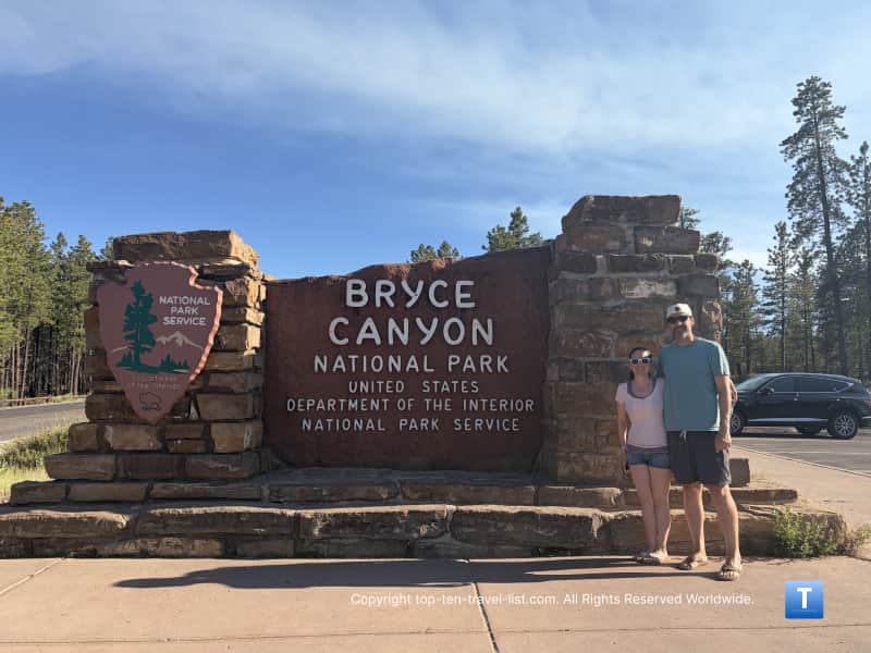
Don’t forget to take your picture by the National Park sign! It’s located on the main park road about a mile from the visitor’s center.